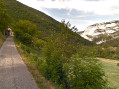
Circular walk from La Vacherie via the Canyon des Gueulards

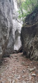
An unusual hike through the Canyon des Gueulards, a circular route starting from La Vacherie. Particularly pleasant in hot weather.

Details

104610158
Creation:
Last update:
Last review:
  • Walking
    Activity: Walking
  • ↔
    Distance: 7.08 mi
  • ◔
    Average duration: 4h 15 
  • ▲
    Difficulty: Moderate

  • ⚐
    Back to start: Yes
  • ↗
    Ascent: + 1,112 ft
  • ↘
    Descent: - 1,132 ft

  • ▲
    Highest point: 3,064 ft
  • ▼
    Lowest point: 2,339 ft

Photos

Description of the walk

Park in the car park in the village of La Vacherie, next to the church.

(S/E) With your back to the church, head down the road that runs between the church and the ‘Colo du Chaffal’.

(1) At the first junction, turn left, leaving the Route de La Morelle, and join a road.

(2) Follow it to the right towards Tête Noire and join the GR® 9 coming from Léoncel.

(3) Leave the road and continue straight on, following the GR® towards Les Moreaux.

(4) Walk past La Morelle farm and continue southwards to a junction.

(5) Leave the GR® and continue to the left towards the Canyon des Gueulards.

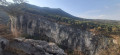
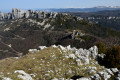
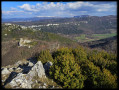
(6) Turn right to continue along the path leading up to Le Pêcher du Haut and reach the cliffs and the viewpoint.

(7) Take the hairpin bend to the right and head towards the Ferme du Pêcher du Bas.

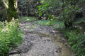
(8) At the “Sept Lacets”, continue to the right, leaving the Ferme du Pêcher du Bas on your left, then follow the path down to the canyon and cross it.

(9) At the sign marking the exit from the canyon, turn left towards a small bridge (do not follow the sign for “Gorges d’Omblèze” on the right)

(10) Turn right onto the GR®9 and rejoin the junction from the outward journey.

(5) Carry on straight ahead (do not turn right again towards the Canyon des Gueulards) then continue, following the path in the opposite direction towards the village of Le Chaffal until you reach the La Vacherie car park (S/E).

Waypoints

  1. S/E : mi 0 - alt. 3,064 ft - Car park - Église Saint-Robert (La Vacherie)
  2. 1 : mi 0.04 - alt. 3,058 ft - Junction with Route de La Morelle
  3. 2 : mi 0.12 - alt. 3,051 ft - Chemin de Tête-Noire junction
  4. 3 : mi 0.23 - alt. 3,051 ft - GR9 junction
  5. 4 : mi 0.76 - alt. 2,894 ft - La Morelle
  6. 5 : mi 1.27 - alt. 2,713 ft - Junction of the circular loop – Les Moreaux
  7. 6 : mi 1.43 - alt. 2,687 ft - Combleroufle Stream
  8. 7 : mi 3.47 - alt. 2,474 ft - Cliffs
  9. 8 : mi 3.71 - alt. 2,388 ft - Seven Hairpin Bends
  10. 9 : mi 5.26 - alt. 2,720 ft - Exit from the Canyon
  11. 10 : mi 5.43 - alt. 2,835 ft - Return to the GR9
  12. S/E : mi 7.08 - alt. 3,064 ft - Car park - Église Saint-Robert (La Vacherie)

Notes

Some sections in the canyon are quite difficult. Sturdy walking boots and walking poles are essential.

Avoid this route if there is a risk of thunderstorms or heavy rain.

Other route variations, not starting from the La Vacherie car park:

  1. First alternative, which is 4 km shorter than starting from La Vacherie: park at Les Moreaux (5). Please note, however, that the road is partly stony, there is very little space to park at the side of the road, and the route crosses private roads, so please be respectful.
  2. Thesecond alternative is 9 km longer than starting from La Vacherie: set off from Léoncel, following the signposts for walk no. 102276908 (which joins this route at La Tête Noire).

Always be cautious and plan ahead when you're outdoors. Visorando and the author of this route cannot be held responsible for any accidents occurring on this route.

The GR® and PR® markings are the intellectual property of the Fédération Française de Randonnée Pédestre.

Other walks in the area

For more walks, use our search engine .

The GPS track and description are the property of this route's author. Please do not copy them without permission.