Circular route in Donnazac

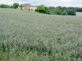
A very straightforward walk through the Tarn countryside, amongst fields and vineyards, forming a circular route between Donnazac and Arzac, offering lovely views, particularly of stone buildings. The unmarked section on the return journey is not difficult; just take a little care as the route itself presents no difficulties. However, avoid the intense summer heat as the route is often exposed to the sun. You’ll find few other people on this route.

Details

n°32271545
Creation:
Last update:
Last review:
  • Walking
    Activity: Walking
  • ↔
    Distance: 5.22 mi
  • ◔
    Average duration: 2h 35 
  • ▲
    Difficulty: Easy

  • ⚐
    Back to start: Yes
  • ↗
    Ascent: + 240 ft
  • ↘
    Descent: - 240 ft

  • ▲
    Highest point: 968 ft
  • ▼
    Lowest point: 725 ft

Photos

Description of the walk

Park in the small square by the town hall in Donnazac, Place Saint-Jacques: there are a few spaces for two or three cars.

Unmarked section for approximately 700 m

(S/E) With your back to the town hall, turn left onto the Chemin des Douves, a grassy path leading to the Route d’Arzac. Follow this to the right to reach the Fork in the road with the PR®.

Marked section

(1) Take the road to the right. You are now on thePR® (the Sentier des Lavoirs). Continue straight on along this west-facing path until you reach the path on the left.

(2) Follow this well-marked south-facing path which runs alongside a stream on your right; it turns first left, then right, runs alongside a woodland, and turns right again.

(3) At the road not far from the Taillade farm, turn left and you’ll come out facing the railway line (marked by a cross). Follow it to the right.

(4) Pass underneath the railway line, turn right onto the road, then take the sharp left-hand bend (marked by a cross). Continue along Chemin des Grèzes to reach the pretty little village of Arzac.

Unmarked section

(5) Leave thePR® path, which heads off to the right, and turn left onto Route d’Arzac, heading north-east, and walk through the village. Turn left to arrive in front of the church (on your left).
From the church, take the road that goes downhill and leads past the top of the cemetery. At the first junction, ignore the road on your right. At the second junction, turn right onto the road that passes the cemetery. Continue straight on along this road. It passes a farm on your right, bends to the left and leads straight to a junction with the yellow-marked path (PR®).

(6) Turn left onto this marked path, which crosses the woodland.

Marked section

Carry on straight along this path; at the junction with the Route de Lafargue, keep left, cross the bridge over the railway line and head straight on to the next junction.

(1) Turn right to return to the starting point via the same route you took on the way there (S/E).

Waypoints

  1. S/E : mi 0 - alt. 965 ft - Town hall square in Donnazac
  2. 1 : mi 0.44 - alt. 912 ft - Crossroads at the end of the circular loop
  3. 2 : mi 0.7 - alt. 837 ft - Junction on the path
  4. 3 : mi 1.73 - alt. 830 ft - Taillade Farm
  5. 4 : mi 2.14 - alt. 781 ft - Passage under the railway line
  6. 5 : mi 2.55 - alt. 758 ft - Arzac
  7. 6 : mi 3.36 - alt. 764 ft - Junction on the left (PR)
  8. S/E : mi 5.22 - alt. 965 ft - Town hall square in Donnazac

Notes

For this walk, please take at least the IGN map extract provided with the description and, if possible, a compass and, of course, a GPS device – which is very useful with the Visorando app.

You can have a picnic in the small square by the town hall in Donnazac (tables and benches).

There is a bench in front of Arzac Church halfway along the route.

Worth a visit

Stone houses, dovecotes and lovely views of the countryside.
The little village of Arzac is well worth a stop.

You can extend the route to (6) by taking the Roumanou path – an extra 8 km – thus opening up the possibility of a day’s hike.

Always be cautious and plan ahead when you're outdoors. Visorando and the author of this route cannot be held responsible for any accidents occurring on this route.

The GR® and PR® markings are the intellectual property of the Fédération Française de Randonnée Pédestre.

Reviews and comments

4.3 / 5
Based on 2 reviews

Reliability of the description
5 / 5
Ease of following the route
4.5 / 5
Route interest
3.5 / 5
aline.viguier@hotmail.fr

Machine-translated

aline.viguier@hotmail.fr

Overall rating : 4.3 / 5

Date of your route : Nov 09, 2026
Reliability of the description : ★★★★★ Very good
Ease of following the route : ★★★★☆ Good
Route interest : ★★★★☆ Good
Very busy route : Yes

Machine-translated

Vendinielle
Vendinielle
• Edited:

Overall rating : 4.3 / 5

Date of your route : Oct 24, 2024
Reliability of the description : ★★★★★ Very good
Ease of following the route : ★★★★★ Very good
Route interest : ★★★☆☆ Average
Very busy route : No

A simple, local countryside route, fairly flat. The layout of the land doesn’t really show the vineyards to their best advantage. In short, it’s a bit of a bore on foot.

Machine-translated

Other walks in the area

For more walks, use our search engine .

The GPS track and description are the property of this route's author. Please do not copy them without permission.