Country:

 City:


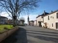
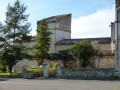
The start of this walk is in Noailles, a small village not far from Cordes-sur-Ciel. You can park easily in the main square or next to the cemetery.
(S/E) Cross the main square and, with your back to the church, take the small road opposite (D30), heading north-east. At the Fork in the road, leave the D30, which turns left, and take the road on the right. This first passes a pigsty and then a large silo on your left before reaching a junction.
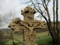
(1) Carry on straight ahead and, at the crossroads marked by a wayside cross, turn left.
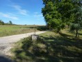
(2) When the road begins to curve to the right, leave it and continue straight ahead along a wide, gently ascending farm track. Ignore the track branching off to the right towards La Maureillé and join the D107.
(3) Cross over and carry on straight ahead. Pass a wide track on your left and reach the Fork in the road about fifty metres further on.
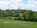
(4) Turn left at the fork. The gently sloping track runs alongside a reservoir on your left and joins a small road. Don’t miss the view to the left of the magnificent site of Cordes-sur-Ciel
(5) Turn right and follow the road for about 800 metres.
(6) Just before a slight bend to the right, leave the road and turn left onto a wide track which climbs up the hill. At the first junction, go straight on to reach the D600, the Albi–Cordes road, which is dangerous as it is very busy.
(7) Cross with the utmost caution and head towards the small church at Livers-Cazelles on the opposite side of the road. Turn left and return to the D600, which you follow for 150 metres, taking the same care. Take a small road on the right, keeping the tower of the beautiful Château de Cazelles and its centuries-old trees in your sights. At the junction (cross), ignore the path on the left leading to the château and turn right.
(8) Before reaching the first houses in La Bonetié, turn left onto another small road which leads downhill to the Cantegrel farm (signposted). After crossing the stream and just before the farm, turn left onto an uphill path that avoids going through the buildings. You’ll come out onto a farm track which takes over from the road after the farm. Turn left and join the D7.
(9) Follow this road to the right for about fifty metres, then take the path on the left. You’ll soon reach a small road; follow it to the left until you come to a junction. Carry on straight ahead, past a sharp bend to the left and a fountain.
(10) Leave the road and turn right onto a track that leads back to the D7. Turn left and head towards a junction.
(11) Ignore the two roads and continue along the track opposite. At the first junction, carry on straight ahead; then at the second (elevation 320), turn right to rejoin the D7 a few metres further on.
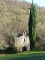
(12) Take the road opposite leading to Milhavet (road sign). Follow the road straight on to the village, pass through it and, on leaving, turn left downhill towards the church. Continue to a junction just after an old wash house on the right (cross).
(13) Turn right onto the wide farm track which leads out of the woods and joins a road. Turn right, ignore a road on the left and carry on until you reach a three-way junction.
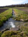
(14) Turn left towards the hamlet of La Cardonnarié and walk through it. Leave the road, which bends to the right, and continue straight on downhill along a wide farm track until you reach the valley where the pretty Mouline stream flows peacefully. Turn left and follow the valley floor for about 800 metres.
(15) Turn right onto the track, cross a small bridge and climb through woodland and meadows until you reach a road; take this road to the right for about 400 metres.
(16) Leave the road and take the path on the right, at a right angle. 300 metres further on, leave the path leading to Le Bresset on your left (not shown on the IGN map) and carry on straight ahead. You’ll come back onto the tarmac at a very beautiful stone house, which you walk round. Where this small road bends sharply left at a 90° angle, take a barely marked and rather rough track that leads to the embankment of the D600, the Albi–Cordes road.
(17) Cross with the utmost caution. Almost directly opposite, take the road leading to Villeneuve-sur-Vère, which you can see perched on the hill (road sign).
Follow the road to the village, cross the square, then pass the primary school on the left and the church on the right.
The road curves left and goes downhill. Ignore the three small roads that branch off successively to the right and then to the left, until you reach a crossroads (with a cross).
(18) Carry on straight ahead until you reach a four-way junction and turn right (road sign for Noailles).
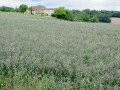
(19) 200 metres further on, leave the road and turn right onto a wide track running alongside a vineyard. This track turns left at a 90° angle. Ignore the two successive tracks branching off to your right until you reach a small road.
Turn right and carry on to the hamlet of Le Mazet, where the road bends sharply to the right.
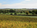
(20) At the last few houses and a barn, turn left onto a wide track that follows the lush green Vère valley and leads onto the D25.
(21) Turn right, cross the bridge over the Vère and head back up to Noailles to return to the starting point (S/E).

 Visorando Member
 Easy

 Moderate