Bois Impérial – Étang du Breuil – Canal de l’Est to Richardménil

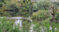
A walk through woodland and alongside a lake. Varied scenery and a route without any major difficulties.

Details

n°70584500
Creation:
Last update:
Last review:
  • Walking
    Activity: Walking
  • ↔
    Distance: 7.50 mi
  • ◔
    Average duration: 3h 45 
  • ▲
    Difficulty: Moderate

  • ⚐
    Back to start: Yes
  • ↗
    Ascent: + 341 ft
  • ↘
    Descent: - 351 ft

  • ▲
    Highest point: 1,040 ft
  • ▼
    Lowest point: 745 ft

Description of the walk

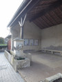
Head to Richardménil and park in the car park near the Jacques Prévert School Complex.

(S/E) Turn right onto Avenue de l’Empereur and cross the motorway bridge.

(1) About fifty metres past the bridge, take a path on the left which will lead you behind the Bois Impérial housing estate.

(2) At the end of this path, turn left onto a wider, stony track and follow it to the edge of the woods.

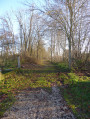
(3) Continue along the path at the edge of the woodland on the right, then head into the woodland for about 200 metres.

(4) Turn left onto the forest track and follow it until you reach the junction with the GRP® Autour de Nancy. 

(5) Follow it to the right and join the D115.

(6) Cross with care and head down to the Canal de l’Est.

(7) Turn left onto the path that runs alongside the canal as far as the Écluse du Prieuré.

(8) Follow the GR®5F to the right, passing alongside the Étang du Breuil. Cross the Pont Chaubourot.

(9) Immediately turn right onto the GR® and continue to the Pont du Gouvernement, crossing it to get over the Moselle.

(10) Immediately take the track on the left to follow the Voie Verte, which runs alongside the Canal de l’Est, and continue to the Pont de la Sablière.

(11) Turn right and cross the bridge to get over the canal, then continue along Rue de la Sablière. At the end of the street, carefully follow Rue de Nancy (D570), which winds its way up to the left into the village, and head for the car park (S/E). 

Waypoints

  1. S/E : mi 0 - alt. 853 ft - School complex car park
  2. 1 : mi 0.15 - alt. 869 ft - Start of the trail
  3. 2 : mi 0.27 - alt. 879 ft - Path on the left
  4. 3 : mi 1.3 - alt. 896 ft - On the right at the edge of the woodland
  5. 4 : mi 1.66 - alt. 1,020 ft - Forest track, on the left
  6. 5 : mi 2.26 - alt. 968 ft - GRP junction°°®°°
  7. 6 : mi 2.84 - alt. 1,010 ft - D115. GRP
  8. 7 : mi 3.59 - alt. 758 ft - Canal de l’Est - Canal de l'Est
  9. 8 : mi 4.41 - alt. 764 ft - Prieuré Lock - Étang du Breuil
  10. 9 : mi 4.99 - alt. 761 ft - Chaubourot Bridge - Moselle (la)
  11. 10 : mi 6.05 - alt. 764 ft - Pont du Gouvernement
  12. 11 : mi 6.86 - alt. 758 ft - Pont de la Sablière
  13. S/E : mi 7.5 - alt. 853 ft - School complex car park

Notes

There are no particular difficulties on this route.

Best avoided during the hunting season.

Always be cautious and plan ahead when you're outdoors. Visorando and the author of this route cannot be held responsible for any accidents occurring on this route.

The GR® and PR® markings are the intellectual property of the Fédération Française de Randonnée Pédestre.

Reviews and comments

4.7 / 5
Based on 1 review

Reliability of the description
5 / 5
Ease of following the route
5 / 5
Route interest
4 / 5
Achile
Achile

Overall rating : 4.7 / 5

Date of your route : Apr 07, 2025
Reliability of the description : ★★★★★ Very good
Ease of following the route : ★★★★★ Very good
Route interest : ★★★★☆ Good
Very busy route : No

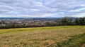
A very varied walk: access to a plateau with intensively farmed land offering beautiful views into the distance, a magnificent and well-maintained oak forest, and a towpath alongside the canal.

Machine-translated

Other walks in the area

For more walks, use our search engine .

The GPS track and description are the property of this route's author. Please do not copy them without permission.