Country:
 City:
City:


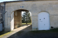
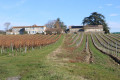
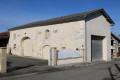
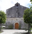
(S/E) Leave the car park in the space opposite the church, turning right onto Rue de la Motte heading south-west. At the next junction, turn right and, at the last building on the right, turn left onto a path that runs between two vineyard plots heading south-west. Follow the path to the Moulin d’Arthus (see the ‘During the walk’ section).
Make the most of being high up on the hill to take in the landscape with the help of the information boards.
(1) Continue along the path down the hill towards a dirt track. Cross it and carry on straight ahead until you reach the D50 road.
(2) Cross it carefully and take the path opposite, which continues to descend. Walk to the second T-junction.
(3) Turn left and cross the hill known as Trier de Bel-Air heading south-east, before descending towards a road leading to the hamlet of Chez Pelletan on your right. When you reach the end of the road, take the path heading north along the River Villier before turning off it to reach the D250E2 road, just north of Herbaud.
(4) Follow the D250E2 road to the right, passing Herbaud, and turn left onto a dirt track just before the bridge spanning a branch of the Villier. The track runs alongside a small rectangular pond on your right. Carry on straight ahead until you reach a T-junction. Turn right and immediately cross the two branches of the Villier via two bridges, then continue to the junction with a farm track on the left.
(5) Take the track on the left until you reach the next track on the right. Turn right and continue to the Route de Chez Févre.
(6) Cross the road carefully and continue straight ahead along a track leading towards Chez Jardonnet. On reaching this point, the track gives way to a road. At the crossroads in the hamlet, turn left onto the road that runs through the hamlet and heads towards a small road to the east.
(7) Carefully set off along the road to the right and immediately turn left onto the road heading towards the Grands Champs area. Carry on to the T-junction with the D251. Turn right and carefully follow the D251 for about a hundred metres to see, on the right in the copse, the Font Cluzac.
(8) Return to the D251 and follow it carefully to the left until you reach a crossroads at Chez Bouchet.
(9) Turn off onto the road on the right, known as Chez Bouchet, which descends towards Chez Lhoumeau. At the hamlet, the road runs alongside it before turning sharply left and heading north-west. Continue to the D50 and carry on straight ahead towards the north-west until you reach the nearby crossroads at a left-hand bend on the D50.
(10) Take the small road known as ‘Chez Genicot’, which climbs towards the hamlet of the same name. Follow it to the end, passing through the hamlet. Carry on straight ahead along the track that continues from the road immediately after the last house. The track climbs up the hill, running alongside a wood on the right-hand side.
(11) At the next junction, take the path opposite (slightly to the right) which leads downhill towards the hamlet of Chez Chambeau, continuing to follow the woodland on your right. The path passes to the north of Chez Chambeau and comes out onto Impasse Chambeau.
Take Impasse Chambeau, which climbs towards Sainte-Lheurine. Continue along Rue des Ecoles, which joins the D251. Carry on to the left and you’ll reach the car park when you arrive in front of the church (S/E).


 Visorando Member
 Easy
Easy 
 Tourist office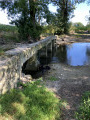
 Local authority