


Refine your search for walks in Belœil
Belœil walks


 The Ath-Blaton Canal between Belœil and Stambruges
 Visorando Member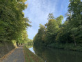
 7.74 mi
 +49 ft
 -49 ft
 3h 35
3h 35
 Moderate
 Departure from Belœil (Hainaut)
Pleasant walk along the Ath-Blaton Canal and return through the woods of Belœil Castle.
Belœil – Hyon
 14.45 mi
+207 ft
-279 ft
6h 50
14.45 mi
+207 ft
-279 ft
6h 50
 Difficult
Departure from Belœil (Hainaut)
Difficult
Departure from Belœil (Hainaut)
This eighth stage is certainly not the most pleasant part of this tour of Wallonia, as it passes through a heavily built-up area. Nevertheless, it is interesting to explore the Borinage not only through its countryside but also through its towns. You’ll find both aspects here. Accommodation with a local host.
The Stambruges Forest, the Bouillante Spring and Belœil Castle
 8.95 mi
+151 ft
-151 ft
4h 15
Moderate
Departure from Belœil (Hainaut)
8.95 mi
+151 ft
-151 ft
4h 15
Moderate
Departure from Belœil (Hainaut)
Discover the undivided forest of Stambruges, its avenues and paths, and the mystery of the Fontaine Bouillante. Follow the narrow streets of Belœil and Stambruges and marvel at the Château du Prince de Ligne, the ‘Belgian Versailles’.
Two other walks are available: “The Ath-Blaton Canal between Belœil and Stambruges” and “The Mer de Sable, the Fontaine Bouillante and the Blaton-Ath Canal”. This one is intended as a summary of the two (excluding the Mer de Sable) but follows different paths and lanes.
La Mer de Sable, the Fontaine Bouillante and the Blaton-Ath Canal
 6.41 mi
+171 ft
-144 ft
3h 05
6.41 mi
+171 ft
-144 ft
3h 05
 Easy
Departure from Belœil (Hainaut)
Easy
Departure from Belœil (Hainaut)
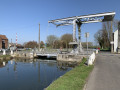
An easy walk accessible to all at Mer de Sable, in the undivided forest of Stambruges, to discover the Fontaine Bouillante and return along the Blaton-Ath canal on the towpath.
The Arbre à Loques, the Fontaine Bouillante and the Mer de Sable
 8.41 mi
+207 ft
-226 ft
4h 05
Moderate
Departure from Belœil (Hainaut)
8.41 mi
+207 ft
-226 ft
4h 05
Moderate
Departure from Belœil (Hainaut)
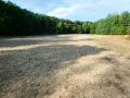
Whilst interesting sites such as the Stambruges Communal Forest, the Mer de Sable, the Fontaine Bouillante and the Ath-Blaton Canal are already well documented, here is a slightly different suggestion that takes in the Arbre à Loques and follows the canal along a forest path rather than the towpath used by so many cyclists!
A picturesque corner of the Borinage and the Harchies Marshes
 8.11 mi
+79 ft
-108 ft
3h 50
Moderate
Departure from Bernissart (Hainaut)
8.11 mi
+79 ft
-108 ft
3h 50
Moderate
Departure from Bernissart (Hainaut)
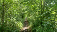
This is an easy walk to visit a picturesque corner of the Borinage region along old miners' paths and discover the charm of the Harchies marshes.
River, railway and geological heritage trail in Bernissart
 6.94 mi
+115 ft
-115 ft
3h 15
Moderate
Departure from Bernissart (Hainaut)
6.94 mi
+115 ft
-115 ft
3h 15
Moderate
Departure from Bernissart (Hainaut)
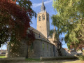
A walk that follows the old Pommeroeul–Antoing and Blaton–Ath canals, takes the old L80/78A Blaton–Bernissart railway line, and ends with country lanes running alongside the geological trail of the Bernissart Museum.
Bernissart’s river, railway, geological and ornithological heritage
 11.89 mi
+177 ft
-167 ft
5h 35
Moderate
Departure from Bernissart (Hainaut)
11.89 mi
+177 ft
-167 ft
5h 35
Moderate
Departure from Bernissart (Hainaut)
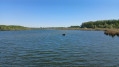
A walk that follows the old Pommeroeul–Antoing and Blaton–Ath canals, takes the old L80/78A Blaton–Bernissart railway line, runs alongside the Bernissart Museum’s geological trail, and ends with country lanes and the Marais d’Harchies
Best done in dry weather! Sections ofthe GR® 121 and 412 are very muddy (almost impassable) in wet weather.
Canals and Marshes in Bernissart
 10.33 mi
+66 ft
-69 ft
4h 50
Moderate
Departure from Bernissart (Hainaut)
10.33 mi
+66 ft
-69 ft
4h 50
Moderate
Departure from Bernissart (Hainaut)
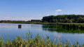
This walk takes you on a discovery of the Harchies Marshes, follows the towpath of the old Antoing-Pommerœul canal, joins the RAVeL of the old railway line linking Blaton to Bernissart, goes around Lake Bernissart and finally takes you into the countryside on the old railway line (not developed) that linked the Sartis coal mine to Bernissart station.
Bird Trail at the Marais d’Harchies
4.20 mi
+377 ft
-381 ft
2h 15
Easy
Departure from Bernissart (Hainaut)
Discover one of Wallonia’s richest natural sites!
Located in the Haine Valley, this 550-hectare area is a wetland of international importance (Natura 2000). This flat route, accessible to all (pushchairs welcome), takes you through vast reed beds, ponds and woodland, offering numerous vantage points from which to admire herons, ducks and, with a bit of luck, the elusive bittern.
Wiers – Belœil
 10.17 mi
+325 ft
-151 ft
4h 55
Moderate
Departure from Péruwelz (Hainaut)
10.17 mi
+325 ft
-151 ft
4h 55
Moderate
Departure from Péruwelz (Hainaut)
Starting from the random point given at the end of the previous stage, we will explore the Belgian-French border region in southern Hainaut, moving back and forth between France and Belgium, including the curious town of Bon-Secours with its cathedral situated right on the border. This stage ends in the municipality of Belœil at a holiday let booked for the occasion.
Circular Chabaud-Latour in Bonsecours
 11.72 mi
+230 ft
-240 ft
5h 35
Moderate
Departure from Condé-sur-l'Escaut (Nord)
11.72 mi
+230 ft
-240 ft
5h 35
Moderate
Departure from Condé-sur-l'Escaut (Nord)
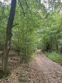
This circular route connects the Chabaud-Latour Pond to the Bonsecours Forest in Péruwelz. Along the route, you can see the Fosse Ledoux headframe and its slag heap, the Bernissart Fire Machine and the Basilica of Our Lady of Bon-Secours in Péruwelz.
Coqueréaumont – Pecq
14.89 mi
+686 ft
-801 ft
7h 25
Difficult
Departure from Frasnes-lez-Anvaing (Hainaut)
With this fourth stage, it’s time to tackle the westernmost part of the Tour de Wallonie as you head towards the Scheldt, but not before climbing the area’s toughest hill, Mont-Saint-Aubert.
Route of the two cycle paths
 6.56 mi
+102 ft
-98 ft
3h 05
Moderate
Departure from Dour (Hainaut)
6.56 mi
+102 ft
-98 ft
3h 05
Moderate
Departure from Dour (Hainaut)
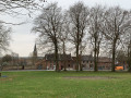
A walk through woods and fields in the Hauts Pays Nature Reserve.
Sept d'Hornu-Wasmes slag heap
 3.74 mi
+200 ft
-197 ft
1h 55
Moderate
Departure from Boussu (Hainaut)
3.74 mi
+200 ft
-197 ft
1h 55
Moderate
Departure from Boussu (Hainaut)
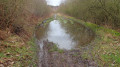
A walk starting from the Sept Hornu-Wasmes slag heap, offering sweeping views of the Borinage and its mining heritage. The cemetery features an unusual piano-shaped memorial. Paths, disused roads, the RAVel cycle route and footpaths make up this easy route, apart from the climb up the slag heap. A walking stick may be useful for the climb; in wet weather, large puddles may form on the path running alongside the N550, so please wear waterproof shoes in such conditions.
A walk through the countryside in Oeudeghien
 10.63 mi
+902 ft
-902 ft
5h 40
Moderate
Departure from Frasnes-lez-Anvaing (Hainaut)
10.63 mi
+902 ft
-902 ft
5h 40
Moderate
Departure from Frasnes-lez-Anvaing (Hainaut)
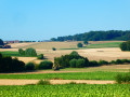
Situated in the Pays des Collines Nature Park, the Oeudeghien region is devoted to farming and livestock rearing. There’s no sign of any industrial activity on the horizon. The natural rolling hills of this part of Picardy Wallonia offer magnificent scenery.
On the way to the Caillou-qui-Bique
 11.49 mi
+558 ft
-568 ft
5h 45
Moderate
Departure from Quiévrain (Hainaut)
11.49 mi
+558 ft
-568 ft
5h 45
Moderate
Departure from Quiévrain (Hainaut)
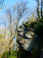
This lovely circular walk takes hikers through the Haut-Pays towards Onnezies (with its famous wolf and the manor tower), towards Gussignies (home to the equally renowned Brasserie du Baron) and the Caillou qui Bique above Grande Honnelle.A must for anyone unfamiliar with the region!Mostly through the countryside, the route also follows a section of the RAVeL and forest paths.It crosses part of the Natagora nature reserve at Grande Honnelle, where there are clear signs instructing you to follow the paths and not to pick the flowers – especially not the daffodils or hyacinths, which bloom in turn by the thousands in early spring!
Warguignies and the Bois de Saint-Ghislain
 4.05 mi
+177 ft
-177 ft
2h 00
Easy
Departure from Colfontaine (Hainaut)
4.05 mi
+177 ft
-177 ft
2h 00
Easy
Departure from Colfontaine (Hainaut)
A lovely walk, half through the countryside and half through woodland, along the paths of Warquignies and the Bois de Saint-Ghislain, where you can enjoy the coolness of the Ruisseau d’Elwasmes on hot days. It is worth noting that the Bois de Saint-Ghislain is, curiously, situated between Dour and Warquignies.
Sauwartan from Le Petit Dour
 2.34 mi
+85 ft
-102 ft
1h 10
Easy
Departure from Dour (Hainaut)
2.34 mi
+85 ft
-102 ft
1h 10
Easy
Departure from Dour (Hainaut)
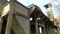
A walk that’s half through woodland and half across open countryside, where you’ll discover the remains of the Sauwartan coal mine and the site of an old watermill, as well as “Nounours” the llama.
The more adventurous can climb to the top of the slag heap.
The green and black heart of the Borinage in the Hauts-Pays Nature Reserve
 7.48 mi
+541 ft
-509 ft
3h 55
Moderate
Departure from Frameries (Hainaut)
7.48 mi
+541 ft
-509 ft
3h 55
Moderate
Departure from Frameries (Hainaut)
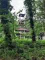
Set off from two listed monuments – the House of François Salignac de la Mothe-Fénélon, Bishop of Cambrai, and the Tour du Lait Buré (a reference to cuckoo flower or a cheese shaped like a ball) – to explore former mining sites, the Molettes frame at Sauwartan and the Grand Bouillon d’En Haut slag heap. Wander through the Bois de Colfontaine and the Bois l’Évêque along wide avenues and gently undulating footpaths. Save your energy for the final stretch of the walk: the 12% gradient of the Rampe Anfouette, which is said to owe its name to the lashes of the whips used by the drivers of the horse-drawn carts that used to travel up the ramp.
The Bois de Colfontaine and its stream
3.90 mi
+745 ft
-745 ft
2h 25
Easy
Departure from Frameries (Hainaut)
A pleasant walk through the woods, allowing you to discover the hidden contours of the woodland, the meandering Ruisseau de Colfontaine and the woodland paths.
“Ah! This wood, so beautiful and picturesque, with its whimsical paths disappearing into the valleys, following the unexpected twists and turns of the chattering streams and climbing the rugged slopes; its lanes, running from the R’mite cellar, passing not far from the Fountain, all the way to the Pavilion, veering off towards Blaugies or returning towards the first roundabout, its grassy paths winding through the thickets towards the Croatte tavern, or leading you back to the Baraque-à-Ramons, towards the Blondiau skittles alley! What a sight of couples dressed in their Sunday best! What a host of merry and boisterous groups! It was as though all the lovers of the Borinage had taken possession of the Wood…’ Dr Valentin Van Hassel (website link below)
If it’s a wet season, make sure you wear suitable footwear as the site (4) is often muddy in such conditions. Currently (June 2025) the ground is dry.
Ghislenghien - Coqueréaumont
 16.24 mi
+430 ft
-374 ft
7h 50
Difficult
Departure from Lessines (Hainaut)
16.24 mi
+430 ft
-374 ft
7h 50
Difficult
Departure from Lessines (Hainaut)
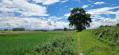
This third stage links two small villages in northern Hainaut: Ghislenghien and Coqueréaumont. It passes through Ath, where there are sports shops. This walk allows you to discover the two Dendre rivers, the eastern one flowing into the western one within the town, and to walk along the Way of St James. The route then heads back into the countryside, which is very hilly, heading westwards.