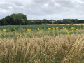
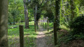
The green and black heart of the Borinage in the Hauts-Pays Nature Reserve

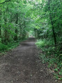
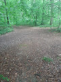
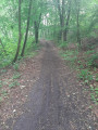
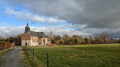
Set off from two listed monuments – the House of François Salignac de la Mothe-Fénélon, Bishop of Cambrai, and the Tour du Lait Buré (a reference to cuckoo flower or a cheese shaped like a ball) – to explore former mining sites, the Molettes frame at Sauwartan and the Grand Bouillon d’En Haut slag heap. Wander through the Bois de Colfontaine and the Bois l’Évêque along wide avenues and gently undulating footpaths. Save your energy for the final stretch of the walk: the 12% gradient of the Rampe Anfouette, which is said to owe its name to the lashes of the whips used by the drivers of the horse-drawn carts that used to travel up the ramp.

Details

35152683
Creation:
Last update:
Last review:
  • Walking
    Activity: Walking
  • ↔
    Distance: 7.48 mi
  • ◔
    Average duration: 3h 55 
  • ▲
    Difficulty: Moderate

  • ⚐
    Back to start: Yes
  • ↗
    Ascent: + 541 ft
  • ↘
    Descent: - 509 ft

  • ▲
    Highest point: 443 ft
  • ▼
    Lowest point: 203 ft

Photos

Description of the walk

Car park near the Tour du Lait Buré and the former residence of Fénélon, Bishop of Cambrai, on Rue Belle Maison in Paturages. There is no designated car park and, on busy days, you will need to park in the adjacent streets.

(S/E) Leave the Tour du Lait Buré on your right and enter the woods. Take the path on the left, which soon becomes a track. Join a wider path that runs along the edge of the woods. Pass the first, faintly marked track on your right, then a second one (closed to the public), and arrive at the next one.

(1) Turn right and enter the woods; continue straight on until you reach the tarmac-surfaced Allée de la Belle Maison, and follow it to the right. You’ll reach a crossroads of paths; continue straight on until the next path on the left.

(2) Follow it downhill towards a small stream at a T-junction.
Head uphill to the right until you reach a junction of five paths.

(3) Take the first one heading off to the left. There are several tracks; stay on the one running alongside the ravine on your left. Pass a path on your right, come to a wider track and join a tarmac lane.
Cross it and continue straight ahead towards the bottom of the valley. Stay on the main track and, as you approach the Ruisseau de Colfontaine, pass a path on your right. You’ll reach an imposing dam (given the size of the stream); cross it and reach a T-junction.

GR® signposting

(4) Turn right onto the path which continues to descend, pass an uphill path on the left and, after a bend to the left, take the clearly marked ascent (25-metre climb) which runs alongside the Grand Bouillon d’En Haut slag heap. Pass two paths on the right and reach the edge of the woodland at the foot of a water tower.
Cross Rue du Maréchal Joffre (a concrete road) very carefully, and follow Allée du Bois de Saint-Ghislain diagonally as it enters the woods again, until you reach a junction with its attractive signposts.

End ofGR® signposting

(5) Continue left along Allée Degorge until you reach Rue du Maréchal Joffre again. Cross it
carefully and carry on straight ahead at the next junction. Continue, heading slightly downhill, passing a small path on the left (sign prohibiting horse riders), until you reach a crossroads of paths and turn right. You’ll return to Rue du Maréchal Joffre for a third time;cross itcarefully and follow the path straight ahead on the other side of the road. Carry on until you reach the descent towards the valley of the Jean Finet and Elwasmes streams. At the bottom, after a sharp bend to the left, take care not to miss the steep path on the left.

(6) Climb this path and, once at the top, continue along the narrow path which joins a wider track; follow this track downhill to the right. At the Elwasmes stream, reach the valley floor. Take the wide track to the left which climbs up the other side of the valley. Continue along this path, ignoring the tracks to the left and right, until you reach a junction.

GR® signposting

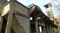
(7) Continue climbing to the left to reach the Sauwartan site and its rare example of a concrete roller frame (known as a ‘saltire’ in France). Please note that the site is on private land; please respect the no-entry sign.

(8) Head back down to the fork.

(7) Turn left. Continue along the main track, ignoring a path that descends to the right, until you reach a wide track running alongside the woodland. Follow Rue Baille de Fer to the right to reach a secluded house.

End ofGR® signposting

(9) The path takes a sharp bend to the left; ignore a track leading off to the right and take the one that continues straight ahead and enters the woods. Here too, stay on the main track and ignore the paths to the right. You’ll reach a T-junction; turn right and begin the descent to a crossroads where numerous tracks intersect, some of which have been created by mountain bikes.

(10) Stay on the main track and continue the descent. All the paths lead to Rue de Robersart. Follow it to the left and reach Ruelle de la Rampe Anfouette on the right.

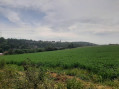
(11) Follow this lane, climbing 35 metres up a slope with a maximum gradient of 12 per cent. Take a moment to turn round and catch your breath, so you can enjoy the sweeping view towards Wasmes and its Protestant church. At the top, walk past a school and reach Rue du Maréchal Joffre. Follow this road to the right and stay on the right-hand pavement. At No. 261,cross theroad carefully and take a small uphill path on the left. At the top, head left and follow the path that runs along the side of the Grand Bouillon d’En Haut slag heap, joining Rue Bois l’Evêque; follow this to the right until you reach the woods at a crossroads.

(12) Continue straight ahead along the tarmac path and take the second path on the left (sign prohibiting horse riding). Pass two paths on your right and reach a five-way junction.

(13) Take the path on the left, reach another crossroads of paths and turn right. Follow this path to the edge of the woods and the Tour du Lait Buré, then on to the car park (S/E).


Waypoints

  1. S/E : mi 0 - alt. 390 ft - Lait Buré Tower
  2. 1 : mi 0.36 - alt. 423 ft - Junction: turn right
  3. 2 : mi 1.1 - alt. 417 ft - Junction, Allée Belle Maison
  4. 3 : mi 1.29 - alt. 400 ft - Junction of five paths
  5. 4 : mi 1.72 - alt. 328 ft - Path after the dam
  6. 5 : mi 2.27 - alt. 374 ft - Crossroads
  7. 6 : mi 3.75 - alt. 299 ft - Bottom of the descent. Fork in the path; turn left
  8. 7 : mi 4.4 - alt. 397 ft - Junction. Return route to the site
  9. 8 : mi 4.48 - alt. 410 ft - Sauwartan site
  10. 9 : mi 5.17 - alt. 377 ft - Isolated house. Crossroads, straight ahead
  11. 10 : mi 5.68 - alt. 351 ft - T-junction
  12. 11 : mi 5.96 - alt. 203 ft - Ruelle de la Rampe Anfouette
  13. 12 : mi 6.7 - alt. 328 ft - Crossroads. Rue Bois l’Evêque
  14. 13 : mi 6.95 - alt. 390 ft - Junction of five paths
  15. S/E : mi 7.48 - alt. 394 ft - La Tour du Lait Buré

Notes

There are no drinking fountains along the route.
Picnic areas: at the entrance to the woods near the Tour du Lait Buré and along the Allée Belle Maison beyond (2).

Worth a visit

The Sparkho Science Park in Frameries
The Van Gogh House in Wasmes and the Marcasse coal mine site.
Find out about the history of the bandit Moneuse.

Always be cautious and plan ahead when you're outdoors. Visorando and the author of this route cannot be held responsible for any accidents occurring on this route.

The GR® and PR® markings are the intellectual property of the Fédération Française de Randonnée Pédestre.

Reviews and comments

4.2 / 5
Based on 4 reviews

Reliability of the description
4 / 5
Ease of following the route
4.3 / 5
Route interest
4.3 / 5
Annecho
Annecho

Overall rating : 3 / 5

Date of your route : Jul 28, 2025
Reliability of the description : ★★☆☆☆ Disappointing
Ease of following the route : ★★★☆☆ Average
Route interest : ★★★★☆ Good
Very busy route : No

This route is very pleasant, but we got lost several times.
I think the small paths are not well maintained, so you're never sure you're on the right track!
We got lost as soon as we saw the first sign. It says when you reach a fork in the path, you should turn or go straight ahead, for example. The problem is that there are only forks in the path, some of which are poorly marked, others more so, but you always end up hesitating!
At another point, the map says to keep a path with a "no horses" sign on your left, but you have to retrace your steps to take it because there aren't any signs further on!
And the worst part is around the Sauwartan site, where we ended up completely lost!
Luckily, there were a few walkers who came along from time to time and were able to help us a little as they knew the area!
That said, it's a very pleasant place and, with the military map, we invented a new route!

Machine-translated

pierre gobin
pierre gobin

Hello, I’m delighted to hear you enjoyed the walk.
As for the problem of fallen trees, this is unfortunately becoming an increasingly common occurrence in the region. The weather conditions over the last few years have had a negative impact on the health of our forests and, as you’ve noticed, the walk isn’t very popular, so maintenance suffers as a result.
Thank you for your comments, and happy hiking.

Machine-translated

Arina Tomberg
Arina Tomberg

Overall rating : 4.3 / 5

Date of your route : Apr 06, 2025
Reliability of the description : ★★★★★ Very good
Ease of following the route : ★★★★★ Very good
Route interest : ★★★☆☆ Average
Very busy route : No

A pleasant and relaxing walk, ideal for summer when it’s hot, as the route runs almost entirely through woodland. In early April, despite the dry weather, several paths are still very muddy. Some large fallen trees block the path, and it’s not always easy to get round them.

Machine-translated

Seblaumaud
Seblaumaud

Overall rating : 4.3 / 5

Date of your route : May 05, 2024
Reliability of the description : ★★★★☆ Good
Ease of following the route : ★★★★☆ Good
Route interest : ★★★★★ Very good
Very busy route : No

A lovely walk through the woods, though it was a bit muddy +

Machine-translated

madydou
madydou ★
• Edited:

Actually, thanks to Pierre Gobin, who’ll be pleased to read your review

Machine-translated

Dubois Thérèse
Dubois Thérèse

Overall rating : 5 / 5

Date of your route : Apr 14, 2024
Reliability of the description : ★★★★★ Very good
Ease of following the route : ★★★★★ Very good
Route interest : ★★★★★ Very good
Very busy route : No

A magnificent walk, a magical experience amidst the ‘swarms’ of hyacinths, which introduced us to the woods of Colfontaine and Saint Ghislain, which we hadn’t visited before: a varied route, with ups and downs, idyllic paths and a particularly interesting concrete wheeled frame.
Just one tiny downside: after this rainy winter, the paths are very, very muddy and sometimes waterlogged. But with wellies or good waterproof ankle boots, you can get through… albeit more slowly (it took us 5 hours to complete the whole route!). We’ll definitely be doing it again.
So, thank you to Netra

Machine-translated

Other walks in the area

For more walks, use our search engine .

The GPS track and description are the property of this route's author. Please do not copy them without permission.