Bernissart’s river, railway, geological and ornithological heritage

A walk that follows the old Pommeroeul–Antoing and Blaton–Ath canals, takes the old L80/78A Blaton–Bernissart railway line, runs alongside the Bernissart Museum’s geological trail, and ends with country lanes and the Marais d’Harchies
Best done in dry weather! Sections ofthe GR® 121 and 412 are very muddy (almost impassable) in wet weather.

Details

19959108
Creation:
Last update:
Last review:
  • Walking
    Activity: Walking
  • ↔
    Distance: 11.89 mi
  • ◔
    Average duration: 5h 35 
  • ▲
    Difficulty: Moderate

  • ⚐
    Back to start: Yes
  • ↗
    Ascent: + 177 ft
  • ↘
    Descent: - 167 ft

  • ▲
    Highest point: 187 ft
  • ▼
    Lowest point: 43 ft

Photos

Description of the walk

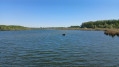
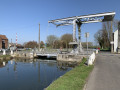
Park at the car park by the first lock on the old Antoing–Pommeroeul Canal.

(S/E) Cross the road carefully (limited visibility) and walk along the left bank of the canal. Pass under the RAVEL’s masonry bridge spanning the old canal and continue to lock no. 5, where an old barge is moored.

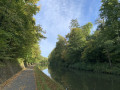
(1) Take the bridge on your right, then head straight on towards the metal footbridge spanning the main Antoing–Nimy Canal, which runs parallel to the green-painted RAVEL bridge. At the end of the footbridge, join the Blaton–Ath Canal on your left and follow it as far as Blaton.

(2) Cross the road bridge on your left, then turn right to continue along the left bank of the canal towards lock no. 4.

(3) Before reaching the lock, cross the bridge on your right and follow Rue de Condé towards the railway bridge.

(4) Once you’ve crossed it, turn left at the first road, Rue du Mont d’Or, and follow it to the RAVEL.

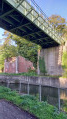
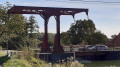
(5) Take it on your left and follow it to Bernissart. Pass alongside the Grande Bruyère de Blaton Nature Reserve and cross the large Antoing-Nimy Canal. Take care as the surface can be slippery in wet weather. Also cross the bridge over the old canal (slippery surface).

(6) At the end of the RAVEL, after the disused Bernissart station, turn left onto Rue de Valenciennes; cross the road and follow it to the left until you reach the first alleyway on your right.

(7) Turn into this lane and follow the geological trail (free entry).

(8) After passing a wasteland on your left and a concrete fence on your right, take the alleyway on your right which leads to Rue Lotard.

(9) Cross this street and, opposite, take the grassy lane at a slight angle between a hedge on your left and barbed wire on your right until you reach a signpostedGR® 121 path on your right (note: this is sometimes flooded; if so, you’ll need to go across the meadow or continue along the path and Rue Sarin to reach Rue Grande, then turn right to rejoin the trail).

(10) Cross Rue Grande and turn right, following theGR® 121 trail. Ignore the street on your left.

(11) After 300 m, join theGR® 121 on your left and follow it for 3 km to the hamlet of Les Sartis (vertical wind turbine on your left).

(12) Take the road on the left towards the Marais d’Harchies.

(13) Enter the marshland and continue to follow the GR®. Turn right at the T-junction.

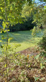
(14) On leaving the marsh, turn left, walk past the car park and re-enter the marsh through the gate, then follow the path that branches off to the right.

(15) At the end of the path, turn right and leave the marsh. Cross the road carefully and join the small path, then follow it, ignoring the turnings to the right. Before reaching the road, continue along the path on your right, following the old canal for 2 km, until you return to the car park where you started (S/E).


Waypoints

  1. S/E : mi 0 - alt. 72 ft - Lock No. 1 of the old - Ancien canal
  2. 1 : mi 1.02 - alt. 102 ft - Lock No. 5 - Canal Nimy-Blaton-Péronnes
  3. 2 : mi 1.8 - alt. 115 ft - Road bridge - Canal Blathon-Ath - Belgique
  4. 3 : mi 2.48 - alt. 128 ft - Bridge before lock no. 4
  5. 4 : mi 2.69 - alt. 131 ft - Rue du Mont d’Or
  6. 5 : mi 2.77 - alt. 141 ft - Ravel L80/78A
  7. 6 : mi 4.82 - alt. 75 ft - End of the RAVEL L80/78A
  8. 7 : mi 4.95 - alt. 79 ft - Alleyway running alongside the geological trail
  9. 8 : mi 5.13 - alt. 79 ft - Alleyway
  10. 9 : mi 5.35 - alt. 66 ft - Rue Lotard (GR 121)
  11. 10 : mi 5.53 - alt. 66 ft - Rue Grande, marked GR 121
  12. 11 : mi 5.72 - alt. 69 ft - GR 121 trail
  13. 12 : mi 7.53 - alt. 56 ft - The Sartis neighbourhood
  14. 13 : mi 7.85 - alt. 59 ft - Harchies Marshes
  15. 14 : mi 9.87 - alt. 66 ft - Marsh car park
  16. 15 : mi 10.89 - alt. 82 ft - Exit from the marsh
  17. S/E : mi 11.89 - alt. 72 ft - Lock No. 1 on the old Antoing–Pommeroeul Canal

Notes

Picnic tables in the geological garden.

Worth a visit

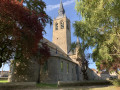
The 11th-century church at Blaton.
Iguanodon Museum in Bernissart.

Always be cautious and plan ahead when you're outdoors. Visorando and the author of this route cannot be held responsible for any accidents occurring on this route.

The GR® and PR® markings are the intellectual property of the Fédération Française de Randonnée Pédestre.

Reviews and comments

5 / 5
Based on 2 reviews

Reliability of the description
5 / 5
Ease of following the route
5 / 5
Route interest
5 / 5
PATRICK NOTTE
PATRICK NOTTE

Overall rating : 5 / 5

Date of your route : Apr 30, 2026
Reliability of the description : ★★★★★ Very good
Ease of following the route : ★★★★★ Very good
Route interest : ★★★★★ Very good
Very busy route : No

A lovely walk, even though it involves some long stretches.
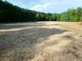
We set off at around 10 am from the car park at the Bernissart Geological Garden and followed the Ravel. After crossing the bridges over the canals, don’t miss the Grande Bruyère sandpit in Blaton. At around 11.45 am, near the gate that blocks off the canal at the foot of the steps, you’ll find Café La Volette in Blaton; the owner is friendly and we were able to eat our picnic and enjoy a nice beer.
In the afternoon, we headed towards the Harchies marshes via the canal; there are now numerous observation points from which to watch the birds.
The Wattrelos Hikers’ Association

Machine-translated

etx61
etx61

Overall rating : 5 / 5

Date of your route : Oct 07, 2022
Reliability of the description : ★★★★★ Very good
Ease of following the route : ★★★★★ Very good
Route interest : ★★★★★ Very good
Very busy route : No

A lovely, varied walk.
Very easy, completely flat.

For convenience and to find a less isolated car park, park at Blaton Church (large car park), situated less than 100 metres from the route at the lock (point no. 2).

Machine-translated

Other walks in the area

For more walks, use our search engine .

The GPS track and description are the property of this route's author. Please do not copy them without permission.