Country:
 City:


Park in the Salle des Fêtes car park.
(S/E) Head towards the town hall and the school and follow the small road to the right towards the church. Take the first tarmac track on the left between the houses, before the church. At the first junction of tracks (the track below), turn right and continue to the road.
(1) Cross the D 22 with care, then head straight on towards the hamlet of Les Coffres. Immediately take the road on the left and turn right as you leave the hamlet, just after the last houses. The road climbs past the last houses on your right. Walk through the woods until you reach a junction where you join theGR®4(marked with red and white signs).
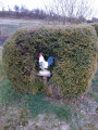
(2) Turn right, passing through the hamlet of Chez Chavigneau with its beautiful miniature models (castle and mill).
Pass through Chez Lavaud, continuing to follow the GR® markings.
(3) Take the first tarmac track on the left, which climbs steeply and then curves back. Pass through the hamlet of Chez Chagneau, ignoring the first road on the left. Carry on straight ahead to the end of the road and continue along the track. Enter the woods and, after about 500 m, you’ll reach a clearly visible T-junction.
(4) Leave theGR®4by turning right onto the first track. Continue until you reach the edge of the woodland on the left and turn left to follow the edge of the woodland. Pass between the woodland and a blackcurrant plantation on the right. When you reach the vineyard, turn left and enter the woodland. Stay on the track until you approach the houses at Chez Jacquiot.
(5) Do not continue straight on, but turn left opposite the small shed. Head straight towards the pond, pass in front of a small shed and then onto the pond’s embankment on your right. Follow the path as it enters the woodland slightly to your left without going all the way to the end of the pond, and continue until you reach the road (D 107).
(6) Cross carefully and head straight on towards Les Forêts. At the entrance to the hamlet, before the first house, turn right onto the first grassy track. Carry on straight ahead along the road until you reach the junction with the D 22.
(7) Cross with care and take the road opposite. Cross the Cluzeau and continue to the T-junction.
(8) Turn right and, 50 metres further on, turn left onto a small grassy track. Follow the edge of the woodland on your left; when you reach the T-junction, turn right. Pass close to the Butte du Télégraphe and the water reservoir, follow the track which turns 90° to the right and rejoins the road you crossed earlier.
(9) Turn left, follow the road with care, then turn right at the next road and walk downhill for about 150 m.
(10) Turn left onto a grassy path marked in yellow, with Plassac church opposite. Follow the path to the T-junction. Turn right, look at the fountain and head down the small road. Turn left onto the first path to climb back up to the church. Visit the church, then go down to see the underground church.
Then turn left, then left again before the town hall to reach the car park (S/E).

 Tourist office

 Visorando Member
 Easy