Bel Air via the Chalets de Pertuis

A lovely circular hike in the Vallée d’Abondance offering stunning views of the area’s main peaks. A simple return trip to the Chalets de Pertuis makes for a lovely family hike.

Details

38021382
Creation:
Last update:
Last review:
  • Walking
    Activity: Walking
  • ↔
    Distance: 6.23 mi
  • ◔
    Average duration: 4h 25 
  • ▲
    Difficulty: Moderate

  • ⚐
    Back to start: Yes
  • ↗
    Ascent: + 1,772 ft
  • ↘
    Descent: - 1,752 ft

  • ▲
    Highest point: 5,850 ft
  • ▼
    Lowest point: 4,154 ft

Photos

Description of the walk

Start from the Plan des Feux car park, at the end of the Route du Clos Baron, which begins at the foot of the church in La Chapelle d’Abondance.

Signposts are present at all major junctions. Yellow-arrowed waymarkers are found at intervals along the route.

(S/E) Take the Piste pastorale de la Follière towards Les Prés and Trébentaz, passing a shelter on the right. Climb steadily through the forest, passing under a chairlift line and then under a ski lift line. Pass the top station of a chairlift and then that of a ski lift on the right, and ignore the path leading to a chalet on the right.

(1) At the “Les Prés” signpost, keep to the right towards Chable de la Plagne. Climb gently, pass under a T-bar lift line, stay on the track and ignore a few side paths.

(2) At the “Chable de la Plagne” signpost, turn left onto the Chemin de Pertuis towards the chalets of the same name and Bel Air. Climb more steeply up an alpine track through more open terrain. Pass the top of a ski lift on your left and note the summit of Mont de Grange opposite and higher up.

(3) At the “Altitude 1620 m” signpost, there are two options.
- Head straight to Bel Air: refer to the second reference at point 3 further on in the description.
- As shown on the map, turn left onto the track and continue climbing to reach the Chalets de Pertuis quickly.

(4) Return to the “Altitude 1620 m” signpost.

(3) Take the path towards Bel Air – on the left if you’re coming down from the chalets, on the right if you’re coming directly from Chable de la Plagne. Climb up steep switchbacks through the forest and between some rocks. Then follow a gentler traverse through more open terrain. This will take you to the “Bel Air” signpost.

(5) Immediately head right towards a small hillock which serves as the summit (extensive views).

(6) Return to the signpost.

(5) Head south-west towards the Chalet de Leschaux and descend into a mountain pasture. At a fork in the road not shown on the map (signpost), keep to the right. Follow a fence on your right and watch out for the sheer drop on your left. At the first signpost marked “Chalet de Leschaux”, go through a gap in the fence and you’ll soon reach a track (second signpost).

(7) Follow the track to the right towards Plan des Feux and pass the foot of the chalet on the left. Enter the forest and descend steadily.

(8) At the “Sous Leschaux” signpost, turn right onto the track towards Plaine Joux.

(9) At the signpost marked “Alpage de Plaine Joux”, stay on the track and go round the chalets on the right. Climb gently and then descend in the same way.

(10) At the “La Plaine Joux” signpost (with a wooden cross opposite), veer right towards Plan des Feux. Stay on the main track and ignore a dirt track on the right that climbs uphill (elevation 1414). Alternate between gentle descents and gentle climbs, ignoring a few side paths. This will take you to the “Chable de la Plagne” signpost.

(2) Then turn left towards Plan des Feux and, following the reverse route of the outward journey, head back down to the Plan des Feux car park (S/E).

Waypoints

  1. S/E : mi 0 - alt. 4,154 ft - Plan des Feux
  2. 1 : mi 0.59 - alt. 4,459 ft - Les Prés
  3. 2 : mi 1.24 - alt. 4,636 ft - Chable de la Plagne
  4. 3 : mi 1.94 - alt. 5,308 ft - Signpost “Altitude 1620 m”
  5. 4 : mi 2.09 - alt. 5,397 ft - Chalets de Pertuis
  6. 5 : mi 2.69 - alt. 5,840 ft - “Bel Air” signpost
  7. 6 : mi 2.71 - alt. 5,850 ft - Bel Air (1783 m)
  8. 7 : mi 3.25 - alt. 5,266 ft - Chalet de Leschaux
  9. 8 : mi 3.7 - alt. 4,921 ft - Below Leschaux
  10. 9 : mi 4.17 - alt. 4,629 ft - Plaine Joux mountain pasture
  11. 10 : mi 4.37 - alt. 4,596 ft - La Plaine Joux
  12. S/E : mi 6.23 - alt. 4,154 ft - Plan des Feux

Notes

Hiking boots recommended.

Fountain at the Chalets de Pertuis (flowing in August 2023). The chalets are private properties occupied in the summer.

Alternative route:
It is, of course, possible to descend from the Chalets de Pertuis directly to the Plan des Feux via the same route as on the way up, but in the opposite direction. Allow for an elevation gain of around 400 m and between 1 hour and 1 hour 30 minutes’ climb for this shorter route.

A detailed map is useful (at the very least, the one accompanying this description).

Hike undertaken by the author on 9 August 2023.

Worth a visit

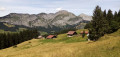
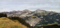
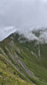
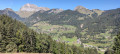
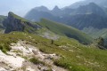
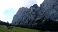
- Beautiful views of the two highest peaks in the Vallée d’Abondance (2,432 m each), the relatively nearby Mont de Grange to the south and the more distant Cornettes de Bise to the north-east.
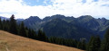
- Beautiful views to the north over Mont Chauffé and its very long ridge.
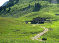
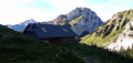
- A lovely cluster of chalets at Pertuis, set in a wild landscape at the foot of Mont de Grange.

Reviews and comments

4.5 / 5
Based on 3 reviews

Reliability of the description
4.5 / 5
Ease of following the route
4.7 / 5
Route interest
4.3 / 5
User 12008148

Overall rating : 4.7 / 5

Date of your route : Jul 10, 2026
Reliability of the description : ★★★★☆ Good
Ease of following the route : ★★★★★ Very good
Route interest : ★★★★★ Very good
Very busy route : No

There’s no one on this path. The view from the top is magnificent, taking in Mont de Grange and all the surrounding mountains. However, it’s worth noting that 80 per cent of the walk is along wide, stony forest tracks designed to allow access for vehicles heading to the mountain pastures; these tracks are therefore not particularly pleasant and are very steep. The climb is quite steep and rather uninspiring, but the view that follows is well worth it and can make you forget the gruelling ascent.

Machine-translated

bbn35bzh
bbn35bzh

Overall rating : 3.5 / 5

Date of your route : Aug 31, 2025
Reliability of the description : Not used / Not applicable
Ease of following the route : ★★★★☆ Good
Route interest : ★★★☆☆ Average
Very busy route : No

Easy circuit with little traffic. Many forest paths.

Machine-translated

Suzanne.bonifas
Suzanne.bonifas

Overall rating : 5 / 5

Date of your route : Sep 18, 2023
Reliability of the description : ★★★★★ Very good
Ease of following the route : ★★★★★ Very good
Route interest : ★★★★★ Very good
Very busy route : No

A very lovely, easy route

Machine-translated

Other walks in the area

For more walks, use our search engine .

The GPS track and description are the property of this route's author. Please do not copy them without permission.