Route around La Chapelle-d’Abondance via Les Mattes

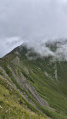
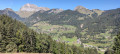
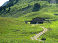
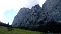
A very beautiful route in this northern part of Mont Grange.
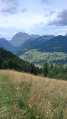
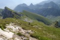
A lovely viewpoint at Les Mattes overlooking the Aiguilles du Midi on the Swiss side.
At the Croix des Cornillons, there’s a view over the valley towards Châtel.

You are in a protected area! Please see the regulations in the practical information section.

Details

18092629
Creation:
Last update:
Last review:
  • Walking
    Activity: Walking
  • ↔
    Distance: 11.35 mi
  • ◔
    Duration according to the author: 7 hrs 
  • ▲
    Difficulty: Very difficult

  • ⚐
    Back to start: Yes
  • ↗
    Ascent: + 3,652 ft
  • ↘
    Descent: - 3,632 ft

  • ▲
    Highest point: 6,302 ft
  • ▼
    Lowest point: 4,022 ft

Photos

Description of the walk

To reach the Plan des Feux car park by car via the D22 from Thonon, drive to the roundabout by the church in La Chapelle d’Abondance. Go round the roundabout, then take the first right onto the Route des Contamines, cross the Drans bridge and you’ll arrive at the chairlift station. Turn right, then right again onto the Route des Oursons to reach Le Plan des Feux, about 2 km away.

(S/E) From the Plan des Feux car park, head east towards Sur Bayard and the Chalets de la Torrens. Take the track suitable for vehicles (Piste Pastorale de l’Auberraz). When it turns south, it meets a track coming from the left from Sur Bayard.

(1) Leave this track on your left – this is the return route – and continue south for a few hundred metres until you reach the signpost for La Louennaz (Alt 1310 m).

(2) Take the track leading uphill across the meadow (electric fence), towards La Pare Midi and Chalet de la Torrens, to reach the junction at the sign for La Pare Midi (alt. 1,551 m).

(3) At the junction, continue straight ahead, ignoring the track to the right, and head towards Les Crottes and Chalet de la Torrens. You’ll reach the junction with theGR®5at the Les Crottes alpine chalet, in front of the sign for Les Crottes Alt 1529 m.

(4) Turn right onto the path climbing through the woodland towards the Chalet de la Torrens and Les Mattes. This section is quite steep and stony until you reach the junction at the Chalet de la Torrens. When you reach the sign, take care on the damp section to the right.

(5) At the signpost near the Chalet d’alpage de la Torrens, turn right towards Les Mattes along a path through the meadow. Once you reach the Col des Mattes and then the Plaine des Mattes, continue to thesecond signpost for Les Mattes (Alt 1930 m), with the alpine chalets on your left.

(6) Take the path slightly to the right towards the Le Pron and L’Étrye chalets. This is a dangerous downhill section. Pass the Le Pron chalets and continue along the path branching off to the right. Caution: wet section. You will reach a junction with a track suitable for vehicles, at the sign for Ruisseau de l’Étrye, Alt 1660 m.

(7) Take the track to the right towards the L’Étrye mountain chalets. There is a drinking fountain by the chalets. Continue along the track towards Lenlevay via theGR®5to the Crête de Coicon (alt. 1,840 m). This is the furthest point on the route.

(8) Turn round and head back down the track in the opposite direction, passing the Étrye alpine chalets once more. Continue along the same track, passing the sign for Étrye (alt. 1,694 m) and rejoining the junction with the Ruisseau de l’Étrye.

(7) Leave theGR®5and continue to the right towards Sur l’Arête and Cornillon until you reach the ‘Sur l’Arête Alt 1658 m’ sign.

(9) Ignore the tracks to the right and left and carry on straight ahead towards the north-east, towards Chalet Cornillon. After a left-hand bend, you’ll arrive in front of the chalet and the ‘Cornillon Alt 1777 m’ sign.

(10) Turn right onto the track towards Les Québales. Pass the ‘Alt 1760’ sign and head towards Les Québales, continuing until you reach the ‘Les Québales Alt 1790 m’ sign.

(11) In front of the sign, take the track on the left towards the Chalet de la Torrens and return to the junction and the sign for the Chalet de la Torrens 1,735 m.

(5) Turn right onto theGR®5path; be careful of a damp section on the left. Continue in the opposite direction along this section, which you already took on the way there, following the path through the woodland – a fairly difficult section – until you reach Les Crottes.

(4) In front of the alpine chalet and the ‘Les Crottes’ sign, leave the path you took on the way up and continue straight on along theGR®5. Head down into the woodland – a fairly difficult section – until you reach the wooden sign pointing towards Sur Bayard.

(12) Leave theGR®5and take the straight dirt track across the meadow, then continue past the sign for ‘Sur Bayard Alt 1230 m’. Take the track, which is partly uphill, then cross the bridge. Continue along the path to the left across the meadow until you reach the sign for ‘Les Ravières Alt 1281 m’ and the junction marking the end of the circular route.

(1) Turn right towards Plan de Feux along the track used on the way out, until you reach the car park (S/E).

Waypoints

  1. S/E : mi 0 - alt. 4,150 ft - Car park - Plan des Feux
  2. 1 : mi 1.13 - alt. 4,193 ft - Crossroads at the circular loop
  3. 2 : mi 1.39 - alt. 4,295 ft - Sign at La Louennaz
  4. 3 : mi 2 - alt. 4,941 ft - Sign at La Pare Midi, altitude 1,550 metres
  5. 4 : mi 2.65 - alt. 5,003 ft - Crossroads. Les Crottes Alt 1529 m
  6. 5 : mi 3.23 - alt. 5,692 ft - Junction. Sign for Chalet de la Torrens 1735 m
  7. 6 : mi 3.79 - alt. 6,273 ft - Sign at Les Mattes, altitude 1,930 m - Pointe des Mattes
  8. 7 : mi 4.7 - alt. 5,449 ft - Junction. Signpost: Ruisseau de L’Étrye 1660 m
  9. 8 : mi 5.57 - alt. 6,043 ft - Sign: Crête de Coicon, Altitude 1,840
  10. 9 : mi 6.82 - alt. 5,433 ft - Sign: “On the ridge, altitude 1,658 m”
  11. 10 : mi 7.23 - alt. 5,837 ft - Chalet Cornillon
  12. 11 : mi 8 - alt. 5,853 ft - Sign: Les Québales, Altitude 1,790 m
  13. 12 : mi 9.77 - alt. 4,091 ft - Wooden signpost to Bayard - Cascade Sur Bayard
  14. S/E : mi 11.35 - alt. 4,150 ft - Le Plan des Feux car park

Notes

Parking is available at the Plan des Feux car park.
Water point at the Étrye mountain chalet
Signposts are in place along the entire route.


REGULATIONS:

This route passes through the Mont de Grange protected natural area. To avoid disturbing wildlife and to preserve its habitat, please respect the regulations in force.

Permitted:

  • Dogs on a lead
  • Camping is permitted between 7.00 pm and 9.00 am.

Prohibited:

  • Picking plants
  • Collecting plants
  • Littering
  • Motor vehicles

During your walk, you may also come across herds grazing in the mountain pastures; please respect the following rules of conduct:

  • Close gates and fences
  • Keep your dogs on a lead and pick up their faeces
  • Do not wash, bathe or clean any objects in the drinking troughs
  • Do not approach the herds
  • Stay on the paths

Here, as elsewhere, nature deserves your respect

Further information: Protection Biotope (APPB) – Pays d’Evian Vallée d’Abondance

This route passes through a protected area, which may be subject to special regulations:

Worth a visit

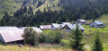
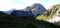
There’s a beautiful view from Chalet Cornillon, to the right of the cross.
Don’t miss the waterfall at Sur Bayard.

Always be cautious and plan ahead when you're outdoors. Visorando and the author of this route cannot be held responsible for any accidents occurring on this route.

The GR® and PR® markings are the intellectual property of the Fédération Française de Randonnée Pédestre.

Reviews and comments

4.8 / 5
Based on 2 reviews

Reliability of the description
5 / 5
Ease of following the route
5 / 5
Route interest
4.5 / 5
kaolak1
kaolak1
• Edited:

Overall rating : 5 / 5

Date of your route : Jul 24, 2025
Reliability of the description : ★★★★★ Very good
Ease of following the route : ★★★★★ Very good
Route interest : ★★★★★ Very good
Very busy route : No

A beautiful loop that allowed me to discover a part of Haute-Savoie that I still know too little about.
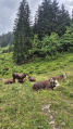
One small downside: there are numerous mountain pastures along the route, and herds of cows sometimes block the path, forcing you to go around them, which caused me to fall...
The only frustration was at point 8, which you reach after a nice climb... only to turn back immediately. I therefore recommend continuing on to a superb viewpoint at 2,004 metres on Mont de Grange. I stopped there for lunch and enjoyed the view.

Despite the rain and even a few hailstones, I was in hiking/trail mode and found the trail really enjoyable to run on. The scenery is well worth the effort.

Machine-translated

ericjrdn2
ericjrdn2

Overall rating : 4.7 / 5

Date of your route : Aug 17, 2023
Reliability of the description : ★★★★★ Very good
Ease of following the route : ★★★★★ Very good
Route interest : ★★★★☆ Good
Very busy route : No

Thank you for this hike.
It took just under 8 hours, which keeps you busy for the whole day. There aren’t any technical or dangerous sections, in my opinion (and I’m afraid of heights!). The walk is demanding; you have to cover 18 km and 1,000 metres of elevation gain. It was a bit of a let-down having to turn back at point 8, but it’s true that going all the way to the summit adds another 600 metres of elevation gain, which starts to add up. Those who want to can still do it, though.
The scenery is lovely to look at and varied.

Machine-translated

Other walks in the area

For more walks, use our search engine .

The GPS track and description are the property of this route's author. Please do not copy them without permission.