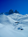
Basse du Gerbier, starting from Le Chalmieu (Montrond)

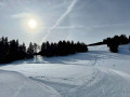
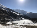
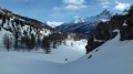
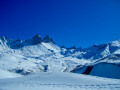
A lovely viewpoint at the foot of the Aiguilles d’Arves, offering a truly beautiful setting in the heart of the Arvan. The route is similar to the summer one, except that it starts from a lower point and is therefore longer.

Details

n°7100038
Creation:
Last update:
Last review:
  • Snowshoeing
    Activity: Snowshoeing
  • ↔
    Distance: 8.25 mi
  • ◔
    Duration according to the author: 7 hrs 
  • ▲
    Difficulty: Moderate

  • ⚐
    Back to start: Yes
  • ↗
    Ascent: + 3,261 ft
  • ↘
    Descent: - 3,261 ft

  • ▲
    Highest point: 8,455 ft
  • ▼
    Lowest point: 5,194 ft

Photos

Description of the walk

From Saint-Jean-de-Maurienne, follow the Arvan Valley; there are then two possible routes:
- via Albiez-Montrond: climb up to Albiez-le-Vieux and the Col du Mollard, then descend to Montrond before climbing back up to Le Chalmieu,
- take the D926 towards the Arvan Valley and Saint-Jean-d’Arves, turn left towards Montrond and climb up to Le Chalmieu.
Park in the car park at the top of the village.

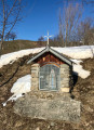
(S/E) Avoid the summer road, which continues on; instead, take the path from the car park that climbs straight up. It crosses the road several times, notably at the Combet oratory, then climbs up to the TV relay station, where the road ends in summer.

(1) Continue along the path, which levels out at Coulouvreuse towards Les Chabottes.

(2) Turn slightly to the right to continue towards Le Plan and Le Lissolet, passing close to Pré-Valloire as you climb; the route then descends slightly along the stream, following a gully to Le Bassin.

(3) Turn right to cross a tributary of the main stream and head uphill towards the Manches chalets until you reach the clearly visible footbridge over the Pradin stream.

(4) Cross the stream via the footbridge or alongside it, depending on the snow conditions, and continue climbing whilst heading south, passing close to the Chalet de la Motte and following the ridge that overlooks the Ruisseau des Mulatières and its gullies on the right.
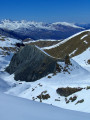
This ridge, which is at times slightly steeper, leads via gentler final slopes to the Col de la Basse du Gerbier, at an altitude of 2,553 m.

(5) Continue along the ridge for a few hundred metres towards the Aiguilles d’Arves for a slightly more unobstructed view.

(6) From this high point of the hike, you can return via the same route, or take a few alternative routes; for example, from the summit, you can head straight down into the rolling hills to rejoin the ascent track further down.

(1) On the final descent from the Relais sur le Chalmieu, if there isn’t enough snow on the path, you can cut across the fields, aiming for the remaining patches of snow to reach the Chalmieu
(S/E).

Waypoints

  1. S/E : mi 0 - alt. 5,194 ft - Le Chalmieu
  2. 1 : mi 1.17 - alt. 6,250 ft - TV relay station
  3. 2 : mi 1.55 - alt. 6,417 ft - Les Chabottes
  4. 3 : mi 2.41 - alt. 6,752 ft - The Bassin
  5. 4 : mi 2.85 - alt. 6,952 ft - Footbridge over the Ruisseau de Pradin
  6. 5 : mi 4.1 - alt. 8,379 ft - Basse du Gerbier
  7. 6 : mi 4.24 - alt. 8,455 ft - High point of the Basse du Gerbier ridge
  8. S/E : mi 8.25 - alt. 5,194 ft - Le Chalmieu

Notes

The path is marked in yellow in its lower section and, most importantly, there are numerous directional signs at every junction.

Worth a visit

The view of the Aiguilles d’Arves and the Aiguilles de la Saussaz is magnificent along much of the route.
From the summit, there are also views of the Sept-Laux, the Lauzière, the Grande Chible and the Pic du Mas de la Grave.

Reviews and comments

4.7 / 5
Based on 1 review

Reliability of the description
4 / 5
Ease of following the route
5 / 5
Route interest
5 / 5
Mimizen38
Mimizen38
• Edited:

Overall rating : 4.7 / 5

Date of your route : Jan 30, 2022
Reliability of the description : ★★★★☆ Good
Ease of following the route : ★★★★★ Very good
Route interest : ★★★★★ Very good
Very busy route : No

A lovely snowshoe hike that’s well worth the trip as the scenery is magnificent.
However, given the narrowness of the roads leading to the starting point and the rather steep slopes before the summit, I’d avoid going there after heavy snowfall.
With a 1,000-metre elevation gain plus the altitude, I’d classify this hike as quite challenging. Otherwise, there are no particular difficulties; the path is easy to follow.
Thank you for introducing me to this route.

Machine-translated

Other walks in the area

For more walks, use our search engine .

The GPS track and description are the property of this route's author. Please do not copy them without permission.