Country:

 City:
City:


The entire route follows the Red Rectangle, unless otherwise stated.
Could there be a mistake regarding the starting point?
(S) Rue de l'Eglise in Barr.
(1) Behind Barr Town Hall, head south, turning left. Continue straight on until you reach the fountain. Turn left, then right onto Rue Rotland.
(2) Follow it to the last houses on the right.
(3) At the last houses in Barr, turn right into the vineyard towards Mittelbergheim. At the end, on the road, turn left, then immediately right, until you reach a crossroads with a cross.
(4) Take the second right. The GR®5 bypasses the centre of Mittelbergheim by passing to the north of the village and heads towards Andlau. Continue to the first fork in the road.
(5) Keep right twice, then first turn left then right to leave the village.
(6) On leaving Mittelbergheim, leave the road via the path on the left, heading towards Andlau. Continue left along the path towards the same village. Then head straight on towards the main road and its bench.
(7) Cross the RD 62 and turn left towards the Andlau business park, then turn right at the junction a little further on; then take Rue du Général Koenig on the left until you reach a Fork in the road.
(8) To visit Andlau, continue straight ahead. To continue on the GR®5, turn right and follow the river, which you must cross at the end to take Rue Clemenceau on the right until you reach Chemin du Gruckert.
(9) Follow this path, which climbs to the left. This marks the start of a long ascent through the Weihermattenthal (4 km, 1h30, +360 m) to the Gruckert refuge. Continue straight on at every junction until you reach the top of the climb. Then turn right towards the refuge.
(10) Further on, turn left towards the Col de l'Ungersberg. Continue straight on at every junction. At the junction with a forest track, continue in the same direction, then climb left towards the Col de l'Ungersberg.
(11) At the Col de l'Ungersberg, begin a steep climb to the left, up to the summit of the Ungersberg. To do this, cross the Chemin Forestier du Milieu and continue in the same direction before veering sharply left to continue the climb towards the summit of the Ungersberg. Stay on the path, which zigzags up a steep slope.
(12) Begin the descent towards the hamlet of Sommerain. Cross the forest track and continue down the path which dips slightly to the left, towards Sommerain. It crosses two forest tracks before joining a good path.
(13) Keep left, then leave the track on the right towards Sommerain. Keep well to the right on the main track, heading towards Sommerain.
(14) Continue straight ahead. Do not miss the Rotenecken forest road on the right, marked by a barrier. Continue along this track towards Châtenois, then turn left. Continue straight on until you reach the edge of the woods. When you reach the valley, turn left and head for the junction of the D253 and D203, towards Châtenois.
(15) At the junction of the RD203 and RD253, head for the clearing opposite, towards the Rocher de l'Âne. At the road, first turn right then left, then continue straight ahead until you reach the road.
(16) Keep going straight, then stay on the path on the left. At the road, turn left, then right, then left, and right again, towards the Rocher de l'Âne.
(17) At the Rocher de l'Âne, enjoy the view, then continue towards Schulwaldplatz, keeping straight on.
(18) At Schulwaldplatz, continue straight ahead along the road towards Bernstein Castle. At Kasmarkt, head straight ahead along the road, then take a track round the bend to reach the castle.
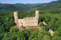
(19) At Bernstein, head straight on towards Ortenburg Castle. At the hamlet of Krieghurst, turn left, then immediately right, and follow the forest track down the valley. Continue to the left at the next junction. Leave the path and take the track on the right, which climbs slightly towards Ortenburg. Then continue straight ahead to Ortenburg.
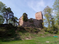
(20) At Ortenbourg, continue to the right towards the neighbouring ruins, those of Ramstein.
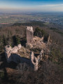
(21) View of Ramstein Castle. A short path leads there. Head down to the right, then left, due south, into the valley, towards Châtenois, towards the old salt road. At the crossroads, turn left and reach the road. First turn right then left to rejoin a path leading to the stream.
(22) Cross the Aubach. After crossing the river, turn left to reach the left bank of the Giessen, which you should follow towards Châtenois, leading onto the RD35.
(23) Follow the road to the right, cross the Giessen and continue towards Châtenois.
(24) Cross the Muhlbach at Châtenois. Go straight ahead at the roundabout, then through the outskirts to reach the old town.
(25) Keep going straight on to reach the town hall (E).

 Visorando Member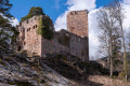
 Moderate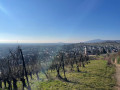
 Difficult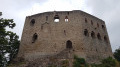
 Easy
Easy