A secret stroll through Moustier-Ventadour

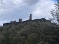
This walk through the rolling countryside of Moustier-Ventadour takes you through meadows and wooded areas to the ruins of Ventadour Castle, which can be visited depending on the season. Before you get there, don’t forget to take a short detour to see the waterfalls of the Ruisseau de la Vigne. The name of this circular walk comes from a hike organised by the Corrèze department in August, which was completed by over one hundred and fifty walkers.

Details

n°106808054
Creation:
Last update:
Last review:
–
  • Walking
    Activity: Walking
  • ↔
    Distance: 4.62 mi
  • ◔
    Average duration: 2h 40 
  • ▲
    Difficulty: Easy

  • ⚐
    Back to start: Yes
  • ↗
    Ascent: + 587 ft
  • ↘
    Descent: - 614 ft

  • ▲
    Highest point: 2,024 ft
  • ▼
    Lowest point: 1,680 ft

Photos

Description of the walk

Park in the small car park as you enter the village, opposite the market hall, on the RD124.

(S/E) Head towards the town hall and the church and follow the departmental road until you reach the town boundary. About thirty metres past the town boundary sign, turn left onto Chemin de la Planche. This tarmac road turns into a country lane, which you should follow until you reach the Planche bridge over the Ruisseau de la Vigne.

(1) Cross the bridge and carry on straight ahead along the same track until you reach the D991.

(2) Cross the road carefully (there’s a bend) and take another track on the left opposite. Head straight up, passing a mobile phone mast about a hundred metres before joining the Route de la Valade.

(3) Turn right for about fifty metres, then take another path on the left. Cross another road to follow a path running alongside a cattle shed on the right. At the junction, turn left to rejoin the road you crossed earlier. First turn right then left to take a path leading to a four-way junction about a good hundred metres further on.

(4) Take the path on the left, then turn left at the fork to return to the Route de la Valade.

(5) Head to the right to reach the hamlet and continue along the path to the left.

(6) Keep to the left, ignoring a path leading off to a plot of land at the first bend, and rejoin the D991.

(7) Cross it carefully and take the path opposite, which leads back to the Pont de la Planche, which you must cross again.

(1) Immediately afterwards, take the path on the right, which runs alongside the Ruisseau de la Vigne.

(8) Take a short detour to the right to seethe waterfalls, as indicated on a wooden sign: please note that the path is narrower and rocky. Then rejoin the route and emerge onto Rue du Château.

(9) Take the path on the right to reach the ruins of Ventadour Castle and enter the grounds if they are open to visitors: see the section: Places to see.

(10) Return to the junction with the path coming from the Ruisseau de la Vigne.

(9) Follow the Route du Château straight on to return to the car park where you started (S/E).

Waypoints

  1. S/E : mi 0 - alt. 1,844 ft - Car park opposite the market hall, on the D124
  2. 1 : mi 0.49 - alt. 1,693 ft - Bridge – Junction of the circular loop
  3. 2 : mi 0.7 - alt. 1,818 ft - Crossing the D991
  4. 3 : mi 1.17 - alt. 2,014 ft - Route de la Valade
  5. 4 : mi 1.69 - alt. 1,995 ft - Crossroads, turn left
  6. 5 : mi 2.16 - alt. 1,942 ft - Back on Route de la Valade
  7. 6 : mi 2.47 - alt. 1,936 ft - At the junction, turn left
  8. 7 : mi 2.89 - alt. 1,801 ft - Crossing the D991
  9. 8 : mi 3.28 - alt. 1,706 ft - Waterfalls junction
  10. 9 : mi 3.69 - alt. 1,775 ft - T-junction. Return trip to the castle
  11. 10 : mi 3.91 - alt. 1,854 ft - Ruins of Ventadour Castle
  12. S/E : mi 4.62 - alt. 1,844 ft - Car park opposite the market hall, on the D124

Notes

A car park with around ten spaces is available on arrival in the village, opposite the market hall on the CD124. On your return, if the Trobar Café is open, you can enjoy a drink and admire the listed keystone on display in the bar; you can also have a bite to eat if you wish. You’ll find the Trobar café opposite the market hall on Rue du Château. The Trobar is often open during the tourist season and at weekends outside the season. Full details at https://www.facebook.com/p/Caf%C3%A9-du-Moustier-61577283915199/

Worth a visit

During this walk, if the ticket office at Ventadour Castle is open (from April to July and in September on weekday afternoons; in July and August, open daily from 10.00–13.00 and 14.30–18.30: further information is available from the Tourist Office in Egletons), do take the opportunity to visit the château (€5), which offers a superb view and an interpretive trail. For the latest dates, opening times and prices, please visit the Château de Ventadour in Corrèze | Official Website

Other walks in the area

For more walks, use our search engine .

The GPS track and description are the property of this route's author. Please do not copy them without permission.