Country:
 City:


You can park in the car park near the town hall, on Place du Champs de Foire.
(S/E) This walk begins in front of the town hall, and the first question takes you back to the Gallo-Roman period and the farming traditions of Villefagnan.
Opposite the town hall, turn right and walk to the end of the street. Stop in front of the market hall building, facing the two entrance doors. Here you’ll learn about the history of this market hall.
Facing the market hall entrance, walk along the right-hand side of the building towards the“16th–17th-century towers” (see signpost). Stop at number 15. This stop provides an opportunity to discuss the two theories regarding the origin of the town’s name.
Carry on to the end of the street and stop at the junction. Take a look at the restaurant ‘L’Étoile d’or’. This former coaching inn raises the question of the horsemen who delivered the royal mail.
Opposite the restaurant, turn right. Walk down the street until you reach the 30 km/h zone road signs. Stop there, opposite the junction (caution: dangerous junction), to find out why this sign is so high up, and what its markings mean.
(1) Return to the front of the restaurant, but this time face the magnificent entrance to the Logis des Tours. Here you’ll learn the technical term used to describe the two towers.
Facing the towers, turn left onto Rue du Temple. Walk on until you reach number 8, which will be on the right-hand pavement. You’ll see two columns flanked by barrels at the entrance to a private courtyard. This is a chance to ask a question about cognac.
Facing the pillars, carry on down the street, turning left. Take the next street on the left, and stop on the central verge between the trees, in front of a water pump. This stop corresponds to the question about hand pumps.
Retrace your steps to continue along Rue du Temple, and walk on until you reach the temple, where you’ll answer the question about the Wars of Religion.
(2) Facing the temple, continue to the left. Take the next street on your left, Rue des Rouhauds. Go to the end of the street and stop at the next junction. Here you’ll learn the third theory regarding the town’s name, thanks to General Romain Fagnanus, and find out what he did upon arriving here.
With your back to the street you’ve just taken, turn right onto Rue Joubert. Stop at the junction with Rue de la Chapelière, in front of the gate, on the corner of number 2. Here you’ll hear one of the town’s best anecdotes: the story of Mr Brothier, who almost went down in history.
Facing the gate, turn left onto Rue de la Chapelière and carry on to the end, where the sight of a weather vane atop a tower provides an opportunity to ask a question about the wind.
(3) Here you can head straight to the Rue du Champ de Foire without going up to the Moulin des Pierres Blanches; please refer to the directions in the ‘Practical Information’ box.
With the weather vane on your left, turn right and walk up Rue de la Magdeleine until you reach the second street on your right (Rue des Noisetiers). Stop there. As with the other quiz walks in the area, here you’ll learn the meaning of a Charente word: ‘quichenotte’.
Carry on straight ahead, cross (carefully) the junction and continue until you reach the access path to Kalidaan Farm on your right. Here, the theme is local cuisine, featuring Chabichou cheese.
At this junction, take the road leading off to the left. Follow it until the third bend. Head into the car park and cross it to reach a small path on the left (just before the gate to the house). Continue along this path to the Moulin des Pierres Blanches to learn more about how it was used and the compulsory tax levied for its use.
(4) Head back to the car park. Cross it to reach the road, then turn right, walking past the house to reach the path that starts at the wooden gate. Follow this path down to the information board on biodiversity. Stop here to answer a question about the biodiversity of this Natura 2000-listed site.
From the sign, carry on to the end of the path. Cross the junction to reach the opposite side, on Chemin du Grand Moulin. Walk to number 13 on the street (the second house) and look at the seashell embedded in the low fence wall between the main gate and the side gate to answer the question.
Opposite the shell, carry on along the street. Take the next street on the left, the Ancienne Rue du Temple. Stop in front of the green gate at number 4. This stop in front of the former Protestant church relates to the question about the King of France who issued the Edict of Nantes.
Facing the gate, continue to the right and, at the corner of the church, take the street leading off to the left, Rue des Audias. Stop at the end of this street. Here, discuss the life of André Rougerie, a native of Villefagne and member of the French Resistance.
With your back to Rue des Audias, turn right onto Rue du Champ de Foire.
(5) Turn left at the next street and head towards the large, tree-lined square – a good opportunity to talk about the annual fairs and an animal for which the region is famous.
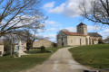
From the Champ de Foire, head towards the church forecourt on your right. Here, use your powers of observation to work out the date of construction of this Romanesque church.
Facing the church entrance, walk along its left-hand side and head towards the town hall, your final stop. At this last stop, read an extract from a poem written by a local resident which, now that you know the town’s history, takes on its full meaning (S/E).


 Visorando Member
 Moderate