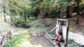
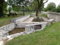
The ‘Passage de la Barque’ at Lichéres from Fontclaireau

On this walk, organised by Philippe and described by Mario, you’ll cross the Charente several times via footbridges. Before crossing it one last time by taking the Lichères ferry. Don’t miss a visit to Saint-Denis Church before arriving in Lichères.

Details

n°6342814
Creation:
Last update:
Last review:
  • Walking
    Activity: Walking
  • ↔
    Distance: 8.90 mi
  • ◔
    Average duration: 4h 25 
  • ▲
    Difficulty: Moderate

  • ⚐
    Back to start: Yes
  • ↗
    Ascent: + 377 ft
  • ↘
    Descent: - 387 ft

  • ▲
    Highest point: 364 ft
  • ▼
    Lowest point: 203 ft
  • ⚐ Country: France
  • ⚐ City: Fontclaireau (16230)
  • ⚑
    Start/End: N 45.894824° / E 0.200564°
  • ❏
    IGN map(s): Ref. 1730SB, 1731SB
  • Hour-by-hour weather

Photos

Description of the walk

The walk starts at the car park opposite Fontclaireau Town Hall. The car park is small; there is only space for 5 or 6 cars.

(S/E) As you leave the car park, facing the Town Hall, turn right and follow the road for 150 m, then turn left.

(1) After the village of Le Logis, take the first path on the right and follow it for about 900 m.

(2) Cross the road, continue along the track opposite and follow it for 1.2 km, running alongside Grandes Combes as far as Puychenin.

(3) At the hamlet, leave Rue du Beauquet on your right, turn left for 40 m and take the next left. At the three-way junction, take the right-hand branch. Turn into the first track on the left and follow it for about 750 m.

(4) Before reaching a wider track, take the path on the right, follow it until it joins a road, and you’ll come to a junction.

(5) Take the track on the right, follow it alongside Grande Combes (on your left) until you reach the junction of the D336 and D56.

(6) Take the D56 to the left, then turn right until you join the D336 in the village of Les Marchais.

(7) Follow this county road to the left until you reach the centre of Moutonneau. At the entrance to the village, look out for the well on the left.

(8) Before the cemetery, turn right onto Rue de la Passerelle and follow it to the footbridge.

(9) Cross the footbridge and follow the path to the Passerelle du Perat.

(10) Cross this footbridge and follow the path to the next junction. Turn right and then follow theGR® 36 to the Church of Saint-Denis, which you can see ahead.

(11) After a quick detour to visit the church, follow theGR® 36 again as far as Lichères.

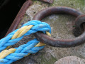
(12) Follow the road along Rue du Bourg to the River Charente, where you’ll find the ferry.

(13) Cross the Charente using the ferry and continue along theGR® 36to Puchenin.

(14) At Puchenin, leave theGR® 36, take the road on the left and follow it to the village of La Salle. In the village, turn left onto the D185 and head towards the town hall.

(15) Turn onto the first track on the right before the town hall and follow it alongside the Prairie de Fontclaireau for 1 km. Turn onto the second track on the right, which climbs towards the village of La Côte. Then follow Rue de la Font du Coteau, pass the church at Fontclaireau and arrive at the car park (S/E).

Waypoints

  1. S/E : mi 0 - alt. 348 ft - Fontclaireau Town Hall car park
  2. 1 : mi 0.24 - alt. 335 ft - The cottage
  3. 2 : mi 0.83 - alt. 335 ft - Bois de Perichon
  4. 3 : mi 1.55 - alt. 289 ft - Puychenin
  5. 4 : mi 2.34 - alt. 351 ft - Bois les Tranches
  6. 5 : mi 2.91 - alt. 335 ft - Les Érables
  7. 6 : mi 3.8 - alt. 223 ft - Junction of the D336 and D56
  8. 7 : mi 4.54 - alt. 256 ft - Les Marchais
  9. 8 : mi 4.78 - alt. 253 ft - Moutonneau Cemetery
  10. 9 : mi 4.92 - alt. 207 ft - Moutonneau Footbridge - Charente (fleuve)
  11. 10 : mi 5.25 - alt. 210 ft - Pérat Footbridge Ford
  12. 11 : mi 5.96 - alt. 243 ft - Église Saint-Denis (Lichéres)
  13. 12 : mi 6.16 - alt. 220 ft - Entrance to Lichéres
  14. 13 : mi 6.34 - alt. 203 ft - Passage de la Barque
  15. 14 : mi 6.9 - alt. 312 ft - Puychenin
  16. 15 : mi 7.57 - alt. 223 ft - La Salle
  17. S/E : mi 8.9 - alt. 348 ft - Return to the Town Hall car park

Notes

If you wish to shorten this walk by almost 2 km, at point (2) in the Bois de Perichon, turn left, then take the first right, and you will reach point (4)

Worth a visit

Well at the entrance to Moutonneau
(9) Moutonneau Footbridge
(10) Perat footbridge
(11) Saint-Denis Church
(13) The boat crossing

Always be cautious and plan ahead when you're outdoors. Visorando and the author of this route cannot be held responsible for any accidents occurring on this route.

The GR® and PR® markings are the intellectual property of the Fédération Française de Randonnée Pédestre.

Reviews and comments

3.7 / 5
Based on 2 reviews

Reliability of the description
3.5 / 5
Ease of following the route
3.5 / 5
Route interest
4 / 5
Martine Ladygrinning

Overall rating : 3.7 / 5

Date of your route : Sep 24, 2023
Reliability of the description : ★★★★☆ Good
Ease of following the route : ★★★★☆ Good
Route interest : ★★★☆☆ Average
Very busy route : No

I would have given 4 stars for the ‘interest’ aspect of the walk if the first section – almost half the route – had been avoided. That section is of no interest whatsoever; there’s nothing to see. Even the landscape is unremarkable: flat, in the middle of fields in full sun. You have to get as far as the village of Moutonneau to see anything worth seeing, and from there it’s a very lovely walk.

Machine-translated

FLOCH
FLOCH ★

Thank you for this review
"It’s a shame – the description needs revising based on actually visiting the location, rather than just looking at a map."
The walk was actually completed by the author (see accompanying photos) and not just by looking at a map.
Describing a route isn’t always easy.

Following your comments, the author will try to improve the description.
Kind regards

Machine-translated

COTEAUXVIGNY
COTEAUXVIGNY

Overall rating : 3.7 / 5

Date of your route : Aug 08, 2023
Reliability of the description : ★★★☆☆ Average
Ease of following the route : ★★★☆☆ Average
Route interest : ★★★★★ Very good
Very busy route : No

A lovely walk, but we took the wrong path twice because the route description wasn’t clear enough. We had to consult the map to work it out. A mention of the colour of the signposting would have helped. Only the GR36 is mentioned, whereas we actually followed blue signposts from point D to 4, for example. Giving the names of paths or places when there are no signs on the ground doesn’t help much with finding your way.
Note: between point 4 and point 5, there’s a road to cross, whereas the route description says to turn right, but that’s further on…
It’s a shame; the route description needs to be checked whilst actually on the trail, not just by looking at a map.

Machine-translated

Other walks in the area

For more walks, use our search engine .

The GPS track and description are the property of this route's author. Please do not copy them without permission.