Country:

 City:
City:


The starting point, at Square Louis Ebelot, has a small car park, just past the bridge over the Ruisseau de Marignac.
(S/E) Take the small road leading uphill to the right of the memorial stone honouring those who escaped from France during the 1939–1945 war. Walk along this tarmac section for about 1.1 km, exploring the eight information panels of the ‘Chemins de la Liberté’. After theeighth panel, a bridge spans the Ruisseau de Marignac.
(1) As soon as you’ve crossed it, leave the return path on your left and turn right. The road becomes a forest track. Continue alongside the stream for 500 m until you reach a junction.
(2) Take the path on the left (information panel no. 11 is on the right). Continue for about a hundred metres until you reach a picnic area with tables, barbecue facilities and information panel no. 12.
(3) Enjoy the spot, then head back along the path you took on the way there for about 600 m along the forest track, rejoining the tarmac road at the bridge over the stream.
(1) Do not cross the bridge; instead, carry on straight ahead towards the clay pigeon shooting range (signposted), ignoring the path leading uphill to the right. Stay on Rue de la Chapelle Saint-Martin. Pass by the clay pigeon shooting range (on your right) and continue to the entrance to Marignac and the chapel; see Practical Information.
(4) Rue de la Chapelle continues as Rue de la Tour. After about 200 m, at a junction, take the left-hand street. This small street passes the remains of the old unloading quays for the marble quarries and reaches a left-hand bend.
(5) There are two options:
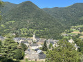
1) Turn right to take a short round trip (150 m) and reach the Tour de Marignac, which offers a beautiful view of the valley; see Practical Information.
2) Option shown on the map: continue along the road until you reach the entrance to the village of Marignac.
You’ll come to a junction with Rue Detch Pouy (opposite No. 20). Turn left, then immediately right, then left again along the stream. Cross the bridge over the Ruisseau de Marignac and return to the car park (S/E). See also ‘During the walk’ or ‘Nearby’.

 Visorando Member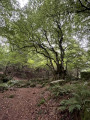
 Moderate
 Difficult
 Very difficult