Walk to the harbour at Cap d’Agde

Enjoy the seaside scenery and the harbour at Cap d’Agde on this walk!

Details

n°68483981
Creation:
Last update:
Last review:
  • Walking
    Activity: Walking
  • ↔
    Distance: 3.35 mi
  • ◔
    Average duration: 1h 35 
  • ▲
    Difficulty: Moderate

  • ⚐
    Back to start: Yes
  • ↗
    Ascent: + 46 ft
  • ↘
    Descent: - 46 ft

  • ▲
    Highest point: 52 ft
  • ▼
    Lowest point: 3 ft
  • ⚐ Country: France
  • ⚐ City: Agde (34300)
  • ⚑
    Start/End: N 43.286325° / E 3.510929°
  • ❏
    IGN map(s): Ref. 2645ET
  • Hour-by-hour weather

Photos

Description of the walk

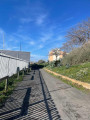
The starting point is at the Alsace-Lorraine car park.

(S/E) Turn right to reach the L’Arbre Henry Berail footbridge. 

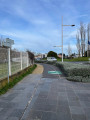
(1) Continue to the left to go round the Musée de l’Ephèbe on your left. On the other side of the museum, turn left. Carry on straight ahead until you reach Avenue des Cantinières. 

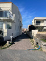
(2) Turn left and cross the avenue to the right. Shortly afterwards, turn right to follow the Passage Guillemet until you reach Avenue des Soldats. 

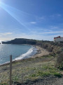
(3) Carry on to the right. Walk to the roundabout, go round it on the right, then head towards a car park on the right. On the other side, you’ll reach Roquille Beach.

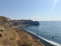
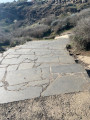
(4) Turn right and continue along the coast, passing Plage du Môle, then Plage de la Grande Conque, before following the path that climbs up to the Cap d’Agde cliffs.

(5) Turn right onto Allée des Dykes to reach Avenue de la Jetée. Go straight through the roundabout, then turn left towards the quays.

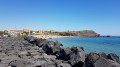
(6) Continue along the quays, round the harbour, to reach the Esplanade Pierre Racine.

(7) With your back to the esplanade, head back up towards Avenue des Sergents to finish the walk (S/E). 

Waypoints

  1. S/E : mi 0 - alt. 7 ft - Alsace-Lorraine car park
  2. 1 : mi 0.24 - alt. 10 ft - The Henry Berail Tree Footbridge
  3. 2 : mi 0.57 - alt. 33 ft - Avenue des Cantinières
  4. 3 : mi 0.85 - alt. 10 ft - Avenue des Soldats
  5. 4 : mi 1.23 - alt. 10 ft - La Roquille Beach
  6. 5 : mi 2.38 - alt. 36 ft - Cap d’Agde Cliffs
  7. 6 : mi 2.72 - alt. 7 ft - Quays at the Port of Cap d’Agde
  8. 7 : mi 3.24 - alt. 3 ft - Pierre Racine Esplanade
  9. S/E : mi 3.35 - alt. 7 ft - Alsace-Lorraine car park

Notes

Make sure you wear shoes suitable for running or trail running, as part of the route along the cliffs is on gravel and uphill.
If you’re planning to go on this walk in hot weather, make sure you take a bottle of water and a cap.

Worth a visit

The beaches: Roquille, Le Môle; La Grande Conque.
The cliffs of Cap d’Agde.
The harbour.
The Ferris wheel at the starting point.

Reviews and comments

4.7 / 5
Based on 1 review

Reliability of the description
5 / 5
Ease of following the route
5 / 5
Route interest
4 / 5
deforge
deforge

Overall rating : 4.7 / 5

Date of your route : Mar 31, 2026
Reliability of the description : ★★★★★ Very good
Ease of following the route : ★★★★★ Very good
Route interest : ★★★★☆ Good
Very busy route : No

A pleasant post-meal stroll

Machine-translated

Other walks in the area

For more walks, use our search engine .

The GPS track and description are the property of this route's author. Please do not copy them without permission.