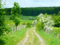
Family walk in Poix-Saint-Hubert

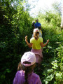
The children in the group will love it… some of the adults, perhaps a little less so: around km 1, the GR®17 follows a barely visible path through mature forests, young spruce trees, young birch trees, broom and also a few brambles. It’s quite refreshing with the morning dew or after a good downpour!

Details

56399407
Creation:
Last update:
Last review:
  • Walking
    Activity: Walking
  • ↔
    Distance: 4.62 mi
  • ◔
    Average duration: 2h 35 
  • ▲
    Difficulty: Easy

  • ⚐
    Back to start: Yes
  • ↗
    Ascent: + 528 ft
  • ↘
    Descent: - 512 ft

  • ▲
    Highest point: 1,385 ft
  • ▼
    Lowest point: 1,053 ft

Photos

Description of the walk

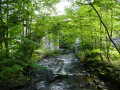
(S/E) Starting from Poix-Saint-Hubert station, the route begins by following the GR®17 southwards, taking Rue des Bouleaux and quickly climbing into the forest, then following the course of the Lomme along the right bank.

(1) After going round the tributary of the Lomme, the GR®17 turns left. The walk continues straight on and rejoins the Lomme just after the railway bridge.

(2) The route turns to the right, runs alongside the railway line and heads towards the hamlet of Maison Blanche.

(3) Cross the N808 road and climb to the top of the hill.

(4) Turn left {or take a shortcut by either continuing straight on or turning right (see the ‘Practical Information’ section)} and follow the GPS route back to the starting point (S/E).

Waypoints

  1. S/E : mi 0 - alt. 1,053 ft - Poix-Saint-Hubert station - Lomme (rivière) - Belgique
  2. 1 : mi 1.42 - alt. 1,217 ft - Junction with the GR17
  3. 2 : mi 1.7 - alt. 1,135 ft - Railway bridge - Lomme (rivière) - Belgique
  4. 3 : mi 2.43 - alt. 1,322 ft - Maison Blanche (local place name)
  5. 4 : mi 2.63 - alt. 1,375 ft - Shortcuts
  6. 5 : mi 4.47 - alt. 1,125 ft - Rue des Ardennes
  7. S/E : mi 4.62 - alt. 1,053 ft - Poix-Saint-Hubert station - Lomme (rivière) - Belgique

Notes

Shortcuts: at (4), you can continue straight ahead for a walk totalling 6.5 km, or turn right to save about 1 km.

Always be cautious and plan ahead when you're outdoors. Visorando and the author of this route cannot be held responsible for any accidents occurring on this route.

The GR® and PR® markings are the intellectual property of the Fédération Française de Randonnée Pédestre.

Other walks in the area

For more walks, use our search engine .

The GPS track and description are the property of this route's author. Please do not copy them without permission.