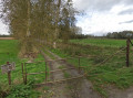
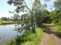
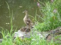
The Scheldt flows past Aux Prés du Dragon

What a delight to pass by the fishing ponds at Bouchain before spotting a kingfisher whilst walking along the Scheldt!

Details

46359292
Creation:
Last update:
Last review:
  • Walking
    Activity: Walking
  • ↔
    Distance: 5.08 mi
  • ◔
    Average duration: 2h 20 
  • ▲
    Difficulty: Easy

  • ⚐
    Back to start: Yes
  • ↗
    Ascent: + 30 ft
  • ↘
    Descent: - 30 ft

  • ▲
    Highest point: 128 ft
  • ▼
    Lowest point: 98 ft

Photos

Description of the walk

Car park opposite Bouchain Church.

(S/E) With the church on your left, continue along the D943 (Rue Léon Piérard). After the bridge, turn right onto the Digue du Pont Malin and go down the steps.

(1) Continue left onto Rue Georges Daix. At the junction, turn right onto Rue Hubert Gallez, then, after the left-hand bend, take the small street on the right.

(2) 90 metres further on, take the path on the left which runs alongside the Le Grand Large pond. At the junction, continue alongside the pond.

(3) After the left-hand bend, take the path on the right which leads to the Escaut. Follow the Escaut, keeping the bridge leading to Hordain on your left.

(4) At the junction, turn right onto the D61, then immediately take the footpath running alongside the road and continue to the next junction.

(5) Turn right onto the road leading to the Scheldt Canal. At the junction, turn right onto the street running alongside the canal, then continue along the Pont Malin embankment.

(6) Pass by the Pont Malin lock and continue along the Escaut until you reach the junction you passed at the start of the walk.

(1) Follow the outward route in the opposite direction to return to the church and the car park (S/E).

Waypoints

  1. S/E : mi 0 - alt. 128 ft - Car park opposite the church - Église Saint-Quentin (Bouchain)
  2. 1 : mi 0.15 - alt. 108 ft - Junction of the circular loop
  3. 2 : mi 0.33 - alt. 112 ft - Étang du Grand Large
  4. 3 : mi 0.73 - alt. 112 ft - Path running alongside the Scheldt
  5. 4 : mi 2.43 - alt. 121 ft - Junction with the D61 - Escaut (fleuve)
  6. 5 : mi 2.67 - alt. 121 ft - Access to the Scheldt Canal
  7. 6 : mi 3.65 - alt. 118 ft - Pont Malin lock
  8. S/E : mi 5.08 - alt. 128 ft - Car park opposite the church

Reviews and comments

4.5 / 5
Based on 2 reviews

Reliability of the description
4.5 / 5
Ease of following the route
4.5 / 5
Route interest
4.5 / 5
mimichophelie
mimichophelie

Overall rating : 5 / 5

Date of your route : Apr 28, 2025
Reliability of the description : ★★★★★ Very good
Ease of following the route : ★★★★★ Very good
Route interest : ★★★★★ Very good
Very busy route : No

A leisurely, well-marked, easy and enjoyable walk. Through the countryside on the way out, along the water on the way back. A lovely circular walk! Nothing but positives!!

Machine-translated

Jacky dum
Jacky dum

The route looks fine to me

Machine-translated

randodom(
randodom(

Overall rating : 4 / 5

Date of your route : Jun 19, 2024
Reliability of the description : ★★★★☆ Good
Ease of following the route : ★★★★☆ Good
Route interest : ★★★★☆ Good
Very busy route : No

A lovely walk, following the Scheldt Canal and then the River Scheldt, with a short stretch through woodland and through the town.

Machine-translated

Other walks in the area

For more walks, use our search engine .

The GPS track and description are the property of this route's author. Please do not copy them without permission.