Country:
 City:
City:



Access: On arriving in Douarnenez, follow signs for Port Rhu. Drive along the estuary and park on the right in the small car park after the footbridge, just before the MJC. There are also plenty of parking spaces all along the quays.
GR®®34markings: White and red
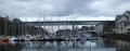
(S/E) Cross the boulevard, take the Jean Marin footbridge opposite to cross the harbour basin, then climb the steps on the right. Follow the tree-lined path overlooking the sea to emerge opposite the marina.
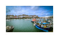
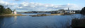
(1) Walk round the docks along the quays and turn right onto the Quai de l’Yser (East). Continue along Rue du Môle, which runs alongside the inlet leading to the marina. On the opposite bank (on your right) you’ll have a view of Tristan Island, and on your left the new water sports centre at the foot of the cliff.
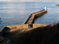
(2) Leave theGR®® for a moment to head down to the jetty, which ends with a lighthouse marking the entrance to Tréboul Harbour, then take the steps back up to the coastal path. Follow it to the right, passing below the maritime cemetery.
(3) Walk past the small Plage Saint-Jean and head up towards the chapel of the same name. Go round the chapel on the right (note the double bust of Max Jacob on the left) and continue via the Passage de l’Armen.
At the grassy esplanade, take a short detour to the left to see the monument commemorating sailors lost at sea, then rejoin the coastal path on the right and continue along it towards the west. Head down towards Plage des Sables Blancs via the path that forms a circular loop (marked route). A steeper flight of steps is also available.
(4) Walk along Plage des Sables Blancs either on the sand or along the paved promenade (the one shown on the map) which runs alongside and around the beach. Head right towards the water sports centre; as you pass, look out for a small menhir near the car park, then continue along the jetty by the sea until you reach a two-level flight of steps.
(5) Climb these steps and, once at the road, turn right. Walk past a holiday centre, turn right (sign on the wall), cross a car park and reach the coastal path, which you’ll follow to the left, heading west. Reach the lower edge of the Vallon Saint-Pierre nature reserve, recognisable by the small stream that flows into it.
No signposting
(6) Leave theGR®® which continues to the right, heading north-west, and head up to the left along the small path which crosses and then runs alongside a stream. Be careful, as some of the stones may be slippery. At the first Fork in the road, continue to the right and head up to the top of the valley (information sign). Head right towards the fountain.
(7) Join the road. Follow this coastal road to the left as it descends towards the beach.
Pass the first street on the right, Rue Ménez Poazh, which leads up into a housing estate, and take a path on the right that joins this street. Ignore the first dead end on the right and carry on. At the top, turn left (campsite opposite) and carry on straight ahead along Avenue du Bois d’Isis, which narrows (alternating traffic) and begins a lovely descent offering a view of the sea.
Pass Rue du Coteau, which branches off to the left, and carry on along the same road.
It is lined with old houses built on the heights of the Bois d’Ys, where there is also a campsite.
When you reach a ‘no entry’ sign at Rue Prad al Lin (signposted ‘town centre’), carry on to the end of Avenue du Bois d’Isis. Turn left into the one-way street just before a ‘dead end’ sign. Walk down this street, cross Rue des Sables Blancs at the pedestrian crossing and continue straight ahead into Passage des Lavandières. Look out for an old wash house on your right – unfortunately derelict – then head up a path towards Rue Fernand Le Goïc.
(8) Walk down it to the right, then turn left onto Rue Jakez Riou for about ten metres. Turn right, cross a small car park and walk up a grassy area to reach a cul-de-sac, then Rue Fernand Le Goïc, which opens out to the right onto Rue des Professeurs Curie.
(9) Pass Rue du Rheun on your left and turn right onto Passage des Sirènes, which leads onto a street where there is a small wayside shrine topped with an iron cross (look out for a sculpture of a skull on the north side). Continue along Rue du Maréchal Foch, which slopes down, until you reach a grassy area with a children’s playground.
(10) Turn left and walk up this slope until you reach the maritime cemetery (Rue Henri Cheffer); turn right to go round the cemetery: there’s a viewpoint overlooking the cemetery, which overlooks Douarnenez Bay. Continue down the street and, at the three-way junction, turn right into the street leading to the church; then turn right to walk round it. In Rue des FFI, turn left then right and you’ll come out opposite the vicarage (No. 4). Walk past a transformer and some toilets, then take a small flight of steps down into a lane called Rue Gabriel Castrec. Turn left into this lane and, at the end, turn right.
(11) Turn into Rue d’Ys (a narrow alleyway). Be careful: this alleyway is so narrow that you might walk past it without noticing. Do not continue down towards the harbour. At the end of the alleyway, turn right then immediately left to continue along Rue Tourville (a flower-lined alleyway). Make a slight left/right turn and carry on straight ahead. At the end of this street (l’Esquisse restaurant), turn right into Rue Jeanne D’Arc. Pass through a wooden gate and walk up this steep little street (a handrail may help).
When you reach a small square, turn left into Venelle Poulmerrien. Follow this narrow passage, which turns sharply left and leads into Rue du Moulin. Turn right onto this uphill street, which is lined with a grassy area.
(12) At the three-way junction, continue straight ahead along Rue de la Montagne to go round the hillock where the old windmill—now converted into a dwelling—stands, then turn left to head back down Rue du Moulin.
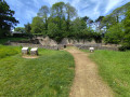
Turn right onto this grassy area dotted with small granite boulders (view of Tréboul harbour). Walk down a dirt track secured by two metal railings and finish with a flight of steps near the Post Office.
Cross the road at the pedestrian crossings, go round the small market building on the left and cross this large square diagonally.
(13) Go round the shipyard on the right and take a flight of steps at the rear of the yard which leads onto Rue Pen ar Vir. Follow this road to the right, turn left down Rue Anne de Bretagne, then left again onto Rue du Treiz, which leads to the edge of the Port Rhu basin.
(14) Turn left to walk alongside the harbour basin, cross the footbridge again and head for the car park (S/E).

 before leaving the GR, avoid crossing the small stream.... Take a small path on the left, which is easier

 Visorando Member
 Easy
Easy