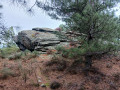
Around the village of Trèves

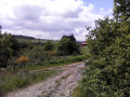
A short walk to get some fresh air in the north of the Pilat Park.

Details

n°44737965
Creation:
Last update:
Last review:
  • Walking
    Activity: Walking
  • ↔
    Distance: 3.15 mi
  • ◔
    Average duration: 1h 40 
  • ▲
    Difficulty: Easy

  • ⚐
    Back to start: Yes
  • ↗
    Ascent: + 269 ft
  • ↘
    Descent: - 266 ft

  • ▲
    Highest point: 1,309 ft
  • ▼
    Lowest point: 1,040 ft

Photos

Description of the walk

Parking is available alongside a children’s playground on Impasse des Dallettes, behind the church. You can also use the car park on the main road (D502) at the entrance to the village.

(S/E) This cul-de-sac continues as a narrow grassy path that descends steeply. It then climbs again to reach a dirt track suitable for vehicles.

(1) Turn left onto this track, pass a few farm buildings and join the Route du Bret, turning right. Continue to the end of this road, which turns into a dirt track again.

(2) Follow the main track as it climbs to a junction of tracks.

(3) Take the right-hand fork, the one where a tree bears a brown and white ‘Croix de Parc’ cross. Follow this track, which turns left to reach another junction.

(4) Take this wide, carriageable track which joins the tarmac road known as the Chemin du Pet Montagny. This road leads to the D502 , which you take to the right until you reach the Allée des Dames. Caution: the D502 is a busy road.

(5) Turn left and head downhill until you turn left onto Rue de la Haute Dhuire. Follow this street until you reach the junction with Chemin des Grandes Terres.

(6) Turn right and head down this tarmac road. Then turn left onto the grassy Malroche path, which becomes tarmac as it crosses the Chemin des Pierres Blanches. Carry on straight ahead through the houses in Trèves until you reach the D502.

(7) Turn right onto it, follow this main road down to the church and turn left to reach the car park (S/E).

Waypoints

  1. S/E : mi 0 - alt. 1,076 ft - Parking near the children’s playground
  2. 1 : mi 0.14 - alt. 1,063 ft - Junction
  3. 2 : mi 0.48 - alt. 1,119 ft - Dirt track junction
  4. 3 : mi 0.88 - alt. 1,230 ft - Take the unmarked path on the right
  5. 4 : mi 1.15 - alt. 1,276 ft - Vehicle-accessible track
  6. 5 : mi 1.64 - alt. 1,266 ft - Junction of the D502 and Allée des Dames
  7. 6 : mi 2.41 - alt. 1,175 ft - Junction with the Chemin des Grandes Terres
  8. 7 : mi 2.98 - alt. 1,112 ft - D502
  9. S/E : mi 3.15 - alt. 1,076 ft - Parking near the children’s playground

Reviews and comments

4.7 / 5
Based on 1 review

Reliability of the description
5 / 5
Ease of following the route
5 / 5
Route interest
4 / 5
aq38
aq38
• Edited:

Overall rating : 4.7 / 5

Date of your route : Feb 16, 2024
Reliability of the description : ★★★★★ Very good
Ease of following the route : ★★★★★ Very good
Route interest : ★★★★☆ Good
Very busy route : No

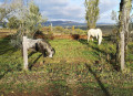
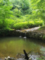
An easy walk with little elevation gain, partly along good paths and through woodland (the first part of the walk), then along small country lanes across fields for the second part. Beautiful views of the northern Pilat and the Monts du Lyonnais.

Machine-translated

Other walks in the area

For more walks, use our search engine .

The GPS track and description are the property of this route's author. Please do not copy them without permission.