Country:
 City:
City:


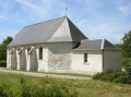
Park in the car park in front of Hauville Church, on Route de Routot.
(S/E) With your back to the church, head left, then turn right onto Route de Barneville and follow it for a few dozen metres.
(1) Take the path on the left, marked by barriers, climb the steps and you’ll come out opposite the leisure park. Ignore the signposts and turn left into a narrow lane. Continue to the crossroads.
(2) Follow the road on the right; you’ll see the mill on your right and come to a Y-junction in the bend near a pond. Turnright onto Rue de la Bouillotte, then leave it at the next right-angled junction.
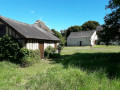
(3) Turn right and head towards the Moulin de Pierre.
(4) Take a moment to admire it, then return to the junction.
(3) Follow Rue de la Bouillotte to the right until you reach the junction. Head straight ahead into the narrow lane which turns into a grassy path. Pass under a high-voltage power line and reach the RD313.
(5) Cross it carefully, then take Rue de La Foulerie opposite. Pass the cemetery on your right, carry on straight ahead at the one-way sign and head down to the River Seine.
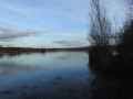
(6) Turn left onto the towpath. Continue along the riverbank, admiring the old Jumièges Abbey on the opposite bank, and pass the ferry landing stage.
(7) Cross the green space on the left, come out opposite the espalier gardens and follow the gently sloping road to the right. Look for a grassy path on the left at the corner of a house.
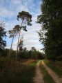
(8) Take this path to the left at the sign for “La Sente Aux Moines”,thenenter the forest. Walk until you reach a metal log barrier.
(9) Then take a sharp left-hand bend. Continue uphill along this main path. You’ll reach a crossroads where a signpost indicates a mountain bike route to the right.
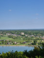
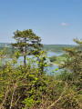
(10) Follow the hairpin bend to the right and you’ll reach the viewpoint and the orientation table opposite the picnic tables on the grassy area on your left. Continue alongthe stony path which bends to the left and leads to the “Aire de La Mailleraye” car park. Attheno-entrysign, carry on along the road to the left and you’ll come out onto the RD913.
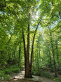
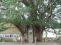
(11) Cross it diagonally with care to find a path almost directly opposite. Enter the forest and, at the gate, carry on straight ahead, then follow the bend to the left. You’ll reach a crossroads where, in the middle on a promontory, stands a remarkable tree known as “Le Chêne Cuve”. Information boards are located there.
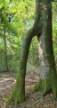
(12) Head off to the right (south-west), then turn right at the next crossroads. Follow this straight path and, just before reaching a perpendicular forest track, take a short detour to the right to see the fused beech trees.
(13) Follow the forest track running perpendicular to the left (as a landmark, the number 483 is marked on a tree on the left). Carry on straight ahead, ignoring any side paths, then follow the natural curve of the track to the left to join the Mare Aux Boeufs forest road between plots 488 and 492 (numbers marked on the trees on either side of the track). Continue to a junction of paths.
(14) Turn rightbefore the gate. Follow the path; you’ll see a farm on your left and continue to a fork. Look out for asign belowmarked ‘route des mares’ and head towards it.
(15) Cross a small ravine on the left, go down the path and follow the direction indicated by the sign.Head up the path on the left between the trees.Reach a small road, cross it and follow the tarmac lane straight ahead for a few dozen metres.
(16) Continue along the grassy path signposted ‘Chemin du Grand Nord’, pass under the high-voltage power line, then carry on between the houses untilyou reach the tarmac road again. You’ll arrive at the junction opposite Rue Au Gué, which you took on the way there.
(2) Turn right and continue to the church (S/E).


 Visorando Member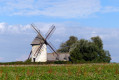

 Easy
Easy