Country:

 City:
City:


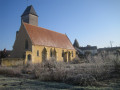
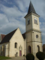
Park in the car park at the church square.
(S/E) Head towards Préval on the RD59 and, after 200 metres, turn right onto the wide gravel track that crosses the Avezé meadow. Turn left onto the first track you come to and follow it until you reach a tarmac road.
(1) Follow it to the right, pass under the railway bridge (take care, as visibility is limited) and immediately turn left onto a tarmac track that climbs the hillside (panoramic view of the valley). You’ll reach the hamlet of Le Tertre.
(2) Turn right onto the dirt track and follow the main path as it climbs steeply up a ravine.
(3) When you reach a fork, turn right and follow the path along the edge of the woods, which eventually leads into them.
(4) On emerging from the woods, turn left onto a small path and follow it along the edge of the woods. It leads onto a stony track; take this to the left and you’ll reach a tarmac road.
(5) Take this road straight ahead, passing in front of the Tuilerie des Saules. At the first bend, turn right onto a path that leads into the woods.
(6) 100 metres further on, turn right onto the path through the undergrowth, pass the house at Beauregard and continue until you reach a stony track.
(7) Take this lane on the left and follow it until you emerge from the woods at a place called Les Moutonnières.
(8) Leave this lane on the right and take the dirt track that enters the woods and descends to a small tarmac road. Take this road to the left and head for the car park at the Hameau du Chêne Vert.
(9) Cross the RD107 (take care, as visibility is poor) and take a tarmac track that passes several houses, turns into a gravel track and joins the D107.
(10) Cross this road and take the small tarmac road opposite, which climbs towards the woods (views over the Theil sur Huisne). When you reach a house, carry straight on along the dirt track which descends to some horticultural greenhouses.
(11) Turn right onto the grassy track, then after 300 metres turn left to reach the Theil bypass
(RD107).
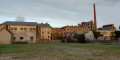
(12) Cross over and follow the road opposite towards Le Theil; cross the bridge over the railway line and turn right after the factory, then left to reach the main street in Le Theil (Rue de la Vallée).
(13) Turn right towards the village exit, cross the Huisne and, after 100m, turn left onto a tarmac track.
Follow this straight track until you reach the first tarmac track on the left. Take this to reach La Thibaudière with ease. Continue along the sunken track which climbs towards the RD288.
Follow this road to the left towards Mâle for 200 metres.
(14) Turn right onto a tarmac road that passes several houses, continuing to the hamlet of Le Haut Queux.
(15) Turn right onto a dirt track which climbs steeply to reach the hamlet of La Malbroue and the RD323.
(16) Cross this road (take care, as it is a busy road) and follow the tarmac track, which turns into a gravel track and descends to the Ruisseau de Jambette.
(17) Ford the stream and continue along the dirt track, which joins a gravel track.
(18) Turn left and, after 100 metres, turn right onto a path that climbs towards the woods until you reach a crossroads at L’Ânerie.
(19) Follow the dirt track to the left; it turns into a gravel track and descends to the road from Ceton to Neuville (RD107).
(20) Turn right towards Le Theil for 50 metres and turn left onto a small tarmac road; leave this road by turning right after 200 metres.
Follow this tarmac road and, after the houses at Le Tuyau, turn right onto a dirt track that leads into the woods.
(21) Follow this track for 50 metres and turn right onto a path that runs along the edge of the woods. Stay close to the edge of the woods; the path climbs steeply past Beauvais Castle and leads onto a wide, stony forestry track.
(22) Cross this track and stay on the grassy path that follows the edge of the woods, going up and down until you reach a crossroads.
(23) Turn right onto a narrow dirt track and you’ll reach a tarmac road at a place called Les Vaux Gomberts.
At a bend, turn left onto a grassy track heading towards the meadows. Cross the Ruisseau des Goutenelles and walk up between two cultivated fields to Le Mané.
(24) At Le Mané, take the tarmac road and follow it to the right. Head down to the RD323.
(25) Cross it (take care, as it’s a busy road) and turn onto a narrow footpath. Walk down to the village and turn right at the roundabout by the post office to reach the church car park (S/E).

 Association / Club / Walk leader
 Average
 Tourism professional
 Visorando Member
 Easy
Easy