Around the Massicart in Verruyes

The vast majority of this walk takes place within the municipality of Verruyes. You’ll start by following paths through the Gâtinais countryside alongside the Ruisseau du Massicart, which flows into the Chambon – on which the Barrage de la Touche Poupard is built. Finally, a series of small roads will take you back to the starting point. You’ll pass through small hamlets typical of the region.

Details

n°20131638
Creation:
Last update:
Last review:
  • Walking
    Activity: Walking
  • ↔
    Distance: 7.05 mi
  • ◔
    Average duration: 3h 35 
  • ▲
    Difficulty: Average

  • ⚐
    Back to start: Yes
  • ↗
    Ascent: + 407 ft
  • ↘
    Descent: - 400 ft

  • ▲
    Highest point: 699 ft
  • ▼
    Lowest point: 479 ft
  • ⚐ Country: France
  • ⚐ City: Verruyes (79310)
  • ⚑
    Start/End: N 46.516396° / W 0.288952°
  • ❏
    IGN map(s): Ref. 1627SB
  • Hour-by-hour weather

Photos

Description of the walk

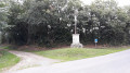
Park in the car park situated between the church and Rue de l’Étang.

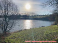
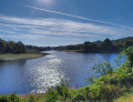
(S/E) From the car park, head east and take the Allée du Stade. At the end of the stadium, walk along its left-hand side and turn right towards the lake, which you’ll follow on the left. Once you reach the car park, follow the access road to the junction with the GR®.

(1) Turn left onto theGR® and follow it to the bridge over the stream, which you cross. Turn right, keeping Piersay on your right, ignore the road on the right and continue to the four-way junction.

(2) Turn right and continue along theGR®. At the junction with a road, carry on straight ahead, following the signposts to La Rebardière. On leaving the hamlet, leave theGR® and carry on straight ahead. At the left-hand bend, continue straight ahead along the path to the crossroads.

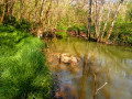
(3) Take the path on the right, which slopes downwards and winds alongside the stream. At the next crossroads, turn right towards the stream until you reach the footbridge over the Ruisseau Massicart.

(4) Cross the footbridge and head towards La Bouchatière until you reach a road.

(5) Take the road on the right until you reach a T-junction. Turn right, pass Les Chaumes and ignore the next road on the left. You have now joined theGR®364. At the left-hand bend, leave the road and head straight on, following the signposts until you reach a road.

(6) Turn right, then follow the next path to the left and reach La Gauffraire, which you cross whilst following theGR® signposts. Carry on, ignoring any side paths, until you reach a wide track.

(7) Turn right, passing the kennels. At the next junction, leave theGR®364, which heads off to the right. Turn left and continue to the next junction with the road leading to L’Herbaudière.

(8) Follow the road on the left until you reach the junction with the D24. Cross it carefully and continue along the track opposite. Pass another kennel, then carry on to the next crossroads.

(9) Carry on straight ahead to La Perdillère. Take the road on the right and rejoin the D24.

(10) Follow it carefully for about 300 metres. At the Croix Nérault, just after number 29, take the Chemin de l’Étang to the four-way junction.

(11) Take the left-hand path, which leads straight down to the Rue de l’Étang; cross this carefully to return to the car park near the church (S/E).

Waypoints

  1. S/E : mi 0 - alt. 600 ft - Car park between the church and Rue de l’Étang
  2. 1 : mi 0.74 - alt. 581 ft - Entrance to the lake
  3. 2 : mi 1.4 - alt. 604 ft - Crossroads
  4. 3 : mi 2.28 - alt. 646 ft - Crossroads (path/road)
  5. 4 : mi 2.94 - alt. 479 ft - Footbridge over the Massicart
  6. 5 : mi 3.21 - alt. 584 ft - La Bouchatière
  7. 6 : mi 3.99 - alt. 656 ft - Junction of the GR364 and Route de la Palnière
  8. 7 : mi 4.79 - alt. 623 ft - Crossroads
  9. 8 : mi 5.14 - alt. 643 ft - junction of Route and Allée Herbaudière
  10. 9 : mi 6 - alt. 620 ft - Crossroads
  11. 10 : mi 6.43 - alt. 692 ft - Junction with the D24
  12. 11 : mi 6.79 - alt. 656 ft - Crossroads
  13. S/E : mi 7.05 - alt. 600 ft - Car park between the church and Rue de l’Étang

Notes

Some paths may be wet during the rainy season, so it is important to wear suitable footwear.
The routes taken are small roads, with the exception of the D24, which you cross and follow for 300 metres.

(S/E) At the car park where the walk starts, there are toilets and a charging point for electric cars.
In the village of Verruyes, there is a bar, a grocery shop and a bakery. During the open season, you can also go camping and swim at the Étang du Prieuré Saint-Martin.
You can also book accommodation at Les Terres de l’Étang lodges (see website).

Worth a visit

The rural commune of Verruyes has fewer than 1,000 inhabitants, and 96 per cent of its land is agricultural. It is best known for its lake, which is open for fishing and swimming.
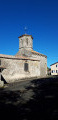
Saint-Martin Church and the Commanderie de Saint-Rémy (listed as a historic monument) are the main heritage buildings.

Always be cautious and plan ahead when you're outdoors. Visorando and the author of this route cannot be held responsible for any accidents occurring on this route.

The GR® and PR® markings are the intellectual property of the Fédération Française de Randonnée Pédestre.

Reviews and comments

4.3 / 5
Based on 2 reviews

Reliability of the description
5 / 5
Ease of following the route
4 / 5
Route interest
4 / 5
TINO1779
TINO1779

Overall rating : 4 / 5

Date of your route : Jul 27, 2023
Reliability of the description : Not used / Not applicable
Ease of following the route : Not used / Not applicable
Route interest : ★★★★☆ Good
Very busy route : No

I use GPX tracks almost exclusively for my hikes.
This one is a lovely walk.

Machine-translated

philouis
philouis

Thank you for your message. It’s a bit of an adventurous walk. Don’t worry about getting through certain sections – there’s another walk marked in yellow that goes through there, and with a good GPS, you can’t go wrong.
See you soon for more hikes.

Machine-translated

Cmarsil
Cmarsil

Overall rating : 4.3 / 5

Date of your route : Mar 30, 2022
Reliability of the description : ★★★★★ Very good
Ease of following the route : ★★★★☆ Good
Route interest : ★★★★☆ Good
Very busy route : No

A route offering a fairly wide variety of paths, some of which are really lovely.
Between points 3 and 4, the route follows a track that has been ‘appropriated’ by a farmer who has put up fences to allow his animals to reach a water source. You can pass through without any trouble.
The final part of this section of the path, which descends towards the stream, is not easy to find and, above all, appears to be unmaintained. It may therefore be difficult to follow.
Enjoy your walk

Machine-translated

Other walks in the area

For more walks, use our search engine .

The GPS track and description are the property of this route's author. Please do not copy them without permission.