Country:
 City:


From Le Mans, take the D338 towards Saint-Saturnin. Park in the car park at the Val de Vray Cultural Centre.
(S/E) With your back to the car park, turn left onto Rue de l’Église. Then turn right onto Rue du Bouillon, which later becomes Rue des Surgettières. 300 metres further on, at the first junction, take the path on the right for 500 metres. Continue straight on until you reach Impasse du Petit Prince, where you’ll find Rue de Saint-Exupéry.
(1) Turn left, then left again at the bend, to join the cycle path running alongside Route de la Milesse. Cross Rue des Surgettières to reach the old tram station, which has been restored and features information panels.
(2) Turn left, then right onto Rue Harel de la Noë. At the junction, carry straight on along Rue Ouvrard de Lignières. Turn right onto a footpath and follow it to where it ends at Rue de l’Église.
(3) Walk down the street and turn right onto Impasse du Plan d’eau. At the first junction, go straight on and enter the park, walking alongside the football pitch (leave Impasse du Parc on your right). Keep to the right after the football pitch to pass under the railway line (cyclists, dismount), and you’ll come to a junction.
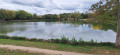
(4) Turn left and follow the row of conifers to the pond. Walk along the left-hand side of the pond, past the outdoor fitness equipment. Pass the first wooden bridge, then reach a second one.
(5) Leave the pond via this second bridge, then turn right onto the path leading to Boulevard de Maule. Cross it at the roundabout and continue straight on along Rue de Coutant. Ignore the first junction, then come to a second one. Turn left onto Rue des Châtaigniers and continue to the park.
(6) Enter the park on the right and walk through it for 150 metres. On leaving the park, rejoin Rue des Tilleuls, then turn left three times, followed by a right, to reach the bandstand.
(7) Admire this beautiful, restored bandstand, which houses a pump that was connected to a Bollée windmill in the 19th century to draw groundwater from the Impasse des Chanoines. Head back to the junction with Rue des Tilleuls and carry on straight ahead into Impasse du Four à Chambre. Continue straight on at the next junction, then turn right onto Chemin du Petit Coutant. On fine days, enjoy the eco-grazing area where goats and sheep graze. Take the first track on the right until you reach Boulevard de Maule.
(8) Turn left for 500 metres, then go round the roundabout and continue along the footpath, running alongside the D338, for 200 metres. Finally, turn right at Impasse Amédée Bollée, which runs alongside the motorway. Carry on straight ahead until you reach the railway line.
(9) Without crossing the railway line, take the path on the right. There are other signposts indicating the direction of the Chemin Montois (towards Mont Saint-Michel) and the Way of St James. For 800 metres, follow the Chemin des Guinaudières until you reach the underpass beneath the railway line, which you have already passed on the way there.
(4) Turn left, then right onto the path running alongside the railway line, then the Ruisseau de l’Antonnière. Turn left when you reach the bridge to reach the Val de Vray Cultural Centre (S/E).
 Visorando Member


 Tourism professional
 Difficult
 Moderate