Country:
 City:


Park in the car park at the Claude Fortin sports centre, 20 Rue des Hortensias.
(S/E) Turn left onto Rue des Hortensias, take the path and follow the yellow signposts to the junction. Turn left onto Rue du Plessis and continue to the junction.
(1) Turn left onto Rue de la Gare, follow it to the three-way junction and take the right-hand branch, joining Chemin du Houx. At the junction with Route d’Aigne, turn left until you reach the Grisonnière three-way junction.
(2) Turn right onto the uphill road to La Maugatelière, until you reach the three-way junction at Les 3 Chênes, where you should take the path on the left.
(3) Turn right towards the hamlet of Fourgault, keeping the path heading north.
(4) Carefully take the road on the left which runs alongside the woods; follow the yellow markings.
(5) Continue left along the road until you reach the junction with the D82.
(6) Take the path running alongside the woodland, marked in yellow, until you reach the steep climb leading up to the Route de la Madeleine.
(7) Carefully turn right onto the road leading down to CP100.
(8) Leave the road and take the path uphill as it winds its way into the woods. Keep heading north.
(9) Turn right, heading due east (CP142), onto the track leading to the entrance of the Roussard quarry. Continue along the Route des Bouquet aux until you reach the Sablons three-way junction.
(10) Turn left onto Impasse de la Sapinière, then immediately take the narrow, descending path that leads into the woods as it leaves the cul-de-sac. Follow the yellow signposting along the path that joins La Bougerie and continue with caution, skirting the Route de Maupertuis. Pass the hamlet of the same name.
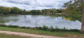
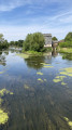
(11) Shortly afterwards, take a sharp right-hand bend, cross a car park and walk alongside the Plan d’Eau des Peupliers on your left. Walk round this lake until you reach the dam separating the two lakes.
(12)
Walk round the pond following the grassy path that runs along the northern bank, then take the fitness trail, cross the Mortier stream and return to the southern end of the dyke.
(12) Continue along the bank of the pond, and at the southern end head north again until you reach the pedestrian crossing which takes you back to the Route de Maupertuis.
(13) Take the path on the far right and head towards La Bazoge.
(14) Cross the road carefully to join the Chemin des Ridois on the left.
(15) Leave the path and turn left onto the Allée des Ridois; follow it until you reach the Route du Général De Gaulle. Turn left onto this road to reach the church.
(16) Head south-east along Rue du Frêne and continue along it until you reach the three-way junction at Grande Lande.
(17) Leave the road and turn into Impasse de la Sonnette; follow this to the railway line, marked with yellow signs. Follow the railway line along the path on the right, which leads back to Route de Neuville. Follow it to the right for a few metres and cross it carefully to rejoin the path opposite
(18) Head due south along the road leading to the Côte des Guigniers, take the Impasse du Bois des Hogues, then turn right onto the path leading to the Avenue du Mans, PC91. Cross it carefully.
19) Take the path running alongside the fence to head south down the Champ de la Poire, before the bend leading to the roundabout. Take the path on the embankment that runs towards the high-speed rail line (LGV), following it for about a hundred metres.
(20) Take the path on the right which heads northwards and joins Rue de la Sauvagerie, then take the path on the right, continuing due north to the hamlet of La Fontaine-les-Pommiers. Continue to the fork in the road (PC100) and take the path on the right, the Chemin de la Croix de la Ville, until you reach the junction with Rue de la Gare, which you must cross with care. Continue along Avenue des Lilas.
(21) Turn left onto the grassy path which leads to the sports hall and the car park at the Claude Fortin sports centre (S/E).
 Visorando Member
 Easy



 Moderate
 Tourism professional