Country:
 City:


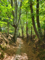
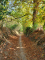
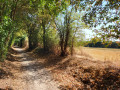

From Le Mans, head towards La Chapelle-Saint-Aubin via the D304. Stop at the Bois de Saint-Christophe car park.
(S/E) Leave the car park and head into the Bois de Saint-Christophe. At the first junction, carry on straight ahead until you reach a second junction.
(1) Turn sharply right, then turn left twice. Continue straight ahead until you reach the next road (D245). Take the path opposite (Chemin des Poneys) to the junction.
(2) Turn left onto the path running parallel to the road (Rue de la Corne) heading towards the village. After 500 m, turn into the second lane on the right and continue along a winding path. Keep going straight on at the first three junctions and continue to the fourth.
(3) Turn left onto a footpath and head towards the road (D304).
(4) Turn right, then take the first path on the left. Near the level crossing, cross the road and take the Sentier des Bassins opposite. Leave the ponds on your left, continue for 500 m alongside the railway line, then turn left (take care, narrow passage).
(5) Take Rue de Boudan to the right for 10 m, then head left up into the park. Ignore the junction. At the top, turn onto the first path on the left and continue through the park, keeping straight on until you reach Rue des Camélias. Carry on for 100 m to the junction by the cemetery.
(6) Turn right onto Allée du Souvenir, climb the first few steps and turn right again. Continue along the path running opposite the cul-de-sac, then take a narrow passageway whilst keeping to the right to cross Parc G. Branchu V. Jauneau. At the exit, turn left onto Rue des Bleuets, then turn left again into Impasse des Bleuets. After 50 metres, turn right into the narrow lane between the gardens and the houses to emerge onto Impasse de la Porchère.
(7) Turn right, then, at the end of the cul-de-sac, continue right onto the street of the same name until you reach the hamlet known as Le Verger, at the next bend. First turn left then right and follow the path to the hamlet of Bel-Air.
(8) Follow the small road to the left which runs alongside the motorway. Take the D304 to the left (medieval cross at Roussard), then use the pedestrian crossing to reach the car park (S/E).
 Tourism professional


 Visorando Member

 Moderate