Country:

 City:


To get there by train or bus: alight at ‘Canfranc estación’, next to the bridge leading to the international station (and hotel).
If you’re coming by car: park at the junction just below the swimming pool and read on from the point (1).
(S/E) Take the road opposite, which slopes upwards diagonally, towards the municipal swimming pool. After two hairpin bends, you’ll approach the swimming pool.
(1) The starting point of the path itself is directly opposite the swimming pool (signposted ‘Olla de Estiviellas’ and ‘Fuente del Centenario’). You’ll walk up a wide, gently sloping, shaded path… Why? Because at the start of the 20th century, when work began on the protective structures for the future Canfranc railway station, this whole area consisted of pastureland without a single tree. It was therefore necessary to lay out proper mule tracks to allow forestry workers to come and plant trees and build avalanche barriers (embankments). A century later, the trees are enormous!
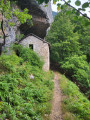
Shortly after you start the climb, you’ll spot an old hut on the right, built of dry stone with earth and grass on the roof. Shepherds used to use these huts in days gone by.
(2) After a few hairpin bends (there will be plenty of them), a signpost suggests a ‘traversée’ (travesía): this is simply a way to join the descent path without climbing any further. Continue along the main path (to the right). Shortly afterwards, you’ll reach the ‘donkey’s spring’ (fuente del burro). Fresh, drinkable water.
Two more hairpin bends, and you’ll reach the entrance to a second viewpoint (5 mins away), on the left. The main path continues to the right. After further hairpin bends, you’ll come to a second ‘crossing’ (travesía), allowing you to join the path leading down without climbing any further. This is a good option if the climb seems a bit long! Otherwise, carry on to the right.
Finally, the path arrives at a remarkable cirque, beneath an overhang from which a waterfall plunges when there is plenty of water – this is the ‘Cola de Caballo’. Take a moment to admire the stone embankment, designed to hold back avalanches and rockfalls.
(3) The path continues to zigzag, veering slightly to the right to cross the escarpment, without any particular difficulty.
(4) You emerge from the forest, above the cliff mentioned earlier. Here, the wall no longer exists; it was blown away by a huge avalanche in 1986. You cross the river (río Estiviellas) with its clear, cool water and, shortly afterwards, reach a signpost marking a fork in the path.
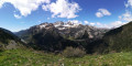
Off the main route: at this point, a path branches off, taking about half an hour to reach the ‘centenary spring’ (fuente del Centenario), a vast landscape with views of the Pic du Midi d’Ossau and all the surrounding mountains.
Carry on straight ahead: this marks the start of the descent, which soon takes you through woodland. You’ll reach a clearing.
(5) You are in a former tree nursery (vivero de Secras); this is where the future trees were sown before being transplanted to the mountains. The path then continues its descent, which is very steady through the woodland.
You’ll reach the junction with the second ‘traverse’ marked on the way up.
(6) Continue down the slope (to the right). Shortly afterwards, at the junction with the first ‘traversée’, continue down the slope (to the right). The slope levels out and the path widens: you’re nearly there!
(7) When you reach a small gravel road, the swimming pool is very close by. If you’ve parked there, follow this small road. Otherwise, carry on straight ahead to reach the station (S/E).

 Visorando Member

 Easy
 Difficult