


Circular route via the Coll de Ladrones and the Caseta de la Cueva (Caseta del Vasco)


A pleasant circular walk, mostly through woodland, with a few sections of scree on the descent. Lovely views over the Canfranc Estación valley and the Candanchu cirque.
A hike of moderate difficulty due to the elevation gain. The path is narrow and you’d be well advised to be sure-footed.
Details
Creation:
Last update:
Last review:
–
–
-
 Activity: Walking
 -
 Distance: 7.76 mi
 -
 Average duration: 6h 15
 -
 Difficulty: Moderate
 -
-
 Back to start: Yes
 -
 Ascent: + 3,094 ft
 -
 Descent: - 3,097 ft
 -
-
 Highest point: 6,181 ft
 -
 Lowest point: 3,914 ft
 Country:

 City:
City:


Waypoints
- S/E : mi 0 - alt. 3,921 ft - Canfranc-Estacion
- 1 : mi 0.65 - alt. 4,304 ft - Casita Blanca mountain hut
- 2 : mi 1.67 - alt. 4,774 ft - Punta Picaubé
- 3 : mi 1.84 - alt. 4,780 ft - Fork
- S/E : mi 7.76 - alt. 3,921 ft
Other walks in the area
La Casita de la Cueva in Canfranc
 Visorando Member
 4.96 mi
+1,654 ft
-1,657 ft
3h 45
4.96 mi
+1,654 ft
-1,657 ft
3h 45
 Easy
Easy
 Departure from Canfranc (Huesca)
The immense forests that dominate the Canfranc resort hide many secrets: amazing hydraulic structures, comfortable paths to access them, unique vegetation and a little-known history. Hiking in this setting is all the more enjoyable, even if the gentle slope of the paths means you cover more ground than you might imagine.
The Chiniprés hut
 2.29 mi
+1,161 ft
-177 ft
2h 05
Moderate
Departure from Canfranc (Huesca)
2.29 mi
+1,161 ft
-177 ft
2h 05
Moderate
Departure from Canfranc (Huesca)
A relatively short route to one of the best viewpoints in the upper Canfranc Valley, offering views of both Canfranc-Gare international station and the Candanchú ski resort.
Canfranc, Agüaré, Gabardito
 4.60 mi
+1,765 ft
-1,765 ft
3h 40
4.60 mi
+1,765 ft
-1,765 ft
3h 40
 Difficult
Departure from Canfranc (Huesca)
Difficult
Departure from Canfranc (Huesca)
A varied circular walk offering a chance to fully appreciate the woodland and historic surroundings of the village of Canfranc. Suitable once the snow has melted (usually in April) and at its best in spring (May–June) when the laburnums and asphodels are in bloom.
Please read the warnings in points 2 and 4!
From Somport to Astún via the ridges – HIKE TO SEE AGAIN
 6.86 mi
+2,782 ft
-2,795 ft
5h 35
Difficult
Departure from Aísa (Huesca)
6.86 mi
+2,782 ft
-2,795 ft
5h 35
Difficult
Departure from Aísa (Huesca)
Hike to revisit
A little-used border hike offering views of the three valleys of Aspe, Canfranc and Ossau from above. Stunning views in all directions. Route for hikers: you will need to find your bearings at the start as there are no signposts. The end of the route can be avoided by hikers who suffer from vertigo.
The Bois du Sansanet and the Col Causiat around Somport
 4.92 mi
+978 ft
-981 ft
3h 05
Easy
Departure from Urdos (Pyrénées-Atlantiques)
4.92 mi
+978 ft
-981 ft
3h 05
Easy
Departure from Urdos (Pyrénées-Atlantiques)
An easy loop allowing you to discover the diversity of landscapes and natural areas on the northern flank of the Col du Somport. The climbs are gentle and the route is fairly easy to follow, provided you have a map on your phone with GPS. In addition, the Espace Somport is a pleasant place to relax. Everything you need for a "cool hike"!
Visorando app recommended
Lake Estaens
 5.26 mi
+1,745 ft
-1,749 ft
3h 55
Moderate
Departure from Urdos (Pyrénées-Atlantiques)
5.26 mi
+1,745 ft
-1,749 ft
3h 55
Moderate
Departure from Urdos (Pyrénées-Atlantiques)
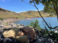
This round trip hike is mostly in Spain and is suitable for all walkers. It is a very easy family walk. The green surroundings are home to marmots and chamois, if you know where to look. From the end of June onwards, numerous flocks of sheep, cows and horses graze here. The lake is splendid and is surrounded by white rock mountains on the left with the Aspe peak and the Visaurin and on the right by red rocks with the Gabedaille peak.
Lac d'Estaens loop via the Chemin des Échelles
 6.65 mi
+2,162 ft
-2,165 ft
4h 55
Moderate
Departure from Urdos (Pyrénées-Atlantiques)
6.65 mi
+2,162 ft
-2,165 ft
4h 55
Moderate
Departure from Urdos (Pyrénées-Atlantiques)
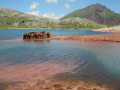
The aim here is to make a loop. You will need to climb down a small chimney and follow a path that runs along the cliff and takes you down a ladder. Magnificent view of the peaks and the valley below.
Circular loop via Lac d’Estaëns or Ibon de Astanès
 6.71 mi
+2,218 ft
-2,221 ft
5h 00
Moderate
Departure from Urdos (Pyrénées-Atlantiques)
6.71 mi
+2,218 ft
-2,221 ft
5h 00
Moderate
Departure from Urdos (Pyrénées-Atlantiques)
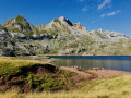
It is a peaceful valley where a thin stream flows, where large herds of horses and cows graze in the calm air, indifferent to this geological feature, this reddish earth, on the border between Spain and France and Lac d'Estaëns (Ibon de Astanès).
For more walks, use our search engine .
The GPS track and description are the property of this route's author. Please do not copy them without permission.

