Around Tourny

An easy, short walk through varied countryside, taking in both fields and the village itself.
The presence of cattle along the route provides opportunities for a few breaks, and perhaps to strike up a conversation…

Details

407378
Creation:
Last update:
Last review:
  • Walking
    Activity: Walking
  • ↔
    Distance: 4.57 mi
  • ◔
    Average duration: 2h 10 
  • ▲
    Difficulty: Easy

  • ⚐
    Back to start: Yes
  • ↗
    Ascent: + 82 ft
  • ↘
    Descent: - 82 ft

  • ▲
    Highest point: 502 ft
  • ▼
    Lowest point: 410 ft
  • ⚐ Country: France
  • ⚐
    Area: Vexin
  • ⚐ City: Tourny (27510)
  • ⚑
    Start/End: N 49.184995° / E 1.545402°
  • ❏
    IGN map(s): Ref. 2112O
  • Hour-by-hour weather

Photos

Description of the walk

(S/E) A very classic route, starting from the crossroads in the centre, near the church (easy to park your car). Head eastwards, towards the bakery.

(1) Turn right onto the lane lined with a double row of lime trees.
At the end of the lane, continue along the path to the right, between the field and the pasture, until you reach the small tarmac road. Turn right, until you reach the main D3 road, without crossing it (be careful, traffic moves quickly at this point in the village; a speed bump would actually be welcome...)
Carry on to the left and cross to the right onto Route de Surcy, then head straight on towards the track, leaving the road at the bend.

(2) At the crossroads, turn right and walk alongside the buildings. Follow the path to the left and join the D4 road at the Moulin de Pierre pond.

(3) Follow the road to the left, passing the pond and the mill. At the junction, turn right and head downhill to the right-hand corner.

(4) Follow the second path on the left; it’s a long straight stretch leading to the small building (it’s not a hunting lodge...).

(5) At the wind turbine substation, take the track on the right to the D3 and continue to the right.

(6) Opposite the recycling centre, take the path on the right and follow the fence. Follow the track as far as possible along the fence; otherwise, veer off and follow the scrub at the edge of the field. The path turns into a tarmac road as you approach the first houses. Turn left, then right onto Rue du Chesnay and continue to the crossroads.

Turn left onto Rue du Rêt and, at the very bottom, take the sharp right-hand bend onto the small tarmac road, Ruelle de la Fontaine de la Ville.

(7) Take the path leading uphill opposite, leaving the cemetery on your left. Carry on until you reach Rue du Chesnay at the square opposite.

(8) Turn left until you reach the starting crossroads (S/E).

Waypoints

  1. S/E : mi 0 - alt. 479 ft - Crossroads in the village centre, church
  2. 1 : mi 0.15 - alt. 492 ft - Allée des Tilleuls
  3. 2 : mi 1.11 - alt. 466 ft - Crossroads
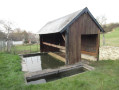
  4. 3 : mi 1.83 - alt. 502 ft - Stone mill and pond
  5. 4 : mi 2.25 - alt. 459 ft - Right angle
  6. 5 : mi 2.67 - alt. 440 ft - High-voltage/low-voltage substation
  7. 6 : mi 3.11 - alt. 446 ft - Recycling centre
  8. 7 : mi 4.13 - alt. 423 ft - Towards the cemetery
  9. 8 : mi 4.43 - alt. 469 ft - Square
  10. S/E : mi 4.57 - alt. 479 ft - Village centre

Notes

No special equipment is required: just suitable trainers.
Make sure you bring sun protection as there is very little shelter or shade.
There’s a water point in the centre of the village, opposite the church… handy before you set off, and on your return…

Worth a visit

The Allée des Tilleuls is the most remarkable spot, whatever the season.

Reviews and comments

4.2 / 5
Based on 3 reviews

Reliability of the description
4.7 / 5
Ease of following the route
4.7 / 5
Route interest
3.3 / 5
Patolihen
Patolihen

Overall rating : 4.3 / 5

Date of your route : Apr 22, 2026
Reliability of the description : ★★★★★ Very good
Ease of following the route : ★★★★★ Very good
Route interest : ★★★☆☆ Average
Very busy route : No

A short, easy walk after lunch, taking about two hours in partly sunny weather

Machine-translated

Grosse  Valérie
Grosse Valérie

Overall rating : 4.7 / 5

Date of your route : Dec 15, 2023
Reliability of the description : ★★★★★ Very good
Ease of following the route : ★★★★★ Very good
Route interest : ★★★★☆ Good
Very busy route : No

An interesting village to explore

Machine-translated

Nicololo
Nicololo

Overall rating : 3.7 / 5

Date of your route : Jan 27, 2018
Reliability of the description : ★★★★☆ Good
Ease of following the route : ★★★★☆ Good
Route interest : ★★★☆☆ Average

This easy walk is best done in fine weather. In my case, it was the day after it had rained. The path, with its ruts left by quad bikes and tractors, will ‘ruin’ your shoes.
A pleasant walk right past the wind turbines and through the fields.
Take care in hot weather, as apart from the start under the avenue of lime trees, there’s no shade. Choose a lovely spring day when it’s been dry for several days, and you’re sure to enjoy this walk. I’ll do it again in those conditions to really appreciate it.

Machine-translated

Other walks in the area

For more walks, use our search engine .

The GPS track and description are the property of this route's author. Please do not copy them without permission.