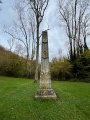
Bailleul, from prehistory to the present day

This walk takes its name from the Neolithic remains you’ll come across along the way. A pleasant route through countryside and woodland, offering you the chance to enjoy some fresh air in peaceful surroundings.

Details

51735439
Creation:
Last update:
Last review:
  • Walking
    Activity: Walking
  • ↔
    Distance: 5.83 mi
  • ◔
    Average duration: 3h 15 
  • ▲
    Difficulty: Moderate

  • ⚐
    Back to start: Yes
  • ↗
    Ascent: + 627 ft
  • ↘
    Descent: - 623 ft

  • ▲
    Highest point: 433 ft
  • ▼
    Lowest point: 52 ft

Photos

Description of the walk

Starting point: 30 Route de Rouen le Goulet, 27950 La Chapelle-Longueville.
Parking: Roadside car park, Le Terminus restaurant.
The car park at the starting point is private; to avoid inconveniencing customers, we ask that you park from Monday to Saturday on the right-hand side of the car park (when your back is to the restaurant), side by side, along the fence.
No restrictions on Sundays.

Signposting: Blue

(S/E) Cross the D6015 at the traffic lights using the pedestrian crossing and follow the D63 until you reach a path on the left, opposite No. 3.

(1) Leave this path and take the track on the left, which climbs through the woods. Follow it all the way to the first path coming from the right.

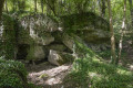
Stay on the path, then turn left to follow the track opposite until you reach the road near the Neolithic rock shelters.

(2) Turn right, then immediately afterwards turn left and continue to the first houses in Saint-Pierre-d’Autils.

(3) Just before the road, turn right and climb the small grassy path between the fences. Keep to the right and cross the woodland to rejoin the road at the Saint-Pierre-d’Autils town boundary sign.

(4) Take the hard-packed track opposite. Continue until you reach the four-way junction after crossing the fields.

(5) Turn left and head towards the first houses of the hamlet of Brosville.

(6) Turn right and head down towards Saint-Étienne-sous-Bailleul. At the end of the road, continue left then right until you reach Rue des Sources.

(7) Take Rue des Sources, then turn right onto the D63 until you reach the junction with theD664E.

(8) Turn left onto Rue du Moulin; walk to the corner of the last house, where you’ll find the start of a path on the right (marked by a sign reading ‘Sente aux Ânes’)

(9) Turn sharply right and take the path through the fields that follows the Saint-Ouen valley. Continue along this path through the valley, keeping to the right, until you reach Le Goulet. Follow the road straight on until you reach a T-junction.

(10) Turn right and continue along the pavement. Cross the D6015 at the pedestrian crossing and head for the car park. (S/E)


Waypoints

  1. S/E : mi 0 - alt. 52 ft - Roadside car park - Seine [la]
  2. 1 : mi 0.04 - alt. 62 ft - Fork in the road
  3. 2 : mi 1.78 - alt. 157 ft - Neolithic rock-shelter sites further upstream
  4. 3 : mi 2.12 - alt. 233 ft - Saint-Pierre-d’Autils
  5. 4 : mi 2.76 - alt. 404 ft - Route
  6. 5 : mi 3.29 - alt. 397 ft - Clémont manor farm
  7. 6 : mi 3.68 - alt. 413 ft - Brosville
  8. 7 : mi 4.01 - alt. 282 ft - Rue des Sources
  9. 8 : mi 4.36 - alt. 102 ft - Road D664E
  10. 9 : mi 4.49 - alt. 128 ft - Path junction
  11. 10 : mi 5.72 - alt. 52 ft - D6015 road
  12. S/E : mi 5.83 - alt. 52 ft - Roadside car park

Worth a visit

The13th -century church of Saint-Pierre d’Autils.

The Neolithic rock-shelter sites, known as the ‘Mammoth’ rock-shelters in Mestreville, in the commune of Saint-Pierre d’Autils, discovered by Alphonse Georges Poulain (1875–1966), a French archaeologist.

Reviews and comments

4.7 / 5
Based on 2 reviews

Reliability of the description
4 / 5
Ease of following the route
5 / 5
Route interest
5 / 5
martine.morel36 @ orange.fr

Overall rating : 5 / 5

Date of your route : Sep 14, 2025
Reliability of the description : ★★★★★ Very good
Ease of following the route : ★★★★★ Very good
Route interest : ★★★★★ Very good
Very busy route : No

See comments on the route "Loop along the banks of the Seine starting from Saint Pierre d'Autils";

Machine-translated

Office de Tourisme Seine-Eure

Hello,

We would like to thank you for your contribution to the description of this walk, which we are taking into consideration.
Kind regards,

The Tourist Office team

Machine-translated

Denis26
Denis26 ★

Thank you, COCHARDMOD, for your comments. I’ve just updated the description.

Machine-translated

COCHARDMOD
COCHARDMOD

Overall rating : 4.3 / 5

Date of your route : Mar 16, 2025
Reliability of the description : ★★★☆☆ Average
Ease of following the route : ★★★★★ Very good
Route interest : ★★★★★ Very good
Very busy route : No

A lovely, varied walk with some beautiful views. The blue signposts are spot on!
You can complete this walk simply by following these markings.
However, over time the markings are likely to become less visible… and then the current route description won’t be enough.
Notably for section 1: the instructions are unclear and there aren’t enough of them.
For route 8: is there no Fork in the road?
Suggestion8: Turn left until you reach the corner of the last house. Head straight up to the right (look for a sign saying ‘sente aux ânes’)
Proposal 9: Turn sharply right (look for a sign saying ‘de la vallée’)......
...keep going right until you reach a stud farm. Continue along the ‘chemin du cotils’ path (sign)... etc...
Suggestion 4: ...near a manor farm. Remove this information as the location is not visible.
Suggestion 5: Remove: ‘At the crossroads’

Thanks for sharing!

Machine-translated

Other walks in the area

For more walks, use our search engine .

The GPS track and description are the property of this route's author. Please do not copy them without permission.