The Moulin Caillet Stream and Notre-Dame du Mont

Discover a secluded valley through which the Ruisseau du Moulin Caillet winds, before a steep climb towards the ridges overlooking the Doubs valley. The route alternates between forest tracks, wild paths and sections through sharp limestone pavements, offering magnificent panoramic views of Montferrand Castle and the Notre-Dame-du-Mont Chapel. A short detour also offers the chance to see a mysterious ancient underground passage carved beneath the cliff face. A varied and charming circular walk, suitable only for walkers with a sure footing for the sections along the cliff edge.

Details

102262907
Creation:
Last update:
Last review:
  • Walking
    Activity: Walking
  • ↔
    Distance: 3.90 mi
  • ◔
    Average duration: 2h 25 
  • ▲
    Difficulty: Moderate

  • ⚐
    Back to start: Yes
  • ↗
    Ascent: + 702 ft
  • ↘
    Descent: - 702 ft

  • ▲
    Highest point: 1,352 ft
  • ▼
    Lowest point: 797 ft
  • ⚐ Country: France
  • ⚐ City: Thoraise (25320)
  • ⚑
    Start/End: N 47.165783° / E 5.90789°
  • ❏
    IGN map(s): Ref. 3323ET, 3323O, 3324ET
  • Hour-by-hour weather

Photos

Description of the walk

Car park at Boussières, at the end of the cul-de-sac, past the recycling centre. Markings: yellow-blue, white-red, mountain bike and trail, with some unmarked sections.

(S/E) Turn right, facing the forest. Join an uphill path and follow it to the right. The path soon forks. Carry on straight ahead, ignoring the marked crossroads. Stay on this wide, straight path which, a little further up, becomes a track winding through the woods. You’ll soon pass the fitness trail. Stay on this well-marked path until you reach the D104 county road.

(1) Follow it to the left, heading down to Moulin Caillet. There’s a short stretch of tarmac, but you’ll soon forget it. Take a look at the wayside cross opposite the old mill.

(2) Carry on to the left along the small tarmac road, which quickly turns to gravel and runs through the little wild valley where the stream that used to power the mill flows. You’ll arrive at a place called La Pierre de Vorges, where a large, beautiful stone once allowed you to cross the stream – now replaced by a wooden footbridge. Look out for the ‘Grand Besançon’ signpost on the left.

(3) Climb up the wide stony path on the left. Soon after, at the nearby fork, leave this path and take the track that climbs up to the left. Shortly after another fork, stay on this wider, steeper track which climbs steeply to the right. You’ll be climbing through the sharp limestone pavement, skirting a deep forest slope on your right. At the top, at a fork, continue along the wider path to the right. After a pleasant passage between small rocks, you’ll join the signposted hiking trail.

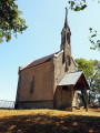
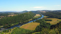
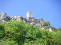
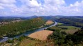
(4) Follow it to the left, enjoying lovely views of the keep of Montferrand Castle, and you’ll arrive at the Notre-Dame-du-Mont Chapel. Walk between the chapel and the gate to reach the superb viewpoint overlooking the upper reaches of the Doubs Valley, under the watchful eye of the keep. Look out for two forked trees on your left, facing the chapel. Opposite, you’ll see the start of a path.

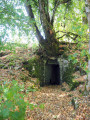
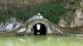
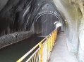
(5) Take the path that branches off about ten metres further down. Proceed carefully along the path on the right, which runs along the edge of the cliff. If you turn round, you’ll spot a strange portico, hidden beneath a tree. It marks the entrance to an old underground passage (I suppose) that would lead all the way to the chapel… though there’s certainly no question of venturing inside. You’ll walk along a ledge with lovely views over the Doubs Valley. You’ll come to a small wooded promontory. The path turns left and, at a fork, leads to a water tower.

(6) Take the path on the left, passing in front of the reservoir, and continue for about a hundred metres. Turn left onto the path that climbs almost vertically up the wooded hillside. At the top, look out for a track leading off at right angles, right at the far right (marked with red logging paint, which may not remain).

(7) Turn right onto this path, which is a bit overgrown in places but very passable, and it will take you back to the car park. (S/E)

Waypoints

  1. S/E : mi 0 - alt. 1,070 ft - Stream Trail
  2. 1 : mi 0.88 - alt. 1,017 ft - The D104 local road
  3. 2 : mi 1.34 - alt. 978 ft - Le Moulin Caillet
  4. 3 : mi 2.49 - alt. 797 ft - The Pierre de Vorges
  5. 4 : mi 3.07 - alt. 1,283 ft - Marked walking trail
  6. 5 : mi 3.29 - alt. 1,237 ft - Chapelle Notre-Dame du Mont (Thoraise)
  7. 6 : mi 3.53 - alt. 997 ft - Water tower
  8. 7 : mi 3.72 - alt. 1,129 ft - Perpendicular path
  9. S/E : mi 3.9 - alt. 1,070 ft - Car park at the top of the recycling centre

Notes

(!) Despite its short distance, this walk can be challenging for the less experienced walker. It requires a sure foot to navigate these beautiful, steep paths running along the cliff edges. The route includes ledge paths and unsecured viewing points. The paths are rocky and slippery in places. Sturdy footwear is essential and the use of walking poles is recommended. Not suitable for young children. Avoid in wet weather (slippery muddy patches).

(5) Under no circumstances should you set off along the dangerous path that starts at the corner of the fence.

Worth a visit

(2) The Moulin Caillet is a former watermill dating back to at least the 16th century. Powered by the stream flowing down from the Essart du Loup, it was rebuilt following a fire in 1845 before being converted into a flour mill and then a hydroelectric power station supplying the industries of Montferrand. Today, the peaceful valley in which it stands preserves the memory of this rich history of milling and industry.

(3)The Pierre de Vorges, nestled at the bottom of a wooded valley, recalls a time when a simple stone slab was used to cross the stream. Although a wooden footbridge now provides a crossing, the site retains all its charm and invites visitors to pause by the water’s edge.

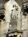
(5) Notre-Dame du Mont: perched at an altitude of 485 metres, the chapel majestically overlooks the Doubs Valley and offers a remarkable panoramic view of the Montferrand keep and the meandering river. The first chapel was built in 1585 following a vow made by Marguerite Perrenot de Granvelle, in gratitude for the Virgin Mary’s protection during the Huguenot attack on Besançon in 1575. Destroyed and rebuilt several times, the present building dates from 1872. For several centuries, Notre-Dame-du-Mont was one of the main places of pilgrimage in Franche-Comté and the seat of a brotherhood that numbered up to 500 members. Every year, the celebrations of the Assumption continue this tradition.

(5)The keep at Montferrand: towering over the Doubs valley from its rocky outcrop, it is the main remnant of a mighty fortified castle built in the 13th century by the lords of Montferrand. Situated on the border of the County of Burgundy, the fortress controlled navigation on the Doubs and the road linking Besançon to Dole. Destroyed on the orders of Louis XI in 1477, all that remains of the castle today is its imposing keep, some twenty metres high. Visible throughout the walk, it is one of the most remarkable examples of the medieval heritage of the Doubs Valley.

Other walks in the area

For more walks, use our search engine .

The GPS track and description are the property of this route's author. Please do not copy them without permission.