


 Country:

 City:


Park in the castle car park at the top of the village.
(S/E) Turn back and head down to the left before the castle (sign for ‘village access’). Ignore a path branching off to the right which leads back to the village. At the next junction, turn right onto Chemin de la Tapy.
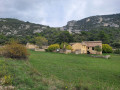
(1) When you reach the stream, cross it via a small submersible bridge and head up the path on the left. Walk alongside a dry stone wall. On the left, on the other side of the valley, stands the rocky outcrop on which the village is built.
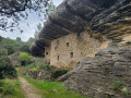
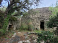
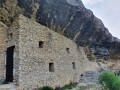
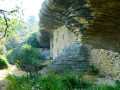
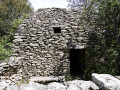
(2) After a bend, the path splits. Continue to the right, passing beneath Ferme Marculy. A little further up, take a short detour to the left to admire the restored troglodytic dwelling and its drystone shelter. At the entrance, a first drystone shelter houses a water inlet. Retrace your steps to continue following the GRP® path (marked in yellow and red), which skirts the farm’s foothills to the left. Walk alongside a private property where you can see numerous low walls and a drystone shelter.
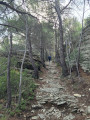
(3) At the “Marculy 344 m” signpost, cross the Chemin des Pessades and take a rocky path opposite. At the next two junctions, turn left. The path runs alongside the boundary wall of a large property. At the next Fork in the road, take the path furthest to the left.
(4) When you reach an opening in a dry stone wall, turn left. Follow this main path, keeping the wall on your right. Cross the Piste des Fayardes and continue along the path opposite, into the Saumane-de-Vaucluse communal forest. A little further on, keep to the left (the start of the path is not shown on the map), then head straight down to the right and then right again onto a gullied path overlooking the Ferme de Valescure. You can actually catch a glimpse of it through the trees.
(5) At the farm, which has been restored by a local association, you can stop for a meal where tables and benches are provided for walkers. Then continue to the right along the track below the farm, the GR®91. Keep to the right and join the Piste de Valescure a little further up, at a bend.
(6) At the signpost marked ‘Valescure 290 m’, head towards Saumane de Vaucluse (3.1 km) / Les Fayardes. At the crossroads of tracks, continue climbing up to the hamlet of Les Fayardes.
(7) After the hamlet and a final gate, turn left in front of a low wall onto a faint track leading to a pair of large drystone shelters. Return to the track on the left until you reach the signpost “Les Fayardes 313 m”. Follow the sign on the right for Saumane-de-Vaucluse, 1.9 km.
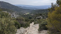
(8) A little further on, leave the track and follow the GRP® markings as they enter the woodland along a pleasant path to the right. This path becomes a paved slanting street. Stay on this main path, following the red and yellow markings. As you climb out of the valley, the paved slanting street passes between two rocks.
(9) Cross the Chemin des Pessades and continue straight ahead. There are numerous dry stone walls and several drystone shelters along the way.
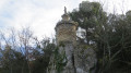
(10) At the signpost marked “Les Lauses 232 m”, head towards Fontaine-de-Vaucluse (3.9 km) straight ahead. At the next signpost marked “Malaisan 225 m”, turn right towards Saumane-de-Vaucluse and follow the yellow markings along a paved slanting street that descends. Cross the stream and head back up towards the village of Saumane. Turn left into Rue des Fontaines. At the wash house, head up to the right for a round trip above the castle’s fortifications , which offers lovely views of the eastern and western parts of the village.
(11) Once back down, follow the Montée du Château straight ahead to return to the car park (S/E).
 Visorando Member

 Difficult
 Easy

