Country:
 City:


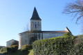
The car park is located on the hard-packed earth car park next to the church, near the junction of the D50 and D249 roads (Rue du Trèfle and Rue du Bourg).
(S/E) Leave the car park by walking past the church towards the war memorial. Walk past the church gate. Cross the D50 with care and take the path opposite heading north-east. The path soon reaches a vineyard plot, which you follow on your left, then continue between two vineyard plots. Further on, turn right, leaving the farm track on your left, and head towards the junction with the second farm track on the right.
(1) Turn right and continue through the vineyards towards the south-east until you reach the D50. Turn left and follow the road carefully to the junction with the D148, to the west of Fontagard.
(2) Turn right and follow the D148 carefully as far as Fontagard.
Turn right onto Rue de la Forge. At a small triangular junction, turn right onto the street, which turns into a track as soon as you pass the buildings lining it on the left-hand side. Continue along the track that follows. This track crosses a small wood and then passes to the east of the Ferme de Parpaillon, which can be seen below on the other side of the stream known as Le Nobla.
Carry on along the path, which soon crosses the Bois de Parpaillon. At the end of the woods, turn right towards the dairy farms of Romas.
(3) When the farm track runs alongside a farm building on your right, turn left and then immediately right onto the farm track which leads onto the road serving the hamlet of Les Métairies de Romas. Carry on straight ahead until you reach the junction with the D249. Cross it carefully and continue straight ahead along a farm track that cuts through the fields and heads towards the River Le Trèfle.
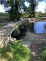
(4) Ford the river and continue along a very shaded track until you reach a T-junction of farm tracks.
(5) Turn onto the path on the right, which goes round the small hill of the Ancien Moulin de la Coterelle. The remains of the mill are still visible at the top. At the next junction, turn right onto a path that crosses a strip of small woodland, following its edge through the woods. The path turns right, then heads north-east and crosses the Trèfle.
(6) At the next crossroads, turn left onto a path running along the hillside towards the Terres Saintes area. Turn onto the first farm track on the right leading towards the hamlet of Chez Hervé (the track is on the right-hand side, just before a rectangular water reservoir).
(7) Once amongst the vineyard plots, at the top of the hill (elevation 47), turn right onto a dirt track which leads back towards Neulles via the Bellevue area. As you approach Neulles, the track gives way to a road. Turn right onto the street that runs through the village parallel to the D50 and head straight to the car park near the church (S/E).


 Visorando Member

 Moderate

 Tourist office