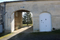
Through the vineyards and woods of Neulles

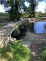
A pleasant walk through the countryside, amongst vineyards, woods and along the riverbank.

Details

n°15717433
Creation:
Last update:
Last review:
  • Walking
    Activity: Walking
  • ↔
    Distance: 6.32 mi
  • ◔
    Average duration: 3h 00 
  • ▲
    Difficulty: Moderate

  • ⚐
    Back to start: Yes
  • ↗
    Ascent: + 98 ft
  • ↘
    Descent: - 98 ft

  • ▲
    Highest point: 194 ft
  • ▼
    Lowest point: 85 ft
  • ⚐ Country: France
  • ⚐ City: Neulles (17500)
  • ⚑
    Start/End: N 45.503319° / W 0.417133°
  • ❏
    IGN map(s): Ref. 1533SB
  • Hour-by-hour weather

Photos

Description of the walk

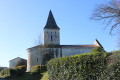
Park at Neulles church.

(S/E) Walk past the church, go past the entrance, and cross the RD50. Take the path opposite between the houses. At the first junction, keep to the path on the right then go straight on towards the Métairie du Bois.

(1) As you approach the hamlet, turn left onto a wide track. Walk past the farm buildings on your right, continue straight on, then turn right onto the track that leads into a wood. Walk through the wood and reach the vineyards at the edge.

(2) Turn left and, at the next junction (marker 47), turn right. Continue along the track, cross a small wood, then turn left towards Les Trappes.

(3) Once you reach the hamlet, follow the road to the left and pass by a water tower. Carry on to the T-junction, turn right, then left onto a wide track about a hundred metres further on. Follow this track straight on until you reach the RD50.

(4) Turn right and, at Minot, turn left onto the small road which leads onto a wide track. Walk for about 1 km.

(5) Take a sharp left-hand bend, then turn right onto the first track heading towards a small copse. At the T-junction, turn right onto a much wider track leading to the banks of the Trèfle. Turn left just before reaching the river, and follow the riverbank to the road.

(6) Turn left, then immediately right onto a wide track. Follow it straight on until you reach the T-junction (marker 30).

(7) Then turn left to head back up towards the village and the church car park (S/E).

Waypoints

  1. S/E : mi 0 - alt. 125 ft - Church Square
  2. 1 : mi 0.53 - alt. 151 ft - Dairy farm of the Bois, on the left
  3. 2 : mi 1.15 - alt. 164 ft - Vignes, on the left
  4. 3 : mi 2.3 - alt. 125 ft - Les Trappes, on the left. Towards the - Trèfle (ruisseau) - Affluent de la Seugne
  5. 4 : mi 3.95 - alt. 89 ft - RD50, turn right then left
  6. 5 : mi 4.74 - alt. 95 ft - Turn left
  7. 6 : mi 5.38 - alt. 89 ft - Road, left-right
  8. 7 : mi 6.1 - alt. 98 ft - Junction, turn left
  9. S/E : mi 6.32 - alt. 125 ft - Church Square

Reviews and comments

5 / 5
Based on 1 review

Reliability of the description
5 / 5
Ease of following the route
5 / 5
Route interest
5 / 5
Mimette
Mimette

Overall rating : 5 / 5

Date of your route : Jul 17, 2023
Reliability of the description : ★★★★★ Very good
Ease of following the route : ★★★★★ Very good
Route interest : ★★★★★ Very good
Very busy route : No

A lovely walk – easy and well described. Thank you!

Machine-translated

Other walks in the area

For more walks, use our search engine .

The GPS track and description are the property of this route's author. Please do not copy them without permission.