Maumont route starting from Sainte-Féréole

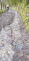
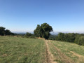
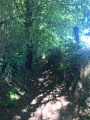
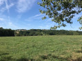
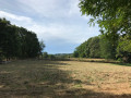
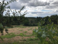
A yellow-marked route starting from Sainte-Féréole, mainly along shaded paths. The route offers lovely views of the countryside. It is very pleasant in summer.

Details

2479295
Creation:
Last update:
Last review:
  • Walking
    Activity: Walking
  • ↔
    Distance: 7.16 mi
  • ◔
    Average duration: 4h 20 
  • ▲
    Difficulty: Moderate

  • ⚐
    Back to start: Yes
  • ↗
    Ascent: + 1,181 ft
  • ↘
    Descent: - 1,198 ft

  • ▲
    Highest point: 1,391 ft
  • ▼
    Lowest point: 705 ft

Photos

Description of the walk

Park in the square by the church at Sainte-Féréole.

(S/E) Walk down Rue du Presbytère. When you reach Avenue du 8 Mai, turn left onto it and cross the road. Turn sharply right and head downhill along Chemin des Haies: please note that this path is not shown on the map. The start of this route is the same as that of the Vacherie route. When you reach the road, follow it to the right until you reach the Cacalerie crossroads.

(1) Take the road on the left, cross La Cacalerie and continue along the footpath. Walk through the woods; on emerging from them, cross the Maumont Noir via a footbridge.

(2) Carry on straight ahead, staying on this path, to reach the D170 road after the hamlet of Guillemy.

(3) Leave the Vacherie route here and turn left onto the D170. Then turn right at the fork, ignoring the turn-off to the left, and continue to the crossroads after the houses at Peuch Loule.

(4) Turn right onto this track and head for the hamlet of Cévennes.

(5) At the entrance to the hamlet, the track joins the Deux Maumonts route starting from Donzenac, which is also marked in yellow. Take great care and turn as far left as possible onto an unmarked path which quickly widens and leads out into a field.

(6) Head up to the left, then follow the road to the right until you reach the crossroads you passed earlier.

(4) Head down the path to the right, cross the road and continue down the path. Cross the Maumont Noir and then head back up to the right.

(7) Ignore a path on the left which offers a quicker return route via La Salesse. In the woods, you’ll reach another crossroads.

(8) Take the path that climbs to the left. Cross the D25 with care and take the path opposite to climb up to the hamlet of Laubeyrie.

(9) Walk right through the hamlet and follow the road along the hillside towards La Besse. You’ll arrive near this hamlet.

(10) Take the wide path on the left. This section is shared with the Saulières trail starting from Sainte-Féréole.

(11) Leave the Saulières trail by taking the path on the left. When you reach the road, turn right onto it and join the D25.

(12) Cross the D25 with care and take the path opposite which branches off immediately to the right. Join the road leading to La Salesse. Turn right and follow it back up to the car park at Sainte-Féréole church (S/E).


Waypoints

  1. S/E : mi 0 - alt. 1,385 ft - Sainte-Féréole church square
  2. 1 : mi 0.54 - alt. 1,207 ft - La Cacalerie
  3. 2 : mi 1.28 - alt. 738 ft - Footbridge, the Maumont Noir
  4. 3 : mi 1.84 - alt. 1,007 ft - Junction with the Vacherie route
  5. 4 : mi 2.23 - alt. 1,024 ft - Start of the circular loop
  6. 5 : mi 2.51 - alt. 928 ft - Cévennes
  7. 6 : mi 2.83 - alt. 1,056 ft - Fields
  8. 7 : mi 3.76 - alt. 728 ft - Junction – Alternative route
  9. 8 : mi 4.18 - alt. 919 ft - Crossroads, turn left
  10. 9 : mi 4.63 - alt. 1,191 ft - Laubeyrie
  11. 10 : mi 5.21 - alt. 1,204 ft - La Besse
  12. 11 : mi 5.59 - alt. 1,270 ft - Crossroads
  13. 12 : mi 6.09 - alt. 1,204 ft - D25
  14. S/E : mi 7.16 - alt. 1,385 ft - Sainte-Féréole church square

Notes

You can extend the route by taking the routes around the two Maumonts (Donzenac), Les Saulières or Travassac.

Reviews and comments

4.3 / 5
Based on 4 reviews

Reliability of the description
4.3 / 5
Ease of following the route
4.3 / 5
Route interest
4.5 / 5
User 3147286

Overall rating : 4 / 5

Date of your route : Jul 20, 2026
Reliability of the description : ★★★★☆ Good
Ease of following the route : ★★★★☆ Good
Route interest : ★★★★☆ Good
Very busy route : No

Stone bridge over the Maumont Noir – closed to pedestrians (one side has collapsed) – not signposted at the start of the walk. It is possible to cross, but at your own risk!!!

Machine-translated

Jacques.cugnon
Jacques.cugnon

Overall rating : 5 / 5

Date of your route : May 19, 2025
Reliability of the description : ★★★★★ Very good
Ease of following the route : ★★★★★ Very good
Route interest : ★★★★★ Very good
Very busy route : No

A lovely, shaded walk away from the tarmac. We thoroughly enjoyed it.

Machine-translated

tmollard19
tmollard19

The path at point 11 may be poorly marked and a little closer to the main road, but it’s still there and is well signposted… if you look back! I did this route again during a spell of heavy rain; part of it is really very wet at the start.

Machine-translated

feixou
feixou

Overall rating : 4 / 5

Date of your route : Feb 02, 2021
Reliability of the description : ★★★★☆ Good
Ease of following the route : ★★★★☆ Good
Route interest : ★★★★☆ Good
Very busy route : No

The path between points 11 and 12 no longer exists… vast fields of crops, with fences and no way to cross… We had to cut the route short. Otherwise, for us, after several days of rain in the area, the paths were very, very wet and very muddy… and therefore slippery. But with the right footwear, everything went well!!!

Machine-translated

Elisabeth Chassaing
Elisabeth Chassaing

Overall rating : 4.3 / 5

Date of your route : Jan 30, 2020
Reliability of the description : ★★★★☆ Good
Ease of following the route : ★★★★☆ Good
Route interest : ★★★★★ Very good

A lovely walk, not much road, with a good amount of elevation gain

Machine-translated

Other walks in the area

For more walks, use our search engine .

The GPS track and description are the property of this route's author. Please do not copy them without permission.