The Three Bridges Route

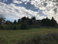
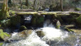
The Vernejoux bridge is worth walking down to the stream for a photo; the other two are rather unremarkable. Several alternatives are possible depending on how keen you are.

Details

1410748
Creation:
Last update:
Last review:
  • Walking
    Activity: Walking
  • ↔
    Distance: 6.29 mi
  • ◔
    Average duration: 3h 35 
  • ▲
    Difficulty: Moderate

  • ⚐
    Back to start: Yes
  • ↗
    Ascent: + 814 ft
  • ↘
    Descent: - 804 ft

  • ▲
    Highest point: 1,270 ft
  • ▼
    Lowest point: 945 ft

Description of the walk

Start from the car park at the Saint-Pardoux-l’Ortigier cemetery.

(S/E) Head back up towards the village via the D156E2, then turn left towards Sadroc via the D34.

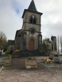
(1) Turn left just before the church, then take the path on the right which goes behind the church and leads down to the wash house. Follow this path to the lake.

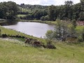
(2) At the lake, take the path on the right signposted ‘Pont de Vernéjoux’.

(3) At the road, continue left then right. Before the hamlet of Vernéjoux, turn right and carry on straight on to Janien.

(4) In Janien, take the path on the right, signposted ‘La Courolle’, and head for Maumont.

(5) Turn right towards Vaujour. Walk through the hamlet, ignoring the road on the left, and continue to Le Plancher.

(6) At Le Plancher, turn right onto the road, which then becomes a track. Pass the Moulin de Vaujour and head for the crossroads before Vernéjoux.

(3) Turn left and follow the route taken on the way out to the lake.

(2) At the lake, turn right to walk round it, then head back up to the village before reaching the finish at the cemetery (S/E).

Waypoints

  1. S/E : mi 0 - alt. 1,165 ft - Cemetery car park
  2. 1 : mi 0.18 - alt. 1,152 ft - Church
  3. 2 : mi 0.49 - alt. 1,089 ft - Water body
  4. 3 : mi 1.2 - alt. 1,096 ft - Vernejoux
  5. 4 : mi 1.77 - alt. 1,125 ft - Janien
  6. 5 : mi 2.83 - alt. 1,227 ft - Maumont
  7. 6 : mi 3.83 - alt. 1,191 ft - Le Plancher
  8. S/E : mi 6.29 - alt. 1,165 ft - Cemetery car park

Notes

Route proposed byMr Bordas of Rando Saint-Pa, from Saint-Pardoux-l’Ortigier.

Possible alternatives:

(3) Option to head down to the right towards Moulin de Vaujour, then on to Le Plancher and Saint-Pardoux-l’Ortigier.

(6) Head directly to Saint-Pardoux-l’Ortigier via Cessolas, continuing straight on.

Reviews and comments

4.4 / 5
Based on 3 reviews

Reliability of the description
4.3 / 5
Ease of following the route
4.7 / 5
Route interest
4.3 / 5
Moiphilippe35@gmail
Moiphilippe35@gmail

Overall rating : 4 / 5

Date of your route : May 20, 2024
Reliability of the description : ★★★★☆ Good
Ease of following the route : ★★★★☆ Good
Route interest : ★★★★☆ Good
Very busy route : No

It’s quite an interesting route; the road isn’t a problem at all as it’s a country road with very little traffic. I really enjoyed the route.

Machine-translated

Bstmexant
Bstmexant

Overall rating : 5 / 5

Date of your route : Jan 20, 2024
Reliability of the description : ★★★★★ Very good
Ease of following the route : ★★★★★ Very good
Route interest : ★★★★★ Very good
Very busy route : No

A very easy route to follow. The paths, which had originally been muddy following heavy rain, were very passable as they had been hardened by the frost. This very cold winter’s day was also very sunny, and it was a real treat to walk through this green, rolling countryside, which offered some stunning views. The elevation gain made for a good cardio workout. Highly recommended.

Machine-translated

Celineetfrederic
Celineetfrederic

Overall rating : 4.3 / 5

Date of your route : May 08, 2021
Reliability of the description : ★★★★☆ Good
Ease of following the route : ★★★★★ Very good
Route interest : ★★★★☆ Good
Very busy route : No

A pleasant, easy walk. A bit too much road for our liking (make sure you bring a hat if it’s very sunny)

Machine-translated

pazkale
pazkale

Thanks for getting back to me so quickly – it did seem a bit dodgy to me

Machine-translated

Netra
Netra ★

Hello pazkale,

You were quite right to raise the issue of the elevation gain on this walk! I’ve just recalculated the altitudes and the elevation gain is only 200 metres, for a walk lasting 3 hours and 25 minutes (estimated). That’s much more reasonable...

Machine-translated

pazkale
pazkale

Hello
Would it be possible to recalculate the elevation gain, which is 1,300 metres? That means it takes 6 hours to cover 10 kilometres. That’s a bit too long.
I’d like to do this hike, but not if it really does take 6 hours.
Thank you

Machine-translated

Other walks in the area

For more walks, use our search engine .

The GPS track and description are the property of this route's author. Please do not copy them without permission.