Country:

 City:


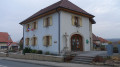
Head to Lebetain in the Belfort area, near Delle. Park in the village centre in the car park opposite the modern church.
(S/E) On leaving the car park, turn left onto Rue des Deux Fontaines. After just under a hundred metres, turn left onto Rue de la Grapatte. At the end of the tarmac road, continue along a farm track (not shown on the IGN map) which runs alongside a meadow. Enter the woods and you’ll reach a junction.
(1) Follow the path marked ‘Green Disc’ to the left. Walk alongside a meadow and make sure you don’t miss the sign on the right indicating a slightly steep descent leading down to the Ruisseau de l’Adour. At the bottom, the gap in the fence is rather narrow and you’ll need to take off your rucksacks.
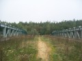
(2) Take the metal footbridge to cross the stream. Turn right and walk upstream along the stream for about 800 metres through idyllic countryside.
(3) At the foot of a series of waterfalls, heading towards a copse, turn left, cross a pasture and reach the edge of the woods (still following the Green Disc). The gap in the fence is a little easier to get through. The path soon opens out onto a tarmac road (D50): take a good track straight ahead. At the end of this, turn right and follow the path, first along the edge of the field and then into the woods.
(4) Do not miss the steep descent on the left – which is certainly quite difficult in wet weather – leading onto a good path. Turn left for 400 m, then turn right to climb up through a stand of conifers along a logging track. At the top, turn right onto a lovely avenue. After 500 m, do not be tempted by this track; instead, keep an eye out on the left for the start of a path (still marked with Green Discs) which actually marks the boundary between the former cantons of Croix and Delle, as evidenced by a few old boundary stones. At the end of the straight stretch, you’ll reach the border.
(5) Follow the path to the right, lined with the famous boundary markers (ignore the blue markings on the left). These markers are decorated with a fleur-de-lis on the French side and a bear (like the city of Bern) on the Swiss side.
(6) At marker 281, turn right and follow a path marked with a Red Ring (leaving the border path on your left). At the next junction, carry on straight ahead (the markings are now accompanied by a Yellow Ring). You’ll emerge at the Pas du Diable rest area, where, according to legend, the rock bears the hoofprints of the devil and the sandals of Bishop Saint-Dizier.
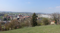
(7) Turn right onto the departmental road for 300 m, then turn left onto the path which soon leads out onto meadows (magnificent panoramic view of the blue line of the Vosges, stretching from the Planche des Belles Filles to the Grand Ballon).
(8) Continue along the top of the hill past the fields. Turn left, then right, and enter the forest again. Leave the Yellow Ring-marked path on your right and continue following the Red Ring markings.
(9) After a few hundred metres, leave the Red Ring markings and veer to the right. As you emerge from a fir forest, at a bend to the right of the track, take the path that climbs to the left between clearings marked with two red lines. The path, facing south, reaches a T-junction near the D50, very close to the hamlets of Le Purgatoire and Le Paradis.
(10) Turn right and you will soon come across a Blue Disc signpost. A short descent leads to a well-maintained stony track: follow this to the left (west). You will emerge onto the D26; follow it to the left (note the cross-shaped castle on the right).
(11) At the junction, turn left and walk through the village of Croix, passing its modern-style church. At the triangular square (rest area with a well), head down to the right.
(12) After about a hundred metres, turn right onto Rue des Pâturages and immediately turn right onto a farm track. Continue straight ahead (north-west). At the crossroads (statue), cross the road and carry on straight ahead, following the ‘Green Ring’ signposting. At the end of the track, follow the D50 to the left and pass under a power line.
(13) At the first right-hand bend, carry on straight ahead along the path marked with a Blue Disc, initially running parallel to a track further to the left. Move away from this track and wind your way through the forest. You’ll rejoin the D50.
(14) Turn left for about ten metres and immediately turn right onto the path known as the ‘path of the boundary stones’ (marked with a Yellow Line). Note several boundary stones, including one that is well-preserved, featuring a caudal cross motif with stars, surmounted by a crown adorned with fleurs-de-lis.
(15) At the junction at the 523-metre mark, turn right (north) and follow the Yellow Ring markings.
(16) At the crossroads, follow the D57 to the right. Follow this quiet road for 1.5 km.
(17) In the wide left-hand bend, turn right onto the lovely road leading to the quarry. Immediately after the barrier, follow the Blue Disc signposting to the left. The road climbs quite steeply and emerges at the foot of a landfill site for inert materials. Continue along the road and head straight through the village of Saint-Dizier-l’Evêque via Rue du Champ au Roi and then Rue Principale. Pass the town hall and turn right into Rue de l’Église (a visit to the church is recommended).
(18) Continue along the street and carry on into a narrow lane to the left (note the small terraced vineyards on the right). The alley leads onto a tarmac road: follow this to the left to enter the hamlet of Le Val (listed washhouse and fountain; note the niches where the mentally ill were made to dip their heads in cold water to aid their recovery).
(19) Turn round and head towards Lebetain. Immediately afterwards, take the stony path on the left. Note the spring of the stream on the left and continue along the path, which passes an old cattle shelter and then simply winds its way up through the pasture.
(3) At the junction you passed on the way there, carry on straight ahead along the stream.
(2) Do not cross the stream but carry on straight ahead along the path. You will come out onto a small road; turn left, then left again to return to the starting point (S/E).


 Visorando Member
 Moderate

 Easy
 Local authority