Tour de Rompon

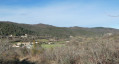
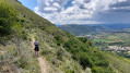
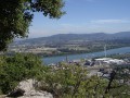
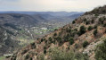
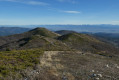
This route offers you the chance to take a short tour of the village of Rompon and enjoy some lovely panoramic views.

Details

18894507
Creation:
Last update:
Last review:
  • Walking
    Activity: Walking
  • ↔
    Distance: 5.57 mi
  • ◔
    Average duration: 3h 40 
  • ▲
    Difficulty: Moderate

  • ⚐
    Back to start: Yes
  • ↗
    Ascent: + 1,230 ft
  • ↘
    Descent: - 1,230 ft

  • ▲
    Highest point: 1,588 ft
  • ▼
    Lowest point: 358 ft

Description of the walk

Park opposite the town hall (D265).

(S/E) Facing the town hall building, turn left onto the D265, heading towards the bridge.

(1) Cross the bridge over the Ruisseau de Chambaud, then turn left again onto Rue du Temple. Cross the Ruisseau des Blaches and head up the street.

(2) At the fork, keep right onto Route de Quintel, leaving the Ruisseau de Chambaud (old temple) on your left, and carry on to a triangular junction (elevation 161).

(3) Turn left and you’ll come to a fork in the road by the vineyards.

(4) Turn right onto the Chemin du Quintel and, in front of a house’s entrance, turn right, go downhill and cross the stream.

(5) Head back up to the right along the stony path. At the road, go up to the left and pass the fire water tank.

(6) At the entrance to the hamlet of La Garde (private property), head up the path through the woodland on the right. Follow it to a junction and turn left; this will take you to the road. Turn left onto the road and, at the three-way junction, turn right onto Chemin de la Branche.

(7) Walk between the houses on La Branche and continue along the path to the right until you reach the entrance to the woods.

(8) Turn left. A little further on, pass a house on your right, then, at the three-way junction, turn right and cross a meadow before taking the winding, fairly steep path which joins a road (D265).

(9) Cross the road and take the path opposite leading to the hamlet of Creyssac, which you pass through. Cross the D265, then take the Route de la Cure opposite and continue for 100 metres past this hamlet.

(10) Turn right and, after 150 m, at the fork well before the cemetery, turn left. Finally, follow the road to a fork just before the bridge.

(11) Carry on to the right along the road, cross the road bridge and rejoin the original fork.

(1) Leave the bridge on your right and continue towards the car park in front of the town hall (S/E).


Waypoints

  1. S/E : mi 0 - alt. 358 ft - Car park opposite the town hall
  2. 1 : mi 0.09 - alt. 371 ft - Junction. Bridge over the Ruisseau de Chambaud
  3. 2 : mi 0.23 - alt. 387 ft - Junction before the Cultural Centre
  4. 3 : mi 0.79 - alt. 525 ft - Triangular crossroads
  5. 4 : mi 0.9 - alt. 558 ft - Junction with Chemin du Quintel (vineyards)
  6. 5 : mi 1.32 - alt. 568 ft - Stream
  7. 6 : mi 1.85 - alt. 863 ft - La Garde hamlet
  8. 7 : mi 3 - alt. 1,555 ft - La Branche
  9. 8 : mi 3.31 - alt. 1,555 ft - Entrance to the woods
  10. 9 : mi 4.26 - alt. 1,017 ft - Route
  11. 10 : mi 4.74 - alt. 554 ft - Junction after La Cure
  12. 11 : mi 5.21 - alt. 394 ft - T-junction before the bridge (Ruisseau de Chambaud)
  13. S/E : mi 5.57 - alt. 358 ft - Car park opposite the town hall

Notes

Pleasenote:

  • There are very few signposts (yellow and white) along this route.
  • In the hamlet of La Branche, (watch out for the dog at the house on the left).

Best avoided in wet weather (mud and slippery conditions possible).

At the starting point, next to the town hall, there is a vending machine selling bread and pastries (payment by card or cash).

For further information, please pick up the guidebook available from the Privas Centre Ardèche Tourist Office.

Worth a visit

Fountain in the hamlet of Creyssac

Reviews and comments

3.9 / 5
Based on 3 reviews

Reliability of the description
3.3 / 5
Ease of following the route
3.7 / 5
Route interest
4.7 / 5
Patrice26
Patrice26

Overall rating : 4.3 / 5

Date of your route : Jan 12, 2026
Reliability of the description : ★★★★☆ Good
Ease of following the route : ★★★★☆ Good
Route interest : ★★★★★ Very good
Very busy route : No

Hike completed in the afternoon, lasting 2½ hours
Very pleasant

Machine-translated

Thierryb26
Thierryb26

No.

The car park is described as being opposite the Town Hall; you need to turn left when facing the Town Hall, so onto the RD265 (Allée des Écoliers), then after the bridge turn left onto Rue du Temple, then right onto Route du Quintel; the community hall remains well to the left of the route.

From the Town Hall, you set off along the RD104; you didn’t follow the route provided, which explains why the description doesn’t seem correct to you.

Take a look at the route on the map – it clears up any confusion...

Machine-translated

André 07
André 07

The map clearly shows that, coming from the town hall, you cross the bridge and then turn right up Rue du Temple, keeping the cultural centre (the former temple) on your right.
I don’t understand the point of keeping an inaccurate version of the walk.
Admittedly, it allows the author to prove they are right, but above all it seriously undermines the credibility of the Visorando guides. I find this deeply regrettable.

Machine-translated

Thierryb26
Thierryb26
André 07
André 07

We don’t have the same idea of what the town hall is!

Machine-translated

Thierryb26
Thierryb26
• Edited:

André 07, no, everything is fine on the ground as described… I think you must have set off along the D104 at the start instead of following the directions as described, which would explain why the landmarks are the other way round…
And after WPT 8, the path is indeed on the left before the cemetery.

Machine-translated

André 07
André 07

Overall rating : 2.3 / 5

Date of your route : Jan 20, 2025
Reliability of the description : ★☆☆☆☆ Very disappointing
Ease of following the route : ★★☆☆☆ Disappointing
Route interest : ★★★★☆ Good
Very busy route : No

The map is reliable but the description is wrong: initially, Rue du Temple is on the right as you come from the town hall, not on the left; likewise, the community hall is on the right-hand side of the street. So then, at point 2, it’s only natural not to see the path in front of the house (which houses, anyway?). Fortunately, the actual route comes to the walker’s rescue, as once you’ve passed the houses, a stony track leads to a wooden bridge over the stream, just as described; from there, the description is correct.
I didn’t do the section between 4 and 8, but at number 8 I didn’t see the return path on the right before the cemetery, but after it. Not worth the effort.
Luckily, the scenery is lovely!

Machine-translated

NiSaLoCa282914/
NiSaLoCa282914/

Overall rating : 5 / 5

Date of your route : Jan 29, 2024
Reliability of the description : ★★★★★ Very good
Ease of following the route : ★★★★★ Very good
Route interest : ★★★★★ Very good
Very busy route : No

A 3-hour walk in the afternoon. Very pleasant and well signposted. A bit of tarmac at the start, but not a problem as the roads are small and quiet.

Machine-translated

Other walks in the area

For more walks, use our search engine .

The GPS track and description are the property of this route's author. Please do not copy them without permission.