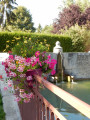
La Pierre-Collon as seen from Les Sièges

After a visit to Les Sièges, its church and its ditches, take a walk in the forest to discover the La Pierre-Collon menhir, then return to Les Sièges.

Details

n°269056
Creation:
Last update:
Last review:
  • Walking
    Activity: Walking
  • ↔
    Distance: 6.37 mi
  • ◔
    Average duration: 3h 20 
  • ▲
    Difficulty: Moderate

  • ⚐
    Back to start: Yes
  • ↗
    Ascent: + 486 ft
  • ↘
    Descent: - 476 ft

  • ▲
    Highest point: 781 ft
  • ▼
    Lowest point: 413 ft

Description of the walk

Start at the Place de l’Église Saint-Cyr et Sainte-Julitte.

(S/E) Set off from the town hall side and take Rue de l’Abreuvoir as far as the bridge.

(1) Turn right onto Rue des Courrées and follow it straight on. Take the path straight ahead.

(2) At the junction with the road, carry on straight ahead along the path to the Bois Communal des Sièges. Carry on straight ahead along the forest track.

(3) Take the first lane on the right (between clearings nos. 25 and 24). Leave the woodland and take the path on the left which runs alongside it until you reach the fourth lane (between clearings nos. 21 and 20).

(4) Enter the woods on the left and follow the ‘Vallée aux coqs’ path. At the fourth lane on your left (between clearings nos. 18 and 17), turn right. The menhir is about 100 metres away.

(5) Go back the way you came and follow the track opposite (between clearings nos. 18 and 17). Turn left at the end of the track and carry on straight ahead.

(6) Turn right into the fourth lane (between clearings nos. 2 and 3) to reach the road. Turn left onto it and follow the road.

(7) Turn right towards the Petit Crosley farm, then turn left towards the Grand Crosley farm.
Head straight back down towards the village along the Crot aux Chiens country lane.

Enter the village via Rue du Belvédère. Turn left until you reach the junction.

(1) Continue straight on along Rue de l’Abreuvoir to return to the church square (S/E).

Waypoints

  1. S/E : mi 0 - alt. 417 ft - Place de l’Église Saint-Cyr et Sainte-Julitte.
  2. 1 : mi 0.15 - alt. 420 ft - Louis XV Bridge
  3. 2 : mi 0.77 - alt. 472 ft - Path to the woods
  4. 3 : mi 1.84 - alt. 712 ft - First lane on the right
  5. 4 : mi 2.65 - alt. 610 ft - ‘La Vallée aux coqs’ path
  6. 5 : mi 3.08 - alt. 640 ft - Pierre-Collon
  7. 6 : mi 4.1 - alt. 741 ft - Turn right into the 4th lane
  8. 7 : mi 5 - alt. 630 ft - Turn right, towards the Petit Crosley farm
  9. S/E : mi 6.37 - alt. 417 ft - Place de l’Église Saint-Cyr et Sainte-Julitte.

Notes

Worth a visit

(S/E) You are here, in the heart of the village with the church, the town hall and the schools.
Les Sièges is an old village known for 833 years under the name Staticus and later Scabiae.
Take a look at the salamanders on the Renaissance doors of the church. The Church of Saint-Cyr and Sainte-Julitte has been destroyed by fire several times, notably in 1706.
To arrange a visit to the church, contact G. Mallet: 03-86-96-81-20 or Ch. Lenglet: 03-86-86-87-99

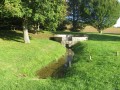
(1) The Louis XV-style bridge was built using the remains of the fortified gate.
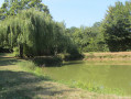
You then walk alongside the moats of the old fortifications built in the 16th century around the village with the royal authorisation of François I.
As you pass, take a look at the beautiful flintwork on one of the houses! All the old houses in the village are built of flint set with a mortar of sand and lime.

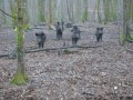
(5) La Pierre-Collon. In this lane, on your left, there is a waterhole for wild boar and traces of wildlife (roe deer, wild boar, badgers).

A superb view of the village, the Côte du Moulin and the isolated farms (La Folie, Chaudron, Les Essarts, Maison Rouge, etc.), the valley leading to the Vanne and, in the distance, the wind turbines at Les Clérimois, Molinons and Coulours.

Reviews and comments

4.7 / 5
Based on 1 review

Reliability of the description
5 / 5
Ease of following the route
5 / 5
Route interest
4 / 5
boiz89
boiz89

Overall rating : 4.7 / 5

Date of your route : May 12, 2025
Reliability of the description : ★★★★★ Very good
Ease of following the route : ★★★★★ Very good
Route interest : ★★★★☆ Good
Very busy route : No

The section between points 3 and 5, on the edge of the woodland bordering the field, is tricky to walk along as the grass has not been mown and visibility is poor; the ground is uneven and covered with numerous ruts.
Otherwise, the rest of the route is varied, taking you through open country between farmland and wooded areas, not forgetting the menhir – the ‘pierre à colon’ – and the village, which has plenty of lovely things to see.
A good route to get back into the swing of things

Machine-translated

Other walks in the area

For more walks, use our search engine .

The GPS track and description are the property of this route's author. Please do not copy them without permission.