Cardonnet Circular Loop

From Cardonnet, in the commune of Saint-Hilaire-de-Lusignan, towards Colayrac-Saint-Cirq.

Details

4391569
Creation:
Last update:
Last review:
  • Walking
    Activity: Walking
  • ↔
    Distance: 4.67 mi
  • ◔
    Average duration: 2h 40 
  • ▲
    Difficulty: Easy

  • ⚐
    Back to start: Yes
  • ↗
    Ascent: + 597 ft
  • ↘
    Descent: - 581 ft

  • ▲
    Highest point: 577 ft
  • ▼
    Lowest point: 171 ft

Photos

Description of the walk

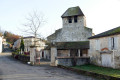
The car park is at the entrance to Cardonnet, by the Salle des Fêtes (the former school).

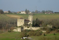
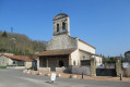
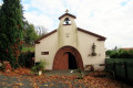
S/E: From the car park, head towards the village and the church (public toilets to the left of the church), then walk past the cemetery and follow this road. Pass the access road to Fossac and look out for Madaillan Castle on the hill to your left.

(1) Turn right onto the Route de Manioudale for about 400 m. When the road veers left, take the path opposite which climbs steeply into a woodland and follow it to the top. Once at the top, take the grassy path to the right between two fields until you reach a road.

(2) Follow this road to the left (yellow markings) until you reach a hairpin bend. Leave the road and go to the right of the house onto a small path marked in yellow. Pass the hamlet of Tripet, then follow the road opposite.

(3) When you reach the signpost, turn right onto the Chemin de Peleguignon until you reach the house at number 270. Turn right along the fence of this house (yellow arrow) onto the steep, narrow path for about 200 metres. After this path, continue along the road until you reach a three-way junction.

(5) Turn left. Leave the Route de Redon on your right and continue along the Route de Lacépède, following the yellow markings, until you reach a four-way junction.

(6) Leave the yellow markings and take the road on the right, the Chemin de Mondot-Pécoul. Pass to the right of the first house (Mondot), then follow the path which descends to the left of the second house and continue along the road until you reach the Chemin de Péni.

(7) Continue to the right for 250 m, then turn left onto the Route de Cardonnet, which you follow to the right until you return to the starting point (S/E).

Waypoints

  1. S/E : mi 0 - alt. 180 ft - Car park at the Cardonnet Village Hall
  2. 1 : mi 0.65 - alt. 210 ft - Chemin de Manioudale on the right
  3. 2 : mi 1.36 - alt. 545 ft - Lacépède Road, on the left
  4. 3 : mi 2.14 - alt. 354 ft - Chemin de Peleguignon, on the right
  5. 4 : mi 2.31 - alt. 344 ft - House no. 270, on the right
  6. 5 : mi 2.81 - alt. 577 ft - Three-way junction, on the left
  7. 6 : mi 3.36 - alt. 486 ft - Junction, on the right.
  8. 7 : mi 4.13 - alt. 184 ft - Chemin de Péni, on the right
  9. S/E : mi 4.67 - alt. 180 ft - Car park at the Cardonnet Village Hall

Notes

Toilets next to the entrance to Cardonnet Church.

Worth a visit

Cardonnet Church.

Madaillan Castle.

Reviews and comments

4.2 / 5
Based on 3 reviews

Reliability of the description
4 / 5
Ease of following the route
4 / 5
Route interest
4.7 / 5
Hely Joly Bernard
Hely Joly Bernard

Overall rating : 4 / 5

Date of your route : May 04, 2024
Reliability of the description : ★★★★☆ Good
Ease of following the route : ★★★★☆ Good
Route interest : ★★★★☆ Good
Very busy route : No

A junction that’s hard to spot as you leave the field, as you come to a circular road loop; and in my view, the term ‘paths’ would be more accurately described as ‘roads’ here, as they’re tarmac-surfaced

Machine-translated

Labat Fabienne
Labat Fabienne

Overall rating : 3.7 / 5

Date of your route : Nov 27, 2022
Reliability of the description : ★★★☆☆ Average
Ease of following the route : ★★★☆☆ Average
Route interest : ★★★★★ Very good
Very busy route : No

A very pleasant route for walking.

Machine-translated

teddygers
teddygers

Overall rating : 5 / 5

Date of your route : Dec 20, 2020
Reliability of the description : ★★★★★ Very good
Ease of following the route : ★★★★★ Very good
Route interest : ★★★★★ Very good
Very busy route : Yes

Machine-translated

Other walks in the area

For more walks, use our search engine .

The GPS track and description are the property of this route's author. Please do not copy them without permission.