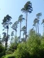
Around La Cholotte 1

A short, picturesque walk around the Auberge de la Cholotte. Discover the area’s biodiversity, the banks of the Mortagne and the Roche Belle Jambe.

Details

n°45744931
Creation:
Last update:
Last review:
  • Walking
    Activity: Walking
  • ↔
    Distance: 1.20 mi
  • ◔
    Average duration: 0h 40 
  • ▲
    Difficulty: Easy

  • ⚐
    Back to start: Yes
  • ↗
    Ascent: + 115 ft
  • ↘
    Descent: - 92 ft

  • ▲
    Highest point: 1,493 ft
  • ▼
    Lowest point: 1,352 ft

Photos

Description of the walk

Car park at the Auberge de la Cholotte.

(S/E) Follow the road to the small bridge over the pretty River Mortagne, which rises about 7 km further upstream.

(1) Turn right and follow the riverbank for a few hundred metres. Just before the wire fence, head up to the path.

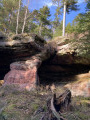
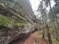
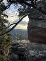
(2) Turn right, go through the iron gate and continue to the Rocher Belle Jambe, which will amaze you with its caves, corbelling and pillar; it will be on your left.

(3) Continue along the path for about 500 metres.

(4) At the bend to the left, turn right and follow the path back down to the inn’s car park (S/E).

Waypoints

  1. S/E : mi 0 - alt. 1,404 ft - Car park at the Auberge de la Cholotte
  2. 1 : mi 0.15 - alt. 1,365 ft - Bridge - Mortagne (rivière)
  3. 2 : mi 0.39 - alt. 1,365 ft - Crossroads
  4. 3 : mi 0.84 - alt. 1,473 ft - Rocher Belle Jambe
  5. 4 : mi 1.11 - alt. 1,486 ft - Turn right at the fork
  6. S/E : mi 1.2 - alt. 1,404 ft - Car park at the Auberge de la Cholotte

Notes

The start is situated between Bruyères and Saint-Dié on the Haut-Fer de Brouaumont forest road.

Reviews and comments

5 / 5
Based on 1 review

Reliability of the description
5 / 5
Ease of following the route
5 / 5
Route interest
5 / 5
BacchusickoubieVino
BacchusickoubieVino

Overall rating : 5 / 5

Date of your route : Sep 15, 2025
Reliability of the description : ★★★★★ Very good
Ease of following the route : ★★★★★ Very good
Route interest : ★★★★★ Very good
Very busy route : No

Very easy hike, even with a dog.

Machine-translated

Other walks in the area

For more walks, use our search engine .

The GPS track and description are the property of this route's author. Please do not copy them without permission.