A short tour of Saint-Brisson

A short, easy walk suitable for all seasons, taking you through wooded countryside and forests to discover typical hamlets, the Morvan Regional Nature Park Centre and the village centre, which is typical of the Morvan region.

Details

68894805
Creation:
Last update:
Last review:
  • Walking
    Activity: Walking
  • ↔
    Distance: 5.33 mi
  • ◔
    Average duration: 2h 45 
  • ▲
    Difficulty: Easy

  • ⚐
    Back to start: Yes
  • ↗
    Ascent: + 341 ft
  • ↘
    Descent: - 348 ft

  • ▲
    Highest point: 2,165 ft
  • ▼
    Lowest point: 1,913 ft

Photos

Description of the walk

Park in the large car park at the Morvan Regional Nature Park Centre, near the monumental statue of the horse. This statue was created by students at the Château-Chinon vocational college.

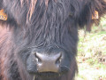
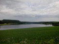
(S/E) Head towards the Maison du Parc and, just before you reach it, turn right onto the path that runs alongside the enclosure housing the Highland cattle. Walk down to the Étang Taureau, which was once used for timber floating, creating the ‘grand flot’ that pushed the logs along the water: a lovely view of the village.

(1) Turn right and walk along the edge of the pond.

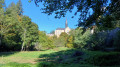
(2) Go through a gate opposite the municipal campsite. On the small road, turn left towards the village and cross the embankment. Take the first small street on the right, called Chemin du Theurais, and follow it past Saint-Brice Church.

(3) Take the path that crosses the meadows on the right. Cross the Vignan, a pretty little river teeming with trout, and then take the lovely track on the right for about 1 km. Cross the Vignan again and you’ll immediately come out onto a departmental road.

(4) Turn right with care, then immediately left to follow a path that climbs up to La Bertoux: in the Morvan, hamlets are named after family surnames. In the hamlet, go straight on, following the red and yellow markings ofthe GR® de Pays.

(5) When you reach Les Grandes Fourches, turn right onto the Chemin du Château d’eau, then, 500 metres further on, take a track on the left. Follow this for about 1 km until you reach a small road near a telecoms mast, then follow it to the right until you reach the junction with the D20.

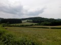
(6) Cross the departmental road with care, then head straight ahead onto the lovely track. Continue straight on across the fields for 1 km until you reach Les Petites Fourches.

(7) Turn right for about 50 metres, keep left and then stay on the left at the next junction. Then leave the road and take a path on the right; turn left at the junction to join the Route de Saulieu (D6).

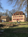
(8) Cross carefully, then turn left to enter the Maison du Parc through an iron gate. Turn left, then right, passing the Morvan Resistance Museums and the Maison des Hommes et des Paysages. Then walk through the herbarium (this large house was once a castle) and turn left twice in succession towards a small pond, walking alongside it.

(9) Turn right to complete the circuit. Walk past the wood chip storage area and turn right towards the orchard. Then head down to the left towards Étang Taureau.

(10) Turn left onto the nature trail and follow it to the end. Turn left at the birdwatching huts and the ‘barefoot’ trail.

(11) Retrace your steps and rejoin the route on the left.

(1) Head back up towards the large car park by turning right and make your way to it (S/E).

Waypoints

  1. S/E : mi 0 - alt. 2,031 ft - Large car park at the Maison du Parc du Morvan
  2. 1 : mi 0.17 - alt. 1,988 ft - Étang Taureau, junction of the circular loop
  3. 2 : mi 0.35 - alt. 1,995 ft - Saint-Brisson Campsite
  4. 3 : mi 0.64 - alt. 1,978 ft - Path on the right
  5. 4 : mi 1.42 - alt. 1,913 ft - Route de Dun
  6. 5 : mi 2.05 - alt. 2,077 ft - Les Grandes Fourches
  7. 6 : mi 2.97 - alt. 2,152 ft - D20, Quarré-les-Tombes main road
  8. 7 : mi 3.8 - alt. 2,116 ft - Les Petites Fourches
  9. 8 : mi 4.05 - alt. 2,060 ft - D6, pedestrian entrance to the Maison du Parc
  10. 9 : mi 4.34 - alt. 2,054 ft - Junction, turn right
  11. 10 : mi 4.7 - alt. 1,991 ft - Discovery trail and sensory trail
  12. 11 : mi 5.08 - alt. 1,985 ft - Observation huts
  13. S/E : mi 5.33 - alt. 2,031 ft - Large car park at the Maison du Parc Naturel

Notes

Bistrot du Parc within the Maison du Parc grounds: 03 86 76 03 25.
Inn in the village and ‘L’escale Morvandelle’ accommodation: 07 66 94 26 89. Off the route, 100 metres past the church on the way up to the war memorial.
Very basic municipal campsite, open during the summer season: 07 88 95 34 41.
Morvan Resistance Museum: 1 hour.
Maison des Hommes et des Paysages: 30 mins.
Picnic tables at the Maison du Parc and in the village near the town hall (very peaceful, a former playground that is now fenced off but freely accessible).
Playground equipment for children at the Maison du Parc and in the village near the town hall.
Morvan Sommets et Grands Lacs Tourist Office: 03 45 23 00 00.
Morvan Tourist Office: 03 86 78 79 57.

Worth a visit

Always be cautious and plan ahead when you're outdoors. Visorando and the author of this route cannot be held responsible for any accidents occurring on this route.

The GR® and PR® markings are the intellectual property of the Fédération Française de Randonnée Pédestre.

Reviews and comments

4.3 / 5
Based on 4 reviews

Reliability of the description
4.7 / 5
Ease of following the route
4.3 / 5
Route interest
4 / 5
User 12791958

Overall rating : 4.7 / 5

Date of your route : Jul 20, 2026
Reliability of the description : ★★★★★ Very good
Ease of following the route : ★★★★★ Very good
Route interest : ★★★★☆ Good
Very busy route : No

Enjoyable and easy to follow 😉

Machine-translated

User 10629673

Overall rating : 3.3 / 5

Date of your route : Jul 12, 2025
Reliability of the description : ★★★★☆ Good
Ease of following the route : ★★★☆☆ Average
Route interest : ★★★☆☆ Average
Very busy route : No

Part of the trail is impassable, the path is completely overgrown with brambles, nettles, ferns, etc

Machine-translated

Emilie Fre
Emilie Fre

Overall rating : 4 / 5

Date of your route : Jul 20, 2025
Reliability of the description : Not used / Not applicable
Ease of following the route : ★★★★☆ Good
Route interest : ★★★★☆ Good
Very busy route : No

The route starts off well with easy parking. It continues quickly through the woods and country lanes. However, as the trail is rarely used, many of the paths are overgrown. It's passable, but you'll need long trousers!
I only came across two people. Overall, very good.

Machine-translated

Daniel Fonteniaud
Daniel Fonteniaud

Overall rating : 5 / 5

Date of your route : Jun 02, 2025
Reliability of the description : ★★★★★ Very good
Ease of following the route : ★★★★★ Very good
Route interest : ★★★★★ Very good
Very busy route : No

A very pleasant walk, alternating between open areas and woodland. It’s probably not very well-used, as some sections were quite overgrown with grass, particularly the ‘Chemin de la Vie Gros Chêne’. Very good overall, with beautiful scenery.

Machine-translated

Other walks in the area

For more walks, use our search engine .

The GPS track and description are the property of this route's author. Please do not copy them without permission.