Around the Chapelle Saint-Pierre in Plogonnec

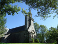
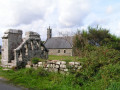
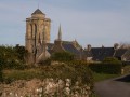
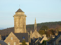
From the majestic Saint-Pierre Chapel, this short circular route continues along the edge of the Bois du Névet, then returns through the countryside via farm tracks and a quiet road serving only farms.

Details

26866086
Creation:
Last update:
Last review:
  • Walking
    Activity: Walking
  • ↔
    Distance: 2.14 mi
  • ◔
    Average duration: 1h 15 
  • ▲
    Difficulty: Easy

  • ⚐
    Back to start: Yes
  • ↗
    Ascent: + 272 ft
  • ↘
    Descent: - 282 ft

  • ▲
    Highest point: 469 ft
  • ▼
    Lowest point: 164 ft
  • ⚐ Country: France
  • ⚐ City: Plogonnec (29180)
  • ⚑
    Start/End: N 48.078597° / W 4.22471°
  • ❏
    IGN map(s): Ref. 0518OT
  • Hour-by-hour weather

Photos

Description of the walk

Access: from the village centre of Plogonnec, take the main street, Rue de Douarnenez, pass between the town hall and the church, and leave the media centre on your right. At the roundabout ahead, continue straight on along the very winding D39. At a place called Toul Colo (cross and old transformer), turn right at the sign for Saint-Pierre Chapel. The small grassy car park is signposted near the chapel.

(S/E) Enter the enclosure, walk round the wayside cross and go the full circuit of the chapel. Take a path on the right that leads downhill and crosses the Névet via a footbridge. Head back up towards a staircase made of logs and join a wide path that climbs to the right, heading north, along the edge of the Bois de Névet.

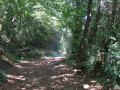
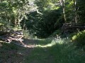
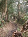
(1) Follow this stony path, lined with old trees, which runs alongside a small stream on your right. Pass a small private pond and continue climbing steadily, still along the edge of the woodland. Pass a wire fence and, after a small pool formed by the stream, look out for a clearing on the right (with a beech tree in the middle).

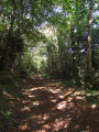
(2) Turn right and cross the small stream. Continue along a sunken track lined with old chestnut and beech trees. Pass under a power line and emerge facing the entrance to a vast field.

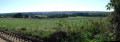
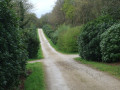
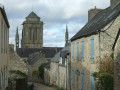
(3) Turn right and follow this farm track, which offers a sweeping view to the west. You’ll come out onto a small road serving the farms (view of the Plogonnec church spire on the left). Follow this road to the right until you reach a Fork in the road (signpost).

(4) Follow the sign for “Roz ar Nevet, Roz ar Veil” to the left. Pass the first farm and, at the second, you’ll reach the end of the road. Turn left onto a stony, downhill farm track (signposted ‘Chapelle Saint-Pierre’). At the Fork in the road, turn right, continuing downhill, then finish with a climb up to the chapel car park (S/E).

Waypoints

  1. S/E : mi 0 - alt. 213 ft - Chapelle Saint-Pierre
  2. 1 : mi 0.14 - alt. 164 ft - Fork in the path at the edge of the woodland
  3. 2 : mi 0.52 - alt. 331 ft - Crossing the stream
  4. 3 : mi 1.06 - alt. 440 ft - Farm track
  5. 4 : mi 1.54 - alt. 404 ft - Signpost
  6. S/E : mi 2.14 - alt. 213 ft - Chapelle Saint-Pierre

Notes

Shaded route.

Worth a visit

Saint-Pierre Chapel, like all the chapels in Plogonnec, is open on Wednesday afternoons during the summer season.

Old trees (chestnut and beech) and peaceful countryside.

Reviews and comments

4.6 / 5
Based on 3 reviews

Reliability of the description
4.7 / 5
Ease of following the route
4.7 / 5
Route interest
4.3 / 5
trimidi
trimidi

Overall rating : 3.7 / 5

Date of your route : Aug 11, 2025
Reliability of the description : ★★★★☆ Good
Ease of following the route : ★★★★☆ Good
Route interest : ★★★☆☆ Average
Very busy route : No

.

Machine-translated

Laurent91
Laurent91

Overall rating : 5 / 5

Date of your route : Aug 13, 2024
Reliability of the description : ★★★★★ Very good
Ease of following the route : ★★★★★ Very good
Route interest : ★★★★★ Very good
Very busy route : Yes

An interesting walk to explore the area around Locronan

Machine-translated

Carole Gouézo
Carole Gouézo

Overall rating : 5 / 5

Date of your route : Jun 05, 2024
Reliability of the description : ★★★★★ Very good
Ease of following the route : ★★★★★ Very good
Route interest : ★★★★★ Very good
Very busy route : No

A lovely, easy walk,
through lovely woodland and fields. One thing to bear in mind, though: at point No. 2, don’t miss the crossing over the stream – it’s very easy to overlook...
The GPX file is very useful for finding it.

Machine-translated

Other walks in the area

For more walks, use our search engine .

The GPS track and description are the property of this route's author. Please do not copy them without permission.