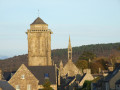
In the Bois du Névet via the Chapelle Saint-Pierre

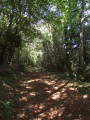
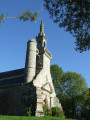
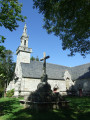
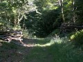
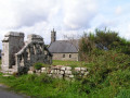
Starting from the beautiful Saint-Pierre Chapel, this route ventures into the Bois du Névet, a deciduous forest.
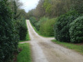
The route follows paths along the edge of the forest, a few sections of wide forest lanes and, towards the end, a wilder path above the Manoir du Névet estate.
In summer, you will appreciate the shaded route and in autumn, the colours of the foliage.

Details

1741842
Creation:
Last update:
Last review:
  • Walking
    Activity: Walking
  • ↔
    Distance: 6.87 mi
  • ◔
    Average duration: 3h 40 
  • ▲
    Difficulty: Moderate

  • ⚐
    Back to start: Yes
  • ↗
    Ascent: + 581 ft
  • ↘
    Descent: - 584 ft

  • ▲
    Highest point: 476 ft
  • ▼
    Lowest point: 141 ft
  • ⚐ Country: France
  • ⚐ City: Plogonnec (29180)
  • ⚑
    Start/End: N 48.078578° / W 4.224758°
  • ❏
    IGN map(s): Ref. 0518OT
  • Hour-by-hour weather

Photos

Description of the walk

Access: Cross Plogonnec and follow the D39 towards Le Juch.
At Toul Colo (cross and old transformer covered in ivy), turn right at the sign for Chapelle Saint-Pierre. The small car park is located just at the end of the road.
Parking near the Chapelle Saint-Pierre.

YellowPR® route Saint-Pierre markings (not very visible).

(S/E) With your back to the small car park, head north-east along the wide farm track that descends towards a stream and then climbs back up towards the house at Roz ar Veil. Continue along the road and at the crossroads (Kergoat Nevet sign), turn right for about 100 metres.

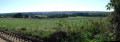
(1) Turn left onto a wide path that climbs and offers a wide panorama to the west. Continue to a fork (entrance to a field on the right).

(2) Turn left onto a small path, pass under a power line and continue along this sunken path lined with old chestnut and beech trees. You will come out facing a stream.

(3) Cross, turn right and climb steadily along the edge of the woods. The path veers left and then runs alongside the road leading to a car park. Continue straight ahead, leaving the car park on your left. Go through a gate, take the wide forest lane Hent Kreiz and pass the forest house.

Mountain bike signposting.

(4) At the Pen ar C'hoad signpost, turn right and then right again at the three-way junction (not visible on the map) and join the edge of the woods marked by a wire fence. Continue with the fence on your right.

GR® 38 white and red markings.

(5) At Plas ar Lochou (on the map), join theGR® which veers to the left. Continue, ignoring all the paths leading off to the left.
Pass a path marked for people with reduced mobility on your left and you will come to a barrier marking the boundary of a car park.

Off the marked trail

(6) At the car park exit, turn left, follow the road and you will come to the gate of the Koat Ar Gazek Glaz estate (Bois de la Jument Verte). At the sign for "Coz-Castel, 2.5km", leave the road, turn left and follow the estate fence.

(7) At the signpost marking the northern boundary of the estate, turn right and continue to follow the fence on your right. Reach the wide forest path Hent Kreiz and take it to the left for about a hundred metres until you reach the crossroads of forest paths.

(8) At the Hent Treuz/Hent Kreiz crossroads, turn right into the forest lane (bench) and continue straight ahead on this wide lane until you reach another forest lane, Hent ar Stankou, which you take on the left. Follow this beautiful lane towards the lake (Stang ar Bleïz on the map) without going all the way to the pond.

YellowPR® Saint-Pierre route markings (not very visible).

(9) At the start of the climb, turn right, leaving the main lane to enter the woods.
The path winds its way between the trees and descends towards a lake that can be seen below. Go down and go around it on the right. Turn left and cross a footbridge over the stream that flows into the pond. Pass through a cleared area, follow the wide path marked out for this work (10/2019) and arrive at a signpost marked: Chapelle 2.5km. Further on, the path joins a wire fence marking the boundary of the Névet manor house, which is not visible. The path runs alongside the wire fence on the right-hand side until it reaches a small clearing extending into a valley.

(10) At the signpost, turn left, leaving the wire fence, and follow a wide grassy path towards a farm building that gradually comes into view.
Shortly before this building, thePR® turns sharply to the right.

(11) Climb into the woods and continue straight ahead. At the next signpost, turn left and continue climbing until you reach a beautiful grassy path.

(12) Turn right to begin a pleasant descent to a crossroads. Descend towards the stream and its footbridge, then climb back up to enter the grounds of the Chapelle Saint-Pierre on your left and return to the car park where you started (S/E).


Waypoints

  1. S/E : mi 0 - alt. 213 ft - Parking near the Chapelle Saint-Pierre
  2. 1 : mi 0.73 - alt. 449 ft - Fork in the path
  3. 2 : mi 1.09 - alt. 440 ft - Fork in the road on a small path
  4. 3 : mi 1.6 - alt. 328 ft - Stream
  5. 4 : mi 2.31 - alt. 423 ft - Pen ar'C'hoad signpost
  6. 5 : mi 2.85 - alt. 417 ft - GR junction
  7. 6 : mi 3.59 - alt. 348 ft - Car park on the Kerlaz side.
  8. 7 : mi 4.14 - alt. 358 ft - Northern boundary of the estate
  9. 8 : mi 4.45 - alt. 328 ft - Hent Treuz/Hent Kreiz crossroads
  10. 9 : mi 4.98 - alt. 217 ft - Fork to the right
  11. 10 : mi 6.03 - alt. 194 ft - Turn left at the signpost.
  12. 11 : mi 6.17 - alt. 272 ft - Fork to the right
  13. 12 : mi 6.53 - alt. 322 ft - Fork to the right
  14. S/E : mi 6.87 - alt. 210 ft - Parking near the Chapelle Saint-Pierre

Notes

This hike is classified as moderate because part of the route is relatively hilly and it is not always easy to find your way. The markings are only visible when you turn and are not preceded by any advance warning signs.
You need to be vigilant.
Between (9) and (12), the path is more difficult, alternating between ascents and descents.
Some sections are shared with horse riders and mountain bikers.

The route is mostly shaded.

Worth a visit

Always be cautious and plan ahead when you're outdoors. Visorando and the author of this route cannot be held responsible for any accidents occurring on this route.

The GR® and PR® markings are the intellectual property of the Fédération Française de Randonnée Pédestre.

Reviews and comments

4.4 / 5
Based on 9 reviews

Reliability of the description
4.5 / 5
Ease of following the route
4.4 / 5
Route interest
4.3 / 5
User 22315309

Overall rating : 5 / 5

Date of your route : Aug 18, 2025
Reliability of the description : Not used / Not applicable
Ease of following the route : ★★★★★ Very good
Route interest : ★★★★★ Very good
Very busy route : No

Very beautiful hike. We relied solely on GPS for navigation. Some sections are difficult to navigate but easy to get around. Varied and pleasant landscapes with plenty of shade, which is much appreciated in this heatwave.

Machine-translated

FATHIGAHU
FATHIGAHU
• Edited:

Overall rating : 4.7 / 5

Date of your route : Jul 20, 2025
Reliability of the description : ★★★★★ Very good
Ease of following the route : ★★★★★ Very good
Route interest : ★★★★☆ Good
Very busy route : No

Perfect for those who enjoy hiking in the forest. Due to the number of paths criss-crossing the large woodland, the app is very useful for finding your way around.

Machine-translated

phidet
phidet

Overall rating : 3.7 / 5

Date of your route : Jun 13, 2023
Reliability of the description : ★★★★☆ Good
Ease of following the route : ★★★☆☆ Average
Route interest : ★★★★☆ Good
Very busy route : Yes

A beautiful forest hike. The starting point and Saint Pierre Chapel offer beautiful scenery. The description between the start and bridge 3, then between 6 and 9, lacks clarity.

Machine-translated

FLOCH
FLOCH ★

Thank you for your feedback.

I had to create several routes passing through this wood.
I also sometimes had problems finding my way around because there are lots of paths, some of which are not marked on the maps and others which are marked but not always obvious on the ground.
A pleasant walk during the heatwave.
Kind regards

Machine-translated

GR3MYTHE
GR3MYTHE

Overall rating : 4.3 / 5

Date of your route : Aug 11, 2022
Reliability of the description : ★★★★☆ Good
Ease of following the route : ★★★★☆ Good
Route interest : ★★★★★ Very good
Very busy route : No

Nice memory.
That said, I feel sorry for novice hikers because the lack of markings is really a problem when you're walking in the forest.
There are three entrances to this wood.
Why not create three routes from these three entrances with different and more numerous markings?
That said, the presence of the GR 38 provides a useful guide.
A scorching hot day = a beautiful hike.

Machine-translated

sunnybaloo
sunnybaloo

Overall rating : 5 / 5

Date of your route : Jul 05, 2022
Reliability of the description : ★★★★★ Very good
Ease of following the route : ★★★★★ Very good
Route interest : ★★★★★ Very good
Very busy route : No

A very beautiful hike, almost entirely through woodland, which was very pleasant with our dogs.
Be careful not to get sunburnt, though. 😉

Machine-translated

yvonnelegall
yvonnelegall
• Edited:

Overall rating : 5 / 5

Date of your route : Oct 08, 2019
Reliability of the description : ★★★★★ Very good
Ease of following the route : ★★★★★ Very good
Route interest : ★★★★★ Very good

A lovely walk in the Névet woods. The description of the walk is perfect for me
as I have no sense of direction.
We didn't make any mistakes, we just followed the description.

Thank you, Mr Floch.

Machine-translated

bpja
bpja

Overall rating : 4.7 / 5

Date of your route : Oct 08, 2019
Reliability of the description : ★★★★★ Very good
Ease of following the route : ★★★★★ Very good
Route interest : ★★★★☆ Good

A lovely walk in the Névet woods. The route of the route is well marked, just follow the directions.
Thank you, Mr. FLOCH, for this hike.

Machine-translated

GeoMir29
GeoMir29

Overall rating : 4 / 5

Date of your route : Oct 06, 2019
Reliability of the description : ★★★★☆ Good
Ease of following the route : ★★★★☆ Good
Route interest : ★★★★☆ Good

Perfect for those who enjoy walks in the forest. The trail is shared with mountain bikes, which are quite numerous on Sundays. The end of the trail zigzags: it is wise to download the Visorando app on your mobile phone in case you need to check your location. Note that at the start of the hike, after passing a small private pond on your right, when you reach a fork in the path, do not turn left onto the main path, but continue on the right, parallel to the stream (a small mistake we made, which can be corrected further on). The description is quite good. Well done to the author!

Machine-translated

Fabrice TENDRON
Fabrice TENDRON

Overall rating : 3.7 / 5

Date of your route : Oct 07, 2019
Reliability of the description : ★★★★☆ Good
Ease of following the route : ★★★★☆ Good
Route interest : ★★★☆☆ Average

MONOTONE!

Machine-translated

Other walks in the area

For more walks, use our search engine .

The GPS track and description are the property of this route's author. Please do not copy them without permission.