Bois du Névet via the bridle path

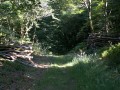
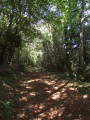
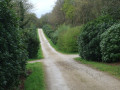
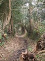
In the Bois du Névet, following the bridle path allows you to venture along small, wild and deserted tracks that criss-cross the woodland. You’ll avoid the wide, often very busy paths.
Why not give this route a go?

Details

631375
Creation:
Last update:
Last review:
  • Walking
    Activity: Walking
  • ↔
    Distance: 5.60 mi
  • ◔
    Average duration: 3h 05 
  • ▲
    Difficulty: Moderate

  • ⚐
    Back to start: Yes
  • ↗
    Ascent: + 591 ft
  • ↘
    Descent: - 584 ft

  • ▲
    Highest point: 476 ft
  • ▼
    Lowest point: 118 ft
  • ⚐ Country: France
  • ⚐ City: Locronan (29180)
  • ⚑
    Start/End: N 48.08904° / W 4.226376°
  • ❏
    IGN map(s): Ref. 0518OT
  • Hour-by-hour weather

Photos

Description of the walk

Access: In Locronan, follow signs for “Latitude Ouest Hôtel & Restaurant”, pass this establishment and you’ll reach a large car park at the entrance to the woodland.

(S/E) Leave the car park following the recommended direction of travel, pass a gate on your right and arrive at the start of the bridle path on the right. A sign provides instructions for riders and details of the route markings.

Markings on the bridle path: brown stripes on tree trunks

Carry on straight ahead until you reach the first marker indicating a change of direction (double brown stripe). Make a note of it carefully, as it will serve as your guide; in the woodland, there are almost no visual landmarks.

(1) Turn right despite a Yellow Cross. At the next junction, turn left and then, a little further on, right to begin a descent. The route winds through the woodland. Ignore all side paths that do not have a marker.

(2) Take a sharp right-hand bend to start another circular loop. Ignore the numerous paths you come across on both the right and left.

(3) Head uphill to the right, then turn left when you reach a wide track, which you should leave on your right. Continue westwards, then veer southwards as you descend. Stay on the signposted bridle path and check your bearings regularly.

(4) Cut across a wide lane (Hent ar Stankou) and head down opposite into the meadow below. Look out for a building on the right – the only real landmark since the start of the route. Climb a steep slope through the woods and continue along the same path, which forms a circular route.

(5) Turn left. The path leads into a slightly marshy area where the trees are also taller. Cut across a wider track called Hent Kreiz (central track) and reach a fork (signpost VTT8-15).
Take care here, as the bridle route offers two options, both signposted. Ignore the one that continues straight ahead and leads to a car park on the Kerlaz side through the undergrowth.

(6) Turn right and follow a long straight stretch which very quickly crosses a wide track called a Hent Treuz (cross-country path). If this does not happen, you took the wrong turn at the fork. Carry on straight ahead and, at the second junction, turn left at a right angle. Turn right onto the first path, which leads to a wider track; follow this to the right for a few tens of metres.

(7) Turn left: be careful, as the signposting was not visible here. You’ll reach the edge of the woodland (GR®38markings). TheGR® heads off to the left: continue to the right along the edge of the woodland (yellowPR® markings).

(8) Veer to the right onto a long straight stretch, leaving thePR®. Cross the first path (Lein ar C’hoat), then the widest path in the Hent Kreiz woodland (central path), and then a third, Hent ar Maner (Manor Path). Continue to the next junction of paths, where you carry on along the extension of the path.

Off the marked horse riding route

(9) At the signpost marked ‘Locronan – Hent al Louarn’ at this multi-way junction, turn left and continue straight on heading due north. At the end, turn left, go through a gate and you’ll emerge at the starting car park (S/E).


Waypoints

  1. S/E : mi 0 - alt. 449 ft - Car park: access from Locronan
  2. 1 : mi 0.15 - alt. 476 ft - First marker (double brown stripe)
  3. 2 : mi 1 - alt. 210 ft - Turn right at the fork
  4. 3 : mi 1.46 - alt. 213 ft - Turn right as you go uphill
  5. 4 : mi 2.61 - alt. 131 ft - Meadow after the Hent ar Stankou lane
  6. 5 : mi 2.89 - alt. 164 ft - Turn left at the junction
  7. 6 : mi 3.51 - alt. 361 ft - Long straight stretch to the right
  8. 7 : mi 4.18 - alt. 436 ft - Path on the left.
  9. 8 : mi 4.42 - alt. 446 ft - On the right
  10. 9 : mi 5.1 - alt. 341 ft - Multiple junctions
  11. S/E : mi 5.6 - alt. 449 ft - Car park: access from Locronan

Notes

The markings for this horse riding route consist of a brown stripe painted on tree trunks.
Each change of direction is indicated by a double brown stripe.
A hilly route running entirely through woodland with few landmarks apart from the markings and a few signposts.
An information map is available at the start showing the route of the bridle path.

Worth a visit

Bois du Nevet. It may be worth downloading this leaflet as it includes a map of the woodland and the horse riding trail.

Always be cautious and plan ahead when you're outdoors. Visorando and the author of this route cannot be held responsible for any accidents occurring on this route.

The GR® and PR® markings are the intellectual property of the Fédération Française de Randonnée Pédestre.

Reviews and comments

3.8 / 5
Based on 4 reviews

Reliability of the description
3.5 / 5
Ease of following the route
3.5 / 5
Route interest
4.3 / 5
ChrisWild
ChrisWild
• Edited:

Overall rating : 3 / 5

Date of your route : Jan 06, 2023
Reliability of the description : ★★★☆☆ Average
Ease of following the route : ★★★☆☆ Average
Route interest : ★★★☆☆ Average
Very busy route : No

A walk for patient people who want to get some exercise, not for those looking for spectacular scenery.
In fact, it’s best to follow the small ‘horse trail’ signs and switch on your GPS, as there are countless paths and plenty of opportunities to get lost.
The landscape is simply a woodland.
But if you just want to go for a walk for the sake of it, by all means, go ahead.

Machine-translated

FLOCH
FLOCH ★

I realise that this route isn’t always easy to follow.
Apart from the signposting on the route, there are few landmarks.
During my recce, I also encountered a few difficulties.
This is what I tried to explain at (5).

What I found appealing about it was walking through the heart of the woods, even at the risk of getting a little lost

Kind regards

Machine-translated

hellie29510
hellie29510

Overall rating : 4 / 5

Date of your route : Sep 30, 2018
Reliability of the description : ★★★☆☆ Average
Ease of following the route : ★★★★☆ Good
Route interest : ★★★★★ Very good

A lovely walk through the heart of the Bois du Névet. However, we did get lost (even though we’ve walked through this woodland before). It’s true that this woodland is notorious for being easy to get lost in!
So we turned on the GPS on the map and carried on without any further trouble.

Machine-translated

jeanpierre29benodet
jeanpierre29benodet

Overall rating : 4 / 5

Date of your route : Aug 13, 2018
Reliability of the description : ★★★★☆ Good
Ease of following the route : ★★★★☆ Good
Route interest : ★★★★☆ Good

A lovely route, with the added bonus of a stunning chapel at the start – and before that, a visit to the church in PLogonnec is a must. 19/07/18

Machine-translated

Fabrice TENDRON
Fabrice TENDRON

Overall rating : 4 / 5

Date of your route : Apr 07, 2018
Reliability of the description : ★★★★☆ Good
Ease of following the route : ★★★☆☆ Average
Route interest : ★★★★★ Very good

We enjoyed this walk in the woods, but we only managed three-quarters of the route: there are so many crossroads and paths in these woods that we got a bit lost... Otherwise, it’s a lovely spot.

Machine-translated

Other walks in the area

For more walks, use our search engine .

The GPS track and description are the property of this route's author. Please do not copy them without permission.