Country:
 City:


Park your car at the Sainte-Catherine spring car park to start the walk.
Follow the blue signposts
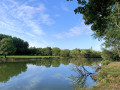
(S/E) Take the path on the right as you leave the car park. You’ll walk alongside a stream on your right and fields on your left. Carry on until you reach the junction.
(1) Turn left onto the tarmac road – watch out for cars. Walk straight on for 300 metres until you reach the statue of Notre-Dame de la Vallée, which will appear on your right.
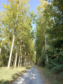
(2) Stay on the path to the right of the statue. Leave the tarmac road and take a shaded path that runs alongside the fields. Follow this path to the end, where you’ll come out onto the road known as ‘le Bois aux Moines’.
(3) Turn left. Walk along a tarmac road until you reach the first left-hand bend, where you’ll come to a sign for ‘La Loge en Vallée’. Watch out for cars.
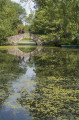
(4) Turn right as indicated by the sign and walk along a path until you reach a sharp bend to the left. Continue straight ahead. You’ll pass through areas of varying openness (woodland, meadows). From time to time, you’ll catch a glimpse of Bouzillé church in the distance on your right. Towards the end of the walk, just before you reach Rue du Seil, you’ll see two small ponds on your left.
(5) Turn right. Walk along the tarmac road to the junction, taking care of traffic. You’ll come to a stop sign.
(6) Keep to the right (signposted ‘Ancenis’), then take the first path on your left straight away. You will then leave the ‘Le Bois aux Moines’ road. Walk straight on until the next junction.
(7) Keep to the left and walk through a hamlet of houses at the place known as ‘la Championnière’, then through another hamlet of a few houses at the place known as ‘la Cabane’. Continue on to the junction with the cross.
(8) Turn left (at the hamlet known as ‘les Ouches’) and walk for about a hundred metres through a small hamlet of houses. Turn right at the hamlet known as ‘la Grande Ouche’ and walk for 500 metres, surrounded by fields on all sides. You’ll arrive at Rue des Fours à Chaux.
(9) Keep to the right, then take the first street on the left, then left again. From there, walk straight on for 1 km and you’ll see the Sainte-Catherine spring on your right the whole way – this will be your landmark for the end of the walk. You’ll then reach a crossroads with several paths.
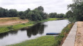
(10) Take the path furthest to the right. Turn round and walk alongside the stream (this time you’ll be on the other side, with the water on your right). Keep an eye out for the rich variety of wildlife in the area. Walk for 1 km along theGR®3to reach the children’s playground (which will be on your right) and head to the car park (S/E).

 Tourist office
 Moderate

 Visorando Member

 Difficult