Île Mouchet

A 3 km walk around Île Mouchet, the Davrays stadium and the Île Mouchet campsite, ending along the banks of the Loire.

Details

3903757
Creation:
Last update:
Last review:
  • Walking
    Activity: Walking
  • ↔
    Distance: 2.05 mi
  • ◔
    Average duration: 0h 55 
  • ▲
    Difficulty: Easy

  • ⚐
    Back to start: Yes
  • ↗
    Ascent: + 10 ft
  • ↘
    Descent: - 13 ft

  • ▲
    Highest point: 39 ft
  • ▼
    Lowest point: 23 ft
  • ⚐ Country: France
  • ⚐ City: Ancenis (44150)
  • ⚑
    Start/End: N 47.362649° / W 1.186873°
  • ❏
    IGN map(s): Ref. 1322SB, 1323SB
  • Hour-by-hour weather

Photos

Description of the walk

Park in the Davrays car park.

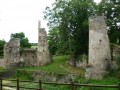
(S/E) Go down the steps opposite the Davrays stadium and walk round the stadium on the right-hand side. On your right, after the roundabout, you’ll pass the Ancenis Theatre, the Ursuline Chapel and the war memorials for the First and Second World Wars.

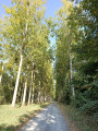
Carry on straight ahead along the Rohan terraces, which consist of three parallel blocks of flats.

(1) At Le Renclos, take the path on your left, then turn right at the end of it. Continue along this path until you reach a four-way junction.

(2) Head straight on, passing the sewage treatment works on your right, and carry on to a junction where there is a lock.

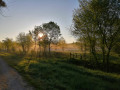
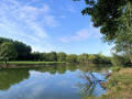
(3) Turn left to follow the banks of the Loire until you reach the end of the route; the water level is high in winter and very low in summer. You’ll find benches to rest on, as well as a fitness trail and a golf course on your left all along the way back.

(4) After the campsite, on your left, there is a children’s playground and some picnic tables.
At the picnic tables, turn left to return to the Davrays car park (S/E).

Waypoints

  1. S/E : mi 0 - alt. 36 ft - La Davrays car park
  2. 1 : mi 0.29 - alt. 36 ft - Renclos
  3. 2 : mi 0.56 - alt. 26 ft - Crossroads
  4. 3 : mi 1.1 - alt. 30 ft - Lock - La Loire
  5. 4 : mi 1.95 - alt. 33 ft - Picnic tables
  6. S/E : mi 2.05 - alt. 33 ft - La Davrays car park

Notes

Just after the start, on your right, are the First and Second World War war memorials and the Ursuline Chapel.

Benches are available along the route, as well as picnic tables towards the end of the route.

Worth a visit

A fitness trail, a golf course and children’s play areas are located along the route, towards the end.

Reviews and comments

4.5 / 5
Based on 2 reviews

Reliability of the description
5 / 5
Ease of following the route
4.5 / 5
Route interest
4 / 5
MAMIDO53
MAMIDO53

Overall rating : 4.3 / 5

Date of your route : Sep 16, 2023
Reliability of the description : ★★★★★ Very good
Ease of following the route : ★★★★☆ Good
Route interest : ★★★★☆ Good
Very busy route : Yes

Nothing to report

Machine-translated

Martin Ader
Martin Ader

Overall rating : 4.7 / 5

Date of your route : Oct 24, 2020
Reliability of the description : ★★★★★ Very good
Ease of following the route : ★★★★★ Very good
Route interest : ★★★★☆ Good
Very busy route : No

A stroll at the city gates
A walk along the banks of the Loire
A walk along the avenue with its various villas
A walk through the countryside

A relaxing and enjoyable stroll
You come across families and joggers, and even cats, dogs and cows

Machine-translated

Other walks in the area

For more walks, use our search engine .

The GPS track and description are the property of this route's author. Please do not copy them without permission.