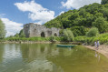
From La Turmelière to Le Champalud, a circular route

A lovely day’s walk, from the hillsides down to the Loire, with superb views of the river, the heritage sites, the vineyards, the wine cellars and the countryside. It is possible to shorten the route by half from the Domaine de la Galloire between points (11) and (27).

Details

55884898
Creation:
Last update:
Last review:
  • Walking
    Activity: Walking
  • ↔
    Distance: 14.74 mi
  • ◔
    Average duration: 7h 25 
  • ▲
    Difficulty: Difficult

  • ⚐
    Back to start: Yes
  • ↗
    Ascent: + 738 ft
  • ↘
    Descent: - 745 ft

  • ▲
    Highest point: 299 ft
  • ▼
    Lowest point: 10 ft
  • ⚐ Country: France
  • ⚐ City: Liré (49530)
  • ⚑
    Start/End: N 47.337278° / W 1.184931°
  • ❏
    IGN map(s): Ref. 1322SB, 1323SB
  • Hour-by-hour weather

Photos

Description of the walk

The starting point is at the Château de la Turmelière (in the commune of Liré), in the car park on the right just before the château.

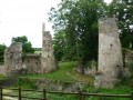
(S/E) Take the path that runs past the château (built in the 19th century) and head towards the ruins. You will then arrive at the ruined birthplace of the poet Joachim Du Bellay. Records of this manor house date back to 1285. According to Gilles Colin, Joachim du Bellay’s great-great-grandfather restored the Turmelière manor house, before his great-grandfather, Jehan de Chabot, moved there in 1472. Continue on to admire the other side of the castle.

(2) Take the path leading down to the left after you have walked round the 19th-century château. Pass the entrance to the Moulin des Robinets, situated on the stream of the same name, on your left and continue to the next junction.

(3) Turn left and cross the stream via the small bridge. Pass, without noticing it, by the hamlet known as Le Douet de Loup (also called Le Doigt de Loup) on your right, cross the Chemin des Robinets and head straight ahead.

(4) At a bend just before Le Pé, take the small path on the left and head for the Plantis crossroads (cross).

(5) Take the path straight ahead through the vineyards: on your left, you’ll enjoy a lovely view of the Château de la Turmelière. Turn right at the crossroads and pass through the hamlet of Les Lombardières, where you’ll see two houses converted from old wine presses.

(6) At La Pointe, cross over to take the path opposite. Turn right at the junction by Maison Neuve to come out onto the D154, which links Drain and Saint-Laurent-des-Autels.

(7) Cross with care. Continue straight on to take the path by the cross at the next junction and head for the hamlet of La Vieille Cour: on your left, you can see the moat of an old fortified house.

(8) Turn right and continue to the crossroads.

(9) Take the path slanting off to the left which descends to the hamlet of La Croix and then joins the D253 (calvary).

(10) Cross the D253 carefully, enter the hamlet of La Parisière and take the first path on the right. Once at the end, follow the road to the left to reach the Sainte-Marguerite Chapel (which is privately owned but open to visitors during the day) at a place called La Galloire.

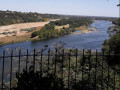
(11) Enjoy the magnificent view over the Loire Valley, then retrace your steps and turn right onto the path through the vineyards.

(12) Turn left at the ‘ANIMAUX’ sign, then immediately right into the woods. After a winding descent, cross the stream. Then follow the path as it winds its way for nearly 2 km along the bottom of the valley, alongside the Ruisseau de la Champenière.

(13) When you reach the bridge, wade across the stream and follow a path that isn’t shown on this map but is clearly there on the ground.

(14) Walk up the hillside to La Gautellerie

(15) Take the path opposite and continue to the next crossroads (calvary).

(16) Turn left and carry on straight ahead to reach the village of Champtoceaux. Go round the roundabout by the gendarmerie on the left and follow Rue Marguerite de Clisson straight ahead to reach the church square.

(17) Turn right to go round it, passing the Saint-Louis care home. Head towards the Champalud, cross the motorhome site and continue to the far end of the park.

(18) The Champalud site: a magnificent viewpoint over the Loire, its islands and Oudon (tower-museum). Turn your back on the river to return to the church via the other side: you can visit the exhibition centre behind it. Then turn right onto Rue Marguerite de Clisson.

(19) At the roundabout by the town hall, take Rue des Remparts, which slopes down, almost directly opposite. Once you reach the Garennes junction, carry on straight ahead for about twenty metres, then veer to the right to follow the path that leads into the woodland.

(20) If you do not wish to visit the ruins of the old citadel of Chateauceaux (the former name of Champtoceaux), carry on straight ahead until you reach the D751.

(21) Turn right and walk along the pavement until you reach the drinking water treatment plant.

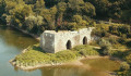
(22) Cross the D751 at the pedestrian crossing and take the path that runs under the road leading to Oudon. You’ll reach the hamlet of Cul du Moulin, with its jetty for boat trips on the Loire. “Directly opposite you, you’ll see the ruins of the Moulin Pendu (13th century).”

(23) Continue along the path that passes beneath the Moulin Pendu and then runs alongside the Loire. Join theGR®3.

(24) Go straight on, past the small river port of La Patache, opposite Île Neuve.

(25) At the junction, continue left onto theGR®3.

(26) Carry on straight ahead, following theGR® which, further on, makes a first turn to the right. Turn left before reaching the D751 and continue for a few hundred metres.

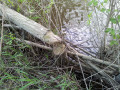
(27) At the junction, leave theGR®3by turning left and, a few dozen metres further on, turn right onto the nature trail. Along this trail, you may come across signs of beaver habitats: piles of trees cut at the base. Continue to the end of the trail.

(28) Take the road to the right, then the track to the left after the bridge. Follow this track for over two kilometres.

(29) At the junction, turn right, then cross theD751 with care to climb the very steep road leading from La Basse Combe to La Haute Combe.

(30) Take the road on the right. Once you reach the crossroads by the wayside cross, go straight on to return to La Turmelière and the castle (S/E).

Waypoints

  1. S/E : mi 0 - alt. 213 ft - Château de la Turmelière
  2. 1 : mi 0.18 - alt. 167 ft - Manor house (ruins) - Ruines du manoir de la Turmelière
  3. 2 : mi 0.33 - alt. 171 ft - Path on the left
  4. 3 : mi 0.68 - alt. 49 ft - Bridge over the - Robinets (ruisseau) - Affluent de la Loire
  5. 4 : mi 1.22 - alt. 190 ft - Path on the left
  6. 5 : mi 1.57 - alt. 213 ft - Entrance to the Lombardières vineyards
  7. 6 : mi 2.17 - alt. 289 ft - La Pointe
  8. 7 : mi 2.46 - alt. 292 ft - Crossing the D253
  9. 8 : mi 2.96 - alt. 282 ft - La Vieille Cour
  10. 9 : mi 3.23 - alt. 292 ft - Crossroads
  11. 10 : mi 3.73 - alt. 190 ft - La Parisière, D253
  12. 11 : mi 4.22 - alt. 200 ft - Domaine des Galloires
  13. 12 : mi 4.4 - alt. 177 ft - Steep descent to the left
  14. 13 : mi 5.21 - alt. 62 ft - Bridge
  15. 14 : mi 5.39 - alt. 75 ft - Climb the hillside via the footpath
  16. 15 : mi 5.74 - alt. 240 ft - La Gautellerie
  17. 16 : mi 6.01 - alt. 230 ft - Crossroads, wayside cross, turn left
  18. 17 : mi 7.24 - alt. 240 ft - Church Square
  19. 18 : mi 7.42 - alt. 203 ft - Viewpoint over the Loire - Panorama du Champalud
  20. 19 : mi 7.64 - alt. 236 ft - Roundabout by the town hall
  21. 20 : mi 8.1 - alt. 75 ft - Access to the old - Les Vestiges de la Citadelle
  22. 21 : mi 8.2 - alt. 59 ft - D751
  23. 22 : mi 8.3 - alt. 39 ft - Crossing the D751
  24. 23 : mi 8.5 - alt. 26 ft - Le Cul du Moulin - La Loire
  25. 24 : mi 9.14 - alt. 26 ft - Junction with GR°°®°°3
  26. 25 : mi 9.74 - alt. 26 ft - Path junction
  27. 26 : mi 10.77 - alt. 26 ft - Junction, go straight on
  28. 27 : mi 11.58 - alt. 23 ft - Discovery trail
  29. 28 : mi 12.45 - alt. 26 ft - End of the path, turn right
  30. 29 : mi 13.89 - alt. 26 ft - Junction
  31. 30 : mi 14.22 - alt. 180 ft - La Haute Combe
  32. S/E : mi 14.74 - alt. 213 ft - Château de la Turmelière

Notes

The route consists of 73 per cent footpaths and 27 per cent local roads.

Some sections are very steep and may be slippery depending on the weather. It is advisable to bring walking poles. In the event of the Loire rising, some sections may be flooded.
Take great care when crossing local roads.
Refreshments are available halfway along the route in the village of Champtoceaux.

(20) If you choose to do so, a visit to the ruins of the old citadel at Chateauceaux takes about 20 minutes and adds a short 1.2 km circular loop to the route.

Worth a visit

La Turmelière
The 19th-century château overlooks the site. Joachim du Bellay lived in the manor house situated a little further down. This manor house is now in ruins. In the village of Liré, a museum traces the life and works of Joachim du Bellay.

The streams
This hilly landscape is criss-crossed by numerous streams and brooks. Along the route, you will mainly come across two small streams: the Ruisseau des Robinets and the Ruisseau de la Champenière.

Domaine de la Galloire
The site offers a beautiful view of the Loire Valley. The Sainte-Marguerite Chapel is privately owned, but is open to visitors during the day.
You can sample local produce – wines, meats and more – by popping into the wine cellar!

Le Champalud
An exceptional site. It offers a splendid panoramic view of the Loire and its islands: Île Neuve, Île Macrière and, further afield, Île Coton.

The old medieval town of “Châteauceaux”
Châteauceaux was a vast fortress overlooking the Loire. It was a key battleground between Anjou and Brittany. Today, only a few ruins remain, which are open to visitors (duration: 20 mins). The association “Les Amis du Vieux Châteauceaux” (the former name of Châteauceaux) maintains the site. The walk passes right by it; you can access it via the (20).

The Hanging Mill
At a place known as Le Cul du Moulin, you’ll find the ruins of this ‘Moulin Pendu’. Beneath the arches, the wheels, driven by the river’s current, could be adjusted to suit the river’s water level.

The ‘boires’
The ‘boires’ are former branches of the river that are fed with water during floods. They are home to an exceptional array of biodiversity. The Boire de la Rompure is a popular fishing spot.

Beavers
The nature route runs alongside the Rompure ‘boire’ (27). Here you can find signs of beaver habitation, such as piles of trees cut at the base. Beavers come out at night.

Always be cautious and plan ahead when you're outdoors. Visorando and the author of this route cannot be held responsible for any accidents occurring on this route.

The GR® and PR® markings are the intellectual property of the Fédération Française de Randonnée Pédestre.

Reviews and comments

4.2 / 5
Based on 3 reviews

Reliability of the description
4.3 / 5
Ease of following the route
4 / 5
Route interest
4.3 / 5
Cinque terre
Cinque terre

Very beautiful hike with a few more challenging sections

Machine-translated

Philippe Germond
Philippe Germond

Overall rating : 4.3 / 5

Date of your route : Jul 08, 2025
Reliability of the description : ★★★★★ Very good
Ease of following the route : ★★★★☆ Good
Route interest : ★★★★☆ Good
Very busy route : No

a beautiful, fairly varied route with some elevation gain

Machine-translated

Cinque terre
Cinque terre

Overall rating : 4.3 / 5

Date of your route : Apr 21, 2025
Reliability of the description : ★★★★☆ Good
Ease of following the route : ★★★★☆ Good
Route interest : ★★★★★ Very good
Very busy route : No

A lovely walk with a few trickier sections

Machine-translated

Polenade
Polenade

Thanks to bikeràpied for their comment. The description has since been updated.

Machine-translated

bikeràpied
bikeràpied

Overall rating : 4 / 5

Date of your route : Aug 07, 2024
Reliability of the description : ★★★★☆ Good
Ease of following the route : ★★★★☆ Good
Route interest : ★★★★☆ Good
Very busy route : No

Please note that once you’ve passed the Galloires estate, it’s no longer possible to follow the trail. I’ve mentioned that there’s now a barrier there. Take the shortcut next to the ‘animals’ sign. After passing a few barriers, carry on to the wooden bridge. Cross it and follow the white markings, which will lead you out of the valley.

Machine-translated

Other walks in the area

For more walks, use our search engine .

The GPS track and description are the property of this route's author. Please do not copy them without permission.